
Mayer, Ferdinand
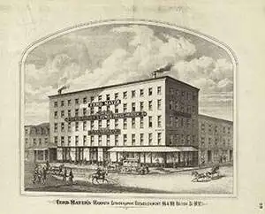
Ferdinand Mayer (October 19, 1817 - November 14, 1879) was a prosperous lithographer based in New York during the latter part of the 19th century. Mayer was born in Württemberg, Germany, but emigrated to the United States following the 1848 March Revolutions that swept through the German Confederation - maybe as late as 1854. Initially, Mayer was associated with various partners, including Prang, Nagel, and Korff - also German immigrants. By 1855, he established himself at 96 Fulton Street and, within a few years, expanded to the neighboring property at 98 Fulton Street. Meyer produced an enormous corpus of varied work, including music sheets, bank notes, broadsides, maps, and views. His career was probably jumpstarted through an early partnership with the important cartographer Henry Walling, many of whose maps and atlases bear the 'Ferd. Mayer' imprint. His most important publication is most likely Egbert L. Vielé's 1865 Topographical Map of the City of New York, one of the most important and influential maps of New York City ever published. The Mayer imprint appears on documents as, variously, 'Ferd. Meyer', 'F. Mayer', and 'Mayer and Sons'.
Early view of America's whaling capital.
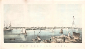
New Bedford, Mass.
$2,500.00
Acquire
- Digital Map Information
- Suitable for large format printing
- File Size: 23.58 MB
- File Type: ZIP / TIFF
- ICC color profile embedded
- Delivered instantly via download link
This is a c. 1858 Joseph Foxcroft Cole view of New Bedford, Massachusetts, the whaling capital of the United States in the leadup to the American Civil War (1861 - 1865). (more details)
One of the most beautiful, important, and enduring maps of Manhattan ever published.
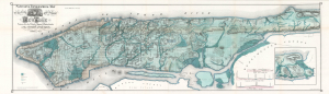
Sanitary and Topographical Map of the City and Island of New York Prepared for the Council of Hygine and Public Health, of the Citizens' Association.
$12,500.00
Acquire
- Digital Map Information
- Suitable for large format printing
- Full resolution TIFF file
- ICC color profile embedded
- Delivered instantly via download link
This is a beautiful example of Egbert L. Viele's 1865 topography and waterways map of Manhattan, one of the scarcest, most important, and most enduring maps of New York City ever published. Viele's map details the canals, swamps, rivers, ditches, ponds, meadows, and drainage basins of Manhattan as they existed prior to the city's urban development. A version of the Viele map remains in use today by architects and contractors who need to be certain they are not building over underground rivers and swamps that may destabilize a new construction's foundation. (more details)
Irrational Railroad Exuberance.
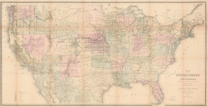
Map of the United States and Territories, Showing the extent of Public Surveys and other details, Constructed from the Plats and official sources of the General Land Office.
$1,000.00
Acquire
- Digital Map Information
- Suitable for large format printing
- Full resolution TIFF file
- ICC color profile embedded
- Delivered instantly via download link
This is an 1870 map of the United States issued by the U.S. General Land Office, led by Commissioner Joseph S. Wilson. Rich in detail, it illustrates the progress of U.S. government land surveys from coast to coast, also reflecting information on mineral deposits, the development of railways, and settlement patterns on the vast American frontier. (more details)
Superior Street Viaduct - transforming Cleveland.
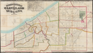
Stringer's Map of Cleveland and Suburbs.
$2,800.00
Acquire
- Digital Map Information
- Suitable for large format printing
- File Size: 2069.47 MB
- File Type: ZIP / TIFF
- ICC color profile embedded
- Delivered instantly via download link
This is an impressive 1873 William Stringer and Otto Dercum large-scale map of Cleveland, Ohio. The map was drawn to illustrate the Super Street Viaduct, a transformative infrastructure project that prompted a wave of urban expansion in the late 19th century. (more details)