
Ramusio, Giovanni Battista
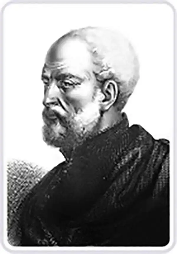
Giovanni Battista Ramusio (July 20, 1485 - July 10, 1557) was an Italian civil servant, humanist, scholar, historian, and geographer active in the middle part of the 16th century. Ramusio spent most of his life in the service of the Republic of Venice, first as part of that state's embassy to France, and later as a reporter on voyages and discoveries. He was born to an illustrious family in Treviso and moved to Vencie as a young man, where his father was a magistrate. He studied at the University of Padua but may not have received a full degree. He entered the civil service shortly after leaving the university and was immediately assigned to diplomatic service for his facility with languages, particularly French. His most significant contribution to cartography is his publication of Navigationi et Viaggi a collection of travel narratives he collected in his service to the state. The narratives include those of Marco Polo, Niccolò Da Conti, Magellan, Alvar Nuñez Cabeza de Vaca, Giosafat Barbaro, and Tomé Pires, among others. Some of the voyages appearing in the Navigationi et Viaggi are otherwise unknown, marking it as an exceptionally important volume. Ramusio died in Venice in 1557.
Foundational First Printed Image of Cusco.
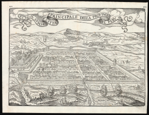
Il Cuscho Citta Principale Della Provincia Del Peru.
$750.00
Acquire
- Digital Map Information
- Suitable for large format printing
- File Size: 13.55 MB
- File Type: ZIP / TIFF
- ICC color profile embedded
- Delivered instantly via download link
This is the scarce 1565 issue of Giovanni Battista Ramusio's map of Cusco (Cuzco), Peru; it is the second edition of the first printed plan of the city based on a firsthand report. This image served as the basis for most illustrations of the city for nearly two centuries. It results from the report of the then-secretary to Francisco Pizarro, Pedro Sancho de la Hoz, who accompanied Pizarro in the conquest of Peru and wrote the first account of it on his return to Spain in 1534. That account was not printed until 1556, when Ramusio translated it into Italian. (more details)
Contemporaneous View of Tenochtitlan's Great Temple.
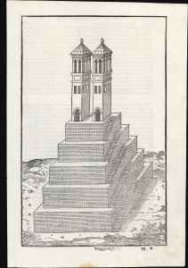
[Untitiled Woodcut].
$450.00
Acquire
- Digital Map Information
- Suitable for large format printing
- File Size: 6.21 MB
- File Type: ZIP / TIFF
- ICC color profile embedded
- Delivered instantly via download link
This scarce 1565 woodcut, appearing in Giovanni Battista Ramusio's description of Mexico-Tenochtitlan, is among the earliest depictions of the main temple at the center of the capital of the Aztec empire. It is drawn from the report of an anonymous conquistador who accompanied Hernan Cortéz, whose account detailed the European view of the city for the first time. (more details)
First separate map of any Southeast Asian island to be based on actual observation.' - Suarez
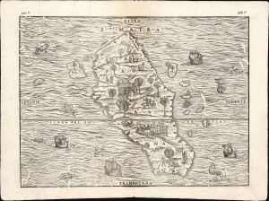
Sumatra / Taprobana.
$750.00
Acquire
- Digital Map Information
- Suitable for large format printing
- Full resolution TIFF file
- ICC color profile embedded
- Delivered instantly via download link
This is the 1606 issue of Giovanni Battista Ramusio's seminal map of Sumatra, 'the first separate map of any Southeast Asian island to be based on actual observation' (Suarez) and one of the first European maps to focus narrowly on so remote a part of the world. It is derived ultimately from the charts of Pierre Crignon, Dieppe navigator and chartmaker, who attended the 1529 attempt of Jean and Raoul Parmentier to set up a trading colony in Sumatra on behalf of the French. The Parmentiers failed and died overseas, but the account of their voyage survived, along with the first detailed charting of the island - preserved in print here. (more details)
Earliest specific map of Brazil.
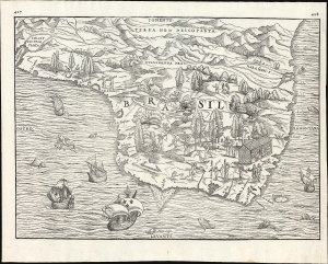
[Brasil].
$2,500.00
Acquire
- Digital Map Information
- Suitable for large format printing
- File Size: 13.62 MB
- File Type: ZIP / TIFF
- ICC color profile embedded
- Delivered instantly via download link
This is Giovanni Battista Ramusio's scarce 1565 map of Brazil, the first printed map to focus specifically on the area. It first appeared in Ramusio's 1556 Navigationi et Viaggi, the first collection of explorers' first-hand accounts of their travels. The woodcut represents the first specific glimpse, in print, of Brazil. While the map's geographical information is frequently credited to Giacomo Gastaldi (1500 - 1566), Ramusio's map is far more likely to have been drawn from his own French sources. (more details)
Capturing a glimpse of Cartier's meeting with the St. Lawrence Iroquois.
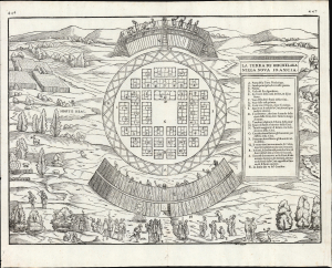
La Terra de Hochelaga Nella Nova Francia.
$4,500.00
Acquire
- Digital Map Information
- Suitable for large format printing
- File Size: 12.67 MB
- File Type: ZIP / TIFF
- ICC color profile embedded
- Delivered instantly via download link
This is an attractive example of the first map of 'Montreal,' in its scarce 1565 second edition. Its first 1556 printing was what Schwartz called 'The very first plan of a village in the United States or Canada,' and it is the earliest printed map to use the place name 'Monte Real,' which would become Montreal. Perhaps even more significantly, this woodcut is one of the only images from the Discovery Period of an intact indigenous town, reflecting its customs. (more details)