
Sanuto, Livio

Livio Sanuto (1520 – 1576) was a Venetian cartographer and scientific instrument maker produced, with his engraver brother, Giulio (fl. 1540-1588) – an array of some of the most important geographical works produced in Venice during the second half of the sixteenth century. These included a 27-inch globe and the 1588 12-sheet atlas, Geografia della Africa. Among Livio and Giulio's works were some, if not all of the maps prepared for Ruscelli's 1561 Ptolemy.
One of the Earliest Maps of the North American East Coast.
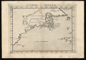
Tierra Nueva.
$1,600.00
Acquire
- Digital Map Information
- Suitable for large format printing
- Full resolution TIFF file
- ICC color profile embedded
- Delivered instantly via download link
This is Girolamo Ruscelli's 1574 map Tierra Nueva, one of the earliest maps to focus on the North American East Coast and the Canadian Maritime Provinces. (more details)
Geographical Reassessment of the eastern Sahara and the Lower Nile.
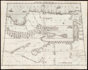
Africae Tabula VI.
$2,500.00
Acquire
- Digital Map Information
- Suitable for large format printing
- DPI: 600
- File Size: 42.73 MB
- File Type: ZIP / TIFF
- ICC color profile embedded
- Delivered instantly via download link
This elegant map of Egypt, focusing on the Lower Nile and Eastern Mediterranean coast was printed in a single edition in 1588 for Livio and Giulio Sanuto's twelve-sheet 'atlas' of Africa. Of the 16th century maps focusing north Africa, Sanuto is unique. His depiction of the continent differed sharply from any contemporaneous map, the result of his thorough reconsideration of African geography in the light of both conventional and newly available sources - marking it as a unique and underappreciated masterpiece of geographical thought. (more details)
Best 16th century map of the region around Marrakesh.
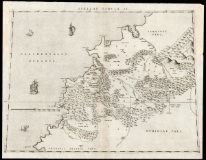
Africae Tabula II.
$2,000.00
Acquire
- Digital Map Information
- Suitable for large format printing
- DPI: 600
- File Size: 44.36 MB
- File Type: ZIP / TIFF
- ICC color profile embedded
- Delivered instantly via download link
This is Livio Sanuto's rare and beautiful 1588 map of central Morocco, focusing on Marrakesh and the area lying between the Oum Er-Rbia and the Sous Rivers. The map depicts the rugged western end of the Atlas Mountains with details drawn almost exclusively from the reports of the Berber-Andalusi traveler, diplomat, and author Johannes Leo Africanus (1494 - 1554). It is moreover a strikingly beautiful engraving, a masterwork of Livio's brother Giulio, who engraved all twelve of the maps comprising their atlas of Africa. (more details)