
Shane, Ralph M.
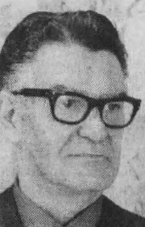
Ralph M. Shane (1910 - July 12, 1984) was an artist and U.S. government engineer. Born near Edelstein, Illinois, Shane's parents moved the family to Pipestone, Minnesota, where he attended public school. After high school, Shane attended the University of Colorado before transferring to the South Dakota School of Mines, where he graduated in 1935 with a B.S. in engineering. He found work with the South Dakota State Highway Commission and drafted strip and right-of-way maps. In November 1936, Shane joined the Bureau of Indian Affairs as an engineering draftsman. He was promoted to junior road engineer the following year. The Bureau transferred him to Sacramento, California, in January 1939 to work as chief of a road survey party. Shane worked as a road engineer for the Bureau of Indian Affairs across the western United States through the 1940s and 1950s, except for a four-month furlough in 1943 when he served as a Navy ensign. He left the Bureau of Indian Affairs in 1955 and bought a newspaper in New Town, North Dakota, which he edited for two years before returning to the Bureau of Indian Affairs. He retired from the Bureau in 1979. Shane was married twice. First to Jeanette Wildman, whom he married in 1936, then to Carolyn Mae Hodgkinson, whom he married on July 14, 1944. He had four children.
A rare map chronicling the history of an Indian Reservation in Oregon.
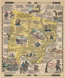
Historical Map Warm Springs Indian Reservation.
$200.00
Acquire
- Digital Map Information
- Suitable for large format printing
- File Size: 21.14 MB
- File Type: ZIP / TIFF
- ICC color profile embedded
- Delivered instantly via download link
This is the 1949 first edition of Ralph M. Shane pictorial map of the Warm Springs Indian Reservation, Oregon. Shane, who worked for the Bureau of Indian Affairs, delivers a detailed graphic history of the reservation and region. (more details)
Warm Springs Indian Reservation, by an American Indian Resident.
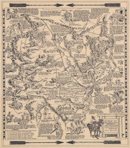
HistoRelief Map of Warm Springs Indian Reservation Warm Springs, Oregon.
$750.00
Acquire
- Digital Map Information
- Suitable for large format printing
- File Size: 17.99 MB
- File Type: ZIP / TIFF
- ICC color profile embedded
- Delivered instantly via download link
This is a 1949 pictorial map of the Warm Springs Indian Reservation, Oregon, compiled by Indian Agents Ralph M. Shane and Ruby D. Leno of the Upper Chinook Tribe. Pictorial vignettes highlight historical events, Native American culture, frontier life, and the conflicts between white settlers and Native Americans. (more details)
Comprehensive History of the Blackfeet Nation.
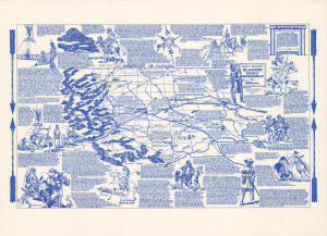
This 1966 pictorial historical map of Montana's Blackfeet Indian Reservation was prepared by Ralph M. Shane. It combines an illustrated account of Blackfeet life with a pointed examination of dispossession, commercial exploitation, and dependence on government rations. A Bureau of Indian Affairs road engineer, Shane developed his reservation maps as a personal educational project intended to encourage understanding of Native American history. Here, buffalo drives, former agency sites, and historic trails share the landscape with modern highways and annotations recording the devastating floods of June 1964. The result presents the reservation as both a historical homeland and a contemporary community. (more details)
Children of the Large-Beaked Bird.
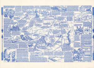
Historical Map of the Crow Indian Reservation : home of the Crows or Absarokee 'children of the large beaked bird.'
$400.00
Acquire
This is a circa 1970 Ralph M. Shane pictorial historical map of Montana's Crow Indian Reservation, conceived to preserve stories of the Crow homeland alongside the better-documented history of battles and treaties. Its dense annotations connect sacred places, intertribal conflicts, schools, and tribal government to a landscape often presented primarily through Custer's defeat at the Battle of Little Bighorn, toward top here, in 1876. A Bureau of Indian Affairs road engineer, Shane developed his reservation maps as a personal educational project intended to encourage understanding of Native American history. (more details)
Struggling for Land Rights in the Little Rockies.
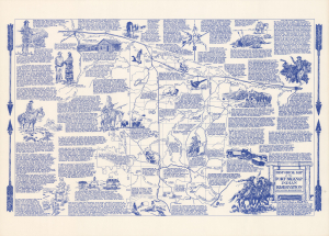
Historical Map of the Fort Belknap Indian Reservation : Gros Ventres and Assiniboines.
$300.00
Acquire
This is a 1974 Ralph M. Shane pictorial historical map of Montana's Fort Belknap Indian Reservation, combining an illustrated regional history with an explicit notice of tribal efforts to recover land in the Little Rocky Mountains. The reservation is the homeland of the Gros Ventre, or Aaniiih, and Assiniboine, or Nakoda, peoples. Shane places treaty boundaries, allotment, tribal government, and sacred geography alongside buffalo hunting, military encounters, mining, and railroad expansion. Its account extends beyond the frontier past up to the 1970s, including the community's continuing efforts to restore the reservation boundaries established in 1888. (more details)
From Encounters with Lewis and Clark to Oil Production.
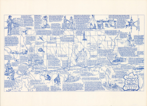
Recreation and Historical Map Fort Peck Reservation Home of the Assiniboine and Sioux.
$350.00
Acquire
This 1978 Ralph M. Shane pictorial historical map of Montana's Fort Peck Indian Reservation connects the Assiniboine and Sioux homeland's history of dispossession with its continuing cultural and economic life. Alongside accounts of military encounters, vanished buffalo herds, and reservation allotment, Shane records oil production, tribal government, rodeos, and annual celebrations. The map belongs to Shane's broader educational project, developed outside his professional work as a Bureau of Indian Affairs road engineer, to document the history and present conditions of various Native American peoples. (more details)
The Northern Cheyenne Exodus.
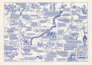
This is a 1966 Ralph M. Shane pictorial historical map of Montana's Northern Cheyenne Reservation. It traces the struggle to return to and retain a homeland after forced removal to Indian Territory, as well as key events in the longer history of displacement, resistance, family survival, and the establishment of the reservation, including the 1876 Battle of Little Bighorn, which took place nearby on the adjacent Crow Reservation. Schools, tribal government, and contemporary industry carry the history of the Cheyenne into the 1960s. (more details)