
Strahlenberg, Philipp Johann von
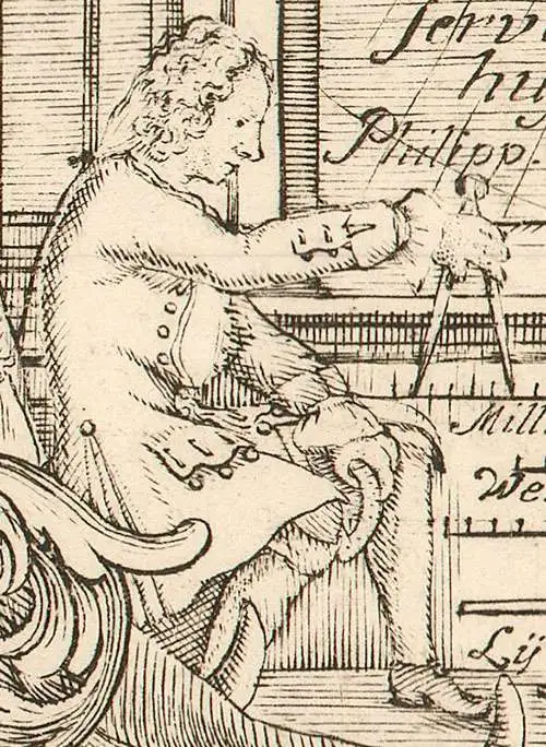
Philipp Johann von Strahlenberg (October 6, 1677 - September 7, 1747), aka Philip Johan Tabbert, was a Swedish army officer of Germanic descent. Strahlenberg was born in the Hanseatic town Stralsund, now Pomerania, Germany, but then part of Sweden. Strahlenberg joined the Swedish army in 1694, being promoted to Captain in 1703. When he was ennobled in 1707, he took the name Strahlenberg. During the Great Northern War (1700 - 1721) between Russia and Sweden, Strahlenberg was captured and sent to Tobolsk, where he lived the commodious life of a noble prisoner of war from 1711 to 1721. During this time, he developed a fascination with the the geography of Siberia and studied the anthropology, languages, and customs of its indigenous peoples. He also worked as an assistant to the German explorer and naturalist Daniel Gottlieb Messerschmidt (1685-1735), who was then working for Peter the Great. Along with fellow Swedish prisoner, Johan Anton von Matérn, Strahlenberg dedicated himself to the composition of a large new map of Russia. Strahlenberg recommended that the Ural Mountains serve as the eastern borders of the European continent, an idea that was later approved by the Tsar. He returned to Sweden in 1722, and in 1730 he published an important book about Siberia, Das Nord- und Ostliche Theil von Europa und Asia (North and Eastern Parts of Europe and Asia), and its accompanying map.
Tatar Empire based on Tatar Sources.
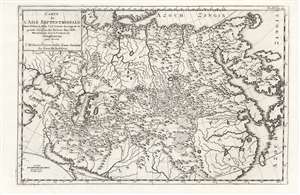
Carte de l'Asie Septentrionale Dans l'Estat où Elle s'est trouvée du temps de la grande Invasion des Tartares dans l'Asie Meridionale sous la Conduite de Genghizcan pour servir à l'Histoire Universelle d'une Societe de Gens de Lettres.
$500.00
Acquire
- Digital Map Information
- Suitable for large format printing
- Full resolution TIFF file
- ICC color profile embedded
- Delivered instantly via download link
This 18th-century map of Asia shows the Tatar Empire during the rule of Genghis Khan. Its 1726 engraver is unknown, despite the map having been used in several works (in this case, a general history printed in 1761.) The map has its genesis in the work of Philipp Johann von Strahlenberg; it is an example of that mapmaker's first map of Russia and Siberia, stolen from him in 1715. (more details)
Strahlenberg's stolen 1715 map of Asiatic Russia and the Tatar Empire.
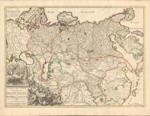
Carte nouvelle de tout l'Empire de la Grande Russie dans l'estat ou il s'est trouvé à la mort de Pierre le Grand. Dressée sur des observations toutes nouvelles et dedoée à l'immortelle memoire de ce Grand Monarque Avec Privilege à Amsterdam.
$3,500.00
Acquire
- Digital Map Information
- Suitable for large format printing
- DPI: 600
- File Size: 29.44 MB
- File Type: ZIP / TIFF
- ICC color profile embedded
- Delivered instantly via download link
This rare, separately issued map of the Russian Empire was printed by Renier and Josua Ottens c. 1730, but the map is based on the work of Philipp Johann von Strahlenberg. It is that mapmaker's first map of Russia and Siberia, stolen from him in 1715. Strahlenberg (1677 - 1747) would rebound to produce his superb 1730 Tattariae Magnae, one of the largest, most groundbreaking, and unique maps of Russia to appear in the first half of the 18th century. This beautiful engraving represents the first complete expression of Strahlenberg's efforts at his seminal mapping of Siberia and the Russian Arctic. (more details)
Uncredited Instance of the Strahlenberg cartography.
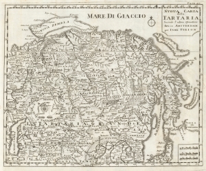
Nuova Carta della Tartaria Secondo l'Ultime Oservationi fata in Amsterdam per Isak Tirion.
$350.00
Acquire
- Digital Map Information
- Suitable for large format printing
- DPI: 600
- File Size: 23.73 MB
- File Type: ZIP / TIFF
- ICC color profile embedded
- Delivered instantly via download link
This is a 1740 Italian edition of Isaac Tirion's map of Tartary, or Russia in Asia. This is one of the few obtainable derivative maps to be based upon the little-known but groundbreaking cartography of Phillip Johann von Strahlenberg, created while he was a prisoner in Tobolsk. (more details)
Search for a Northeast Passage.
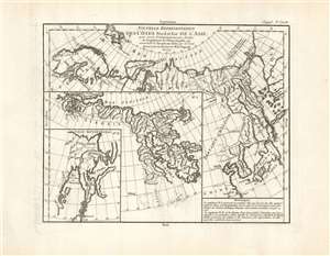
Nouvelle représentation Des Côtes Nord et Est de l'Asie pour servir d'éclaircissement aux Articles du Supplement de L'Encyclopédie qui concernent le passage aux Indes par le Nord.
$400.00
Acquire
- Digital Map Information
- Suitable for large format printing
- Full resolution TIFF file
- ICC color profile embedded
- Delivered instantly via download link
This is the 1772 Robert de Vaugondy map of Siberia, Kamchatka, and the northeastern extremes of Asia. The map is the third of ten maps Robert de Vaugondy supplied for Diderot's Encyclopédie. This seminal map series, exploring the mapping of North America, Asia, and specifically the Northwest and Northeast Passages, was one of the first studies in comparative cartography. As its title suggests, this map was intended to clarify the articles in the Encyclopédie that pertained to European efforts to discover a viable northeast passage to the East Indies. The Northeast Passage, much like America's Northwest Passage, was a long sought after sea route through the Arctic that would save European merchantmen the expense of rounding Africa in order to access the trade riches of East Asia. (more details)