
Tokyo Nichi Nichi Shimbun /

The Tokyo Nichi Nichi Shimbun (東京日日新聞; Tōkyō Nichi Nichi Shinbun), whose names translates literally as the Tokyo Daily News was a newspaper printed in Tokyo, Japan from 1872 to 1943. It began daily distribution to individual addresses in 1875, making it the world's first daily newspaper delivery service. In 1911, the paper merged with Osaka Mainichi Shimbun (大阪毎日新聞, Osaka Daily News) to form the Mainichi Shimbun (毎日新聞, Daily News) company. The two newspapers continued to print independently until 1943.
Spectacular view of Korea.
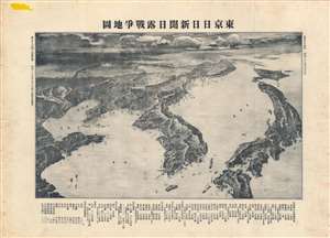
東京日日新聞日露戰爭地圖 / [Tokyo Nichi Nichi Shimbun Japan-Russia War Map].
$750.00
Acquire
- Digital Map Information
- Suitable for large format printing
- File Size: 26.84 MB
- File Type: ZIP / TIFF
- ICC color profile embedded
- Delivered instantly via download link
This is a very rare 1904 or Meiji 37 bird's-eye view map of Northeast Asia covering Manchuria, Korea, and Japan. The view was distributed by the Japanese news daily Tokyo Nichi Nichi Shimbun. Its modified view style illustrates regional topography as well as major cities and ports relevant to the Russo-Japanese War (1904 - 1905). (more details)
How a wood and paper city burns.
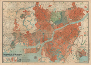
帝都大震火災系統地圖 / Map of the Fire of Tokyo.
$2,500.00
Acquire
- Digital Map Information
- Suitable for large format printing
- Full resolution TIFF file
- ICC color profile embedded
- Delivered instantly via download link
An exceptional example of an infographic masterpiece detailing the ignition and development of the Great Fire of Tokyo following the 1923 Great Kanto Earthquake. This partially bilingual 1923 map of the Great Tokyo Fire was issued by the Relief Information Bureau of Tokyo Imperial University just four months after the disaster. It focuses on ignition points and on the strong winds that coincided with the earthquake, which caused fire to spread rapidly and eventually burn down much of the dense wooden city. This example includes the original index, which we have never seen before, as well as its paper sleeve. (more details)
The Marco Polo Bridge Incident - What some consider the beginning of World War II.
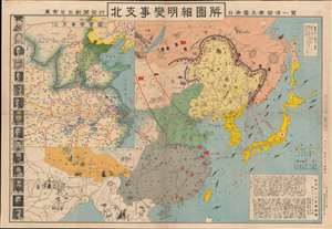
Detailed Map of the North Branch Incident / List all kinds of relations between Japan, Manchuria, Russia, Support, Mengo, and Japan. / 北支事變明細圖解 / 日·満·露·支·蒙·関係一覽.
$1,500.00
Acquire
- Digital Map Information
- Suitable for large format printing
- File Size: 38.75 MB
- File Type: ZIP / TIFF
- ICC color profile embedded
- Delivered instantly via download link
This is a rare Showa 12 or 1937 Japanese pictorial map of northeastern China, Manchuria, eastern Russia, Siberia, and Korea issued by the daily newspaper Tokyo Nichi Nichi Shimbun (東亰日日新聞社). This map was published to illustrate the events of the July 7, 1838 Marco Polo Bridge Incident, the opening salvo of the Second Sino-Japanese War (1937 - 1945), and by extension, World War II (1939 - 1945). Centered on Beijing, the main map coves all of East Asia, from India to Japan, and from Siberia to Hainan Island. Pictorial elements, including flags, military aircraft, and battleships, illustrate zones of power and control. Smaller vignettes illustrate regional novelties (such as the Taj Mahal and Angkor Wat), flora, fauna, and resources - practically in Manchuria, the subject of the conflict. While the focus of the map is conflict between Japan and China, the dark defensive line surrounding Manchuria and the presence of Russian aircraft makes clear who Japanese considered to be the primary threat. A smaller map in the upper left details northeastern China. Portraits of Chinese military and political leaders line the left side of the map. (more details)
Flight around the World on the Brink of War.
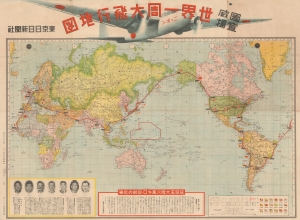
國威宣揚 世界一周大飛行地図 / [Promoting National Prestige Map of Round-the-World Flight].
$1,800.00
Acquire
- Digital Map Information
- Suitable for large format printing
- File Size: 74.33 MB
- File Type: ZIP / TIFF
- ICC color profile embedded
- Delivered instantly via download link
A large 1939 map of the world prepared by the Tokyo Nichi-Nichi Shimbun to celebrate the Nippon, the first Japanese circumnavigational flight. Although a cause for national celebration, the successful flight of the Nippon, intended to promote international peace and goodwill, was overshadowed by the start of World War II (1939 - 1945) in Europe, which caused the plane to divert from its original route. (more details)