
Wilson, Charles

Charles Wilson (1807 - May 16, 1882) was a British-Indian publisher of nautical charts and maps based in London, England. Born in Lucknow, India, Wilson was the son Lieutenant-Colonel William Wilson and his wife Hoosainee Begum, an Indian princess, who was the daughter of the Nizam of Ashrafabad. Wilson was educated in England and worked in the wine trade before joining the Norie firm in 1838. Norie had already partnered with another Wilson, George, who was a nephew to Charles. When Norie retired in 1840, Charles Wilson took over the firm publishing as 'Charles Wilson (Late J.W. Noire and Wilson)'. He married Jane Arabella Bingle on July 1, 1846. Wilson died in 1882 passing the firm on to his sons, George and William Wilson. The brothers merged the firm with that of J. Imray and Sons in 1899 and, as Imray, Laurie, Norie and Wilson Ltd., they continue to publish to the present day.
A stunning decorative sea chart detailing Madeira.
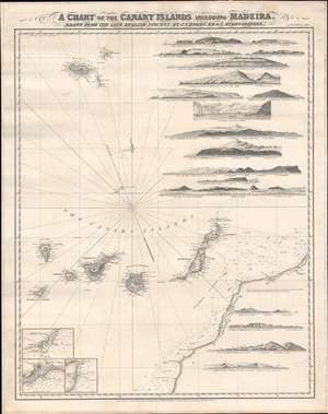
A Chart of the Canary Islands Including Madeira.
$850.00
Acquire
- Digital Map Information
- Suitable for large format printing
- File Size: 32.97 MB
- File Type: ZIP / TIFF
- ICC color profile embedded
- Delivered instantly via download link
An exceptionally beautiful 1867 James Norie and Charles Wilson nautical chart or maritime map of the Canary Islands and Madeira, including part of western Africa. As a whole the map offers excellent detail with inland topography on all of the islands as well as countless depth soundings. There are three inset detail maps in the lower left focusing on Arrecife, Funchal, and Santa Cruz. An additional seventeen land profile charts filling the upper right and lower right. The title is set in an elaborate typeface just outside the map's upper border. (more details)
Detailing the English Channel.
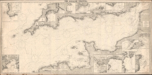
The English Channel.
$800.00
Acquire
- Digital Map Information
- Suitable for large format printing
- File Size: 137.27 MB
- File Type: ZIP / TIFF
- ICC color profile embedded
- Delivered instantly via download link
This is a rare 1887 Norie and Wilson blueback nautical chart of the English Channel. This massive chart is nearly 7 feet long and contains excellent coastal detail and beautiful insets of ports along the English and French coasts. (more details)
Dangerous seas around the Virgin Islands.

West Indies. [Porto Rico and the Virgin Islands].
$1,800.00
Acquire
- Digital Map Information
- Suitable for large format printing
- File Size: 63.13 MB
- File Type: ZIP / TIFF
- ICC color profile embedded
- Delivered instantly via download link
A rare 1888 Charles Wilson nautical chart or maritime map of Puerto Rico and the Virgin Islands. This is the largest and finest specific map of Puerto Rico we have yet encountered. (more details)
The Height of 19th Century Hydrography.
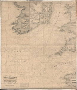
A Chart of the Approaches to the St. George's and English Channels showing the navigation from 47°43 N. Lat. and 11°28 W. Long. to Bristol, Liverpool, and Dublin, Falmouth and Plymouth; Part of the North Coast of France, and the South and West Coasts of Ireland to Cork and Galway.
$500.00
Acquire
- Digital Map Information
- Suitable for large format printing
- File Size: 78.18 MB
- File Type: ZIP / TIFF
- ICC color profile embedded
- Delivered instantly via download link
An unrecorded blueback nautical chart / map of St. George's Channel and the western portion of the English Channel, published by Norie and Wilson in 1894. (more details)