
Winter, Anthonie de

Anthonie de Winter (1653-1707) was a Dutch engraver, etcher, publisher and art dealer. Son of Hendrik de Winter, a seal-engraver and silversmith. Little is known of his education, but it probably involved an apprenticeship to his father prior to his being made a member of the guild of St. Luke in Amsterdam, later joining the guild of booksellers as an engraver. He engraved maps for Nicolas Sanson in 1683, Jacob Lootsman in 1696, and contributed to the Vries Zee Atlas in 1698. He also engraved playing cards with Carel de Waganaer.
French Mapping of Morocco for a Dutch Audience.
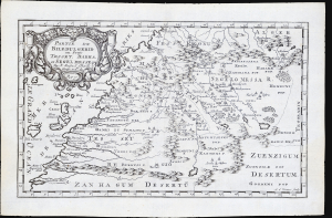
Partie du Biledulgerid ou sont Tesset, Darha, et Segelmesse...
$300.00
Acquire
- Digital Map Information
- Suitable for large format printing
- File Size: 4.67 MB
- File Type: ZIP / TIFF
- ICC color profile embedded
- Delivered instantly via download link
This is Nicolas Sanson's 1656 map of Morocco and its surrounding regions in northwestern Africa, reengraved for its 1683 first Dutch edition. (more details)
French mapping of Siam, Malaya and Cochinchina.
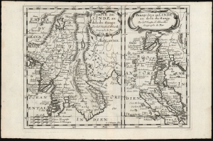
Partie de l'Inde au delà du Gange/ Presqu-Isle de L'Inde au delà du Gange.
$350.00
Acquire
- Digital Map Information
- Suitable for large format printing
- DPI: 600
- File Size: 12.06 MB
- File Type: ZIP / TIFF
- ICC color profile embedded
- Delivered instantly via download link
These, on one sheet, are Nicolas Sanson's 1653 maps of Southeast Asia, here re-engraved for its first Dutch edition of 1683. Coverage includes Siam (Thailand), Vietnam, Cambodia, Laos, Burma, Malaya, and parts of China and Sumatra, a region then generally known as 'India beyond the Ganges. (more details)
French Mapping of Africa for a Dutch Audience.
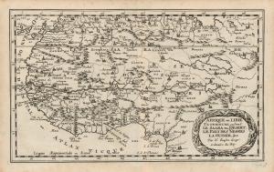
Afrique ou Libie Ulterieure ou sont Le Saara ou Desert. Le Pays des Negres La Guinée, etc. Par N. Sanson Geogr'. ordinaire du Roy.
$300.00
Acquire
- Digital Map Information
- Suitable for large format printing
- DPI: 600
- File Size: 11.35 MB
- File Type: ZIP / TIFF
- ICC color profile embedded
- Delivered instantly via download link
This is Nicolas Sanson's 1656 map of western Africa, reengraved for its first Dutch edition of 1683. (more details)
An Attractive French Map of India.
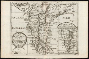
Presqu'Isle de l'Inde deça la Gange, ou sont les Royaumes, de Decan, de Golconde dd Bisnagar, et le Malabar. Par N. Sanson d'Abbeville le Geographe du Roy.
$300.00
Acquire
- Digital Map Information
- Suitable for large format printing
- DPI: 600
- File Size: 11.25 MB
- File Type: ZIP / TIFF
- ICC color profile embedded
- Delivered instantly via download link
This is Nicolas Sanson's 1653 map of the Indian Peninsula, reengraved for its first Dutch edition of 1683. (more details)
French mapping of the Spice Islands.
![1683 Sanson Map of the East Indies w/ the Spice Islands [Maluku Islands, Indonesia]](/mm5/graphics/00000001/M/Moluccas-sanson-1683-M.jpg "1683 Sanson Map of the East Indies w/ the Spice Islands [Maluku Islands, Indonesia]")
Les Isles Molucques; Celebes, Gilolo etc. Par le Sr. Sanson d'Abbeville, Geogr. du Roy.
$400.00
Acquire
- Digital Map Information
- Suitable for large format printing
- DPI: 600
- File Size: 3.9 MB
- File Type: ZIP / TIFF
- ICC color profile embedded
- Delivered instantly via download link
This is Nicolas Sanson's 1653 map of the East Indies, and specifically of the Maluku Islands, known then as the Moluccas or Spice Islands, here in its 1683 first Dutch edition. It covers the islands between Borneo and New Guinea, and includes inset maps of the Molucca Islands, Bachian Island, and Banda Island. (more details)