1876 Walker Map of Norwood, Hillsdale & the Palisade Land Co.,New Jersey
NorwoodHillsdale-walker-1876$175.00

Title
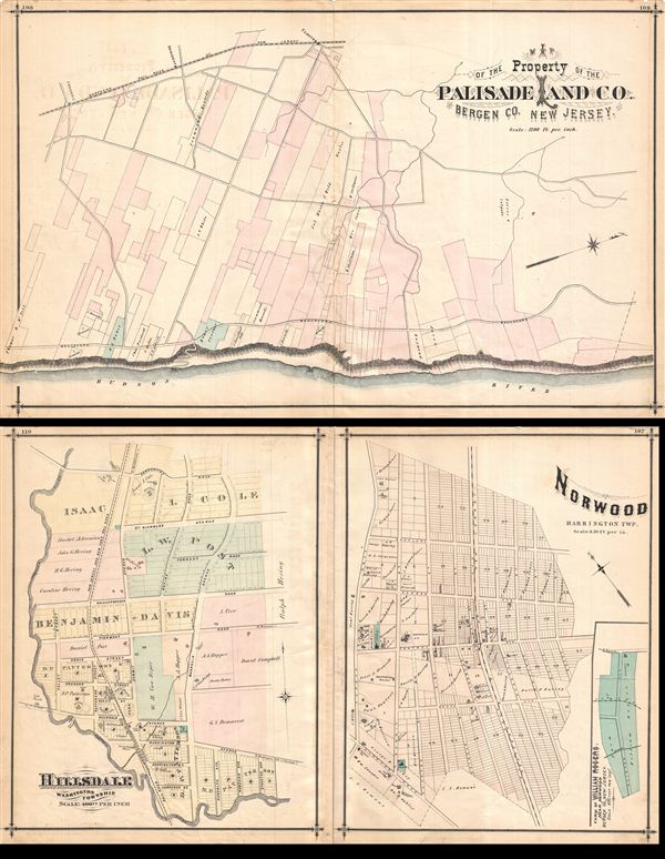
Norwood, Hillsdale, Palisade Land Co.
1876 (undated) 17 x 13.75 in (43.18 x 34.925 cm)
1876 (undated) 17 x 13.75 in (43.18 x 34.925 cm)
Description
Maps of Norwood (plate 107), the property of the Palisade Land Co. (plates 108-109), and Hillsdale, NJ, showing property boundaries and owner names. Notable too is that depiction of school district boundaries-- even at this early date New Jersey schools were being highlighted in the context of property (and presumably property values), a practice that continues to this day. Published in Walker & Pease' exquisite centennial 'topographical, illustrated, historical, descriptive' Atlas of Bergen County, New Jersey, 1876. Note, image above represents the verso and recto (front and back) of a single sheet of paper.
Source
Walker, A. H., and Pease, C. C. Atlas of Bergen County, New Jersey, 1876.
Condition
Good. Even overall toning. Original centerfold exhibits some wear and in verso reinforcement. Minor discolorations here and there. Edge wear mostly confined to margins.
References
Phillips (Atlases) #2152.