This item has been sold, but you can get on the Waitlist to be notified if another example becomes available, or purchase a digital scan.

1864 Artaria Map of Lake Como and Milan

Como-artaria-1864
$475.00
Nuova Carta Topografica Del Lago Di Como. - Main View
Processing...

1864 Artaria Map of Lake Como and Milan

Como-artaria-1864

A superbly executed map of Lake Como and its region.

Title


Nuova Carta Topografica Del Lago Di Como.
  1864 (undated)     23 x 16.75 in (58.42 x 42.545 cm)     1 : 90000

Description


This is a rare 1864 Artaria map of Lake Como and its vicinity, produced shortly after Giuseppe Garibaldi's campaign recaptured the territory from Austria. It masterfully evokes the mountainous terrain, shown with some of the finest hachure-engraving we have seen in this medium. The map includes the area surrounding the cities of Como and Lecco, and the Lago di Pusiano, Lago di Annone, Lago di Mezzola, and the smaller lakes surrounding Lake Como. An inset map in the upper left details the route between Como and Milan, showing the rail connection between the two cities via Monza. The map includes detailed descriptive text for both the city of Como and the lake, its towns and its attractions.
Publication History and Census
This map was engraved by Pietro Allodi, and printed in 1864 by the Milan firm of Ferdinando Artaria e Figlio. A further edition would be published by the firm in 1877 under the imprint of F. Sacchi e Figli. The map appears to be quite scarce: OCLC lists this edition only at the British Library; the 1877 is catalogued only there and the Wurttemburgische Landesbibliothek.

CartographerS


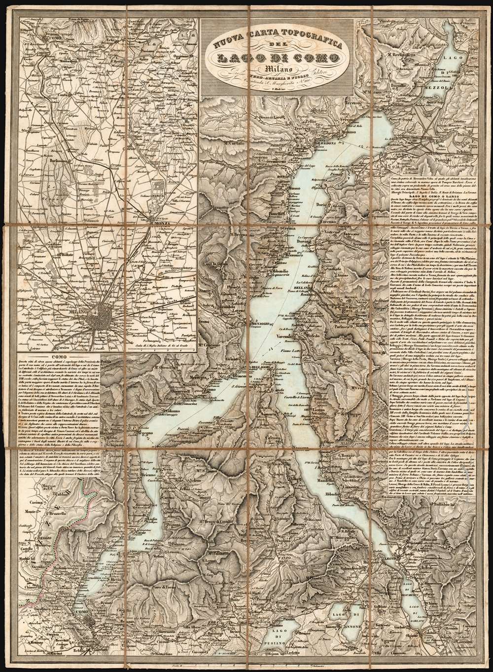
Artaria and Company (1765 - c. 1890) was founded by Carlo Giovanni Artaria in 1765 in Vienna, then the capital of the Austro-Hungarian Empire. Originally a specialty publisher of sheet music, including works by Hayden, Mozart, Beethoven, and Schubert, the company had expanded its business to include maps by the mid-1770s. The company collaborated with Joseph von Scheda and distributed maps for the Militärgeografischen Institutes. Artaria continued to be a major European publisher well into the 20th century. In 1920, the cartographic section was sold to Freytag and Berndt, who published under the imprint Freytag-Berndt & Artaria. More by this mapmaker...


Pietro Allodi (fl. 1859-1878) was an Italian author, engraver, and illustrator; despite his having been apparently prolific in Milan - working for a number of different publishers, including Ferdinand Artaria - virtually nothing is known of his life and his training. Learn More...

Condition


Good condition. Worm tracks in text box to the right, with slight impact on map surface. Dissected and mounted on original linen as issued.

References


OCLC 556945887.