This copy is copyright protected.
Copyright © 2024 Geographicus Rare Antique Maps
1800 Flinders and Arrowsmith Map of Tasmania
Tasmania-flinders-1800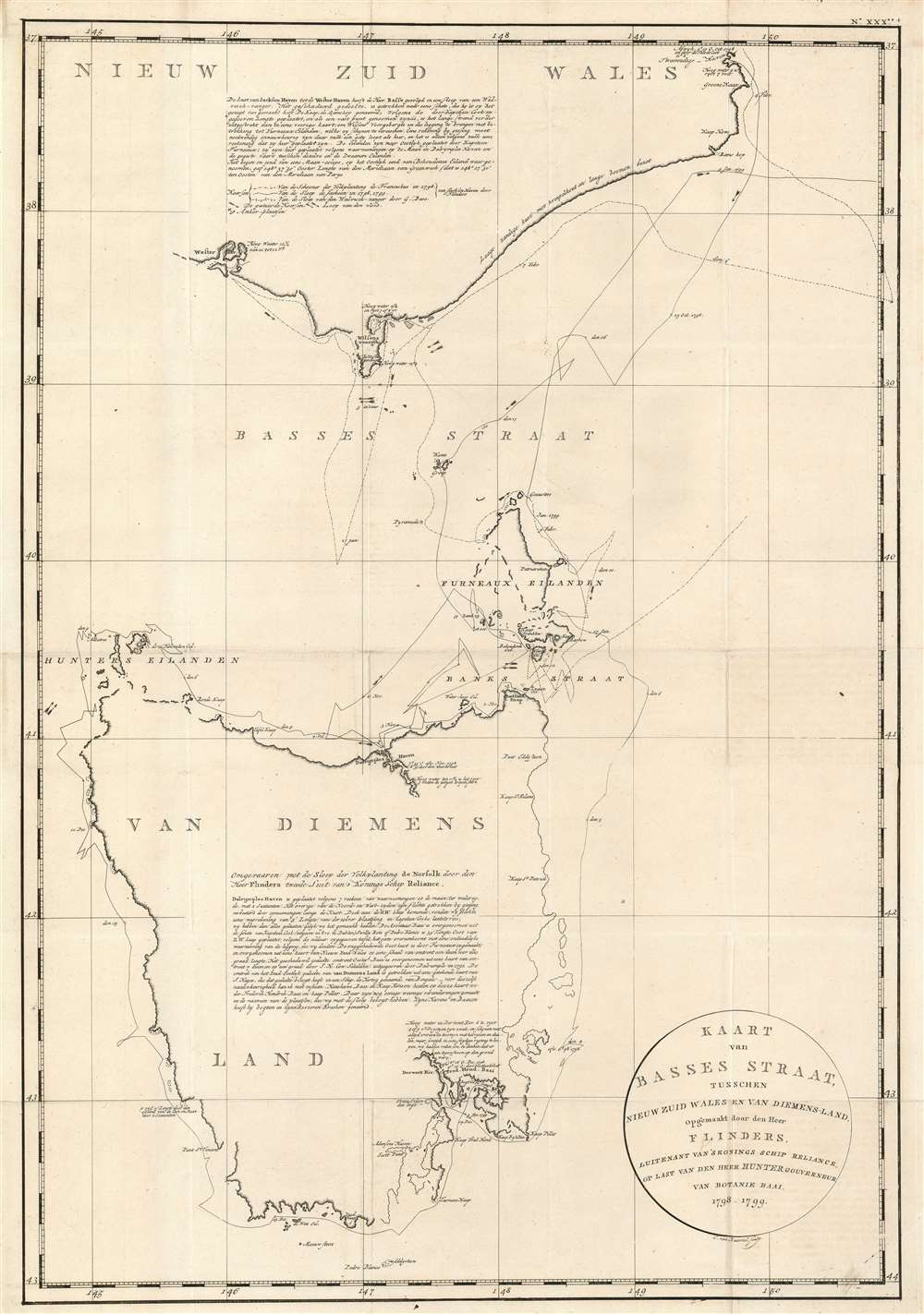

Matthew Flinders (March 16, 1774 - July 19, 1840) was a British navigator and cartographer, renowned for his pioneering work in charting the coastline of Australia. Born in Lincolnshire, England, Flinders studied at Cowley's Charity School, Donington, from 1780 and then at the Reverend John Shinglar's Grammar School at Horbling in Lincolnshire. He joined the Royal Navy at a 15, having developed a passion for naval exploration after reading Robinson Crusoe. He was part of several exploratory and military voyages, including a voyage under the notorious William Bligh, steadily rising in rank. In 1798, as a lieutenant, he embarked on an expedition exploring the Australian coast. Over the course of his voyages, Flinders meticulously charted much of the Australian coastline, including the circumnavigation of the continent, confirming it as a single landmass. He is often falsely credited as being the first person to utilize the name Australia to describe the entirety of that continent - however he did encourage this usage. Flinders' work significantly contributed to the understanding of Australia's geographical layout and was instrumental in the development of safe sea routes for future maritime exploration and trade. Despite facing numerous challenges, including shipwrecks and a lengthy imprisonment by the French on the island of Mauritius due to suspicions during the Napoleonic Wars, Flinders remained dedicated to his scientific pursuits. Flinders died, aged 40, on July 19, 1814, from kidney disease, at his home at 14 London Street (Maple Street), London. This was on the day after his book, A Voyage to Terra Australis, and its accompanying atlas were published. The location of his grave was subsequently lost until rediscovered by archeologists in 2019. Flinders is scheduled to be reburied in the summer of 2024. More by this mapmaker...
Aaron Arrowsmith (1750-1823), John Arrowsmith (1790-1873), and Samuel Arrowsmith. The Arrowsmith family were noted map engravers, publishers, geographers, and cartographers active in the late 18th and early 19th century. The Arrowsmith firm was founded by Aaron Arrowsmith, who was trained in surveying and engraving under John Cary and William Faden. Arrowsmith founded the Arrowsmith firm as a side business while employed by Cary. The firm specialized in large format individual issue maps containing the most up to date and sophisticated information available. Arrowsmith's work drew the attention of the Prince of Wales who, in 1810, named him Hydrographer to the Prince of Wales, and subsequently, in 1820, Hydrographer to the King. Aaron Arrowsmith was succeeded by two sons, Aaron and Samuel, who followed him in the map publication business. The Arrowsmith firm eventually fell to John Arrowsmith (1790-1873), nephew of the elder Aaron. John was a founding member of the Royal Geographical Society. The firm is best known for their phenomenal large format mappings of North America. Mount Arrowsmith, situated east of Port Alberni on Vancouver Island, British Columbia, is named for Aaron Arrowsmith and his nephew John Arrowsmith. Learn More...
Copyright © 2024 Geographicus Rare Antique Maps | Geographicus Rare Antique Maps
This copy is copyright protected.
Copyright © 2024 Geographicus Rare Antique Maps