
Arrowsmith Family
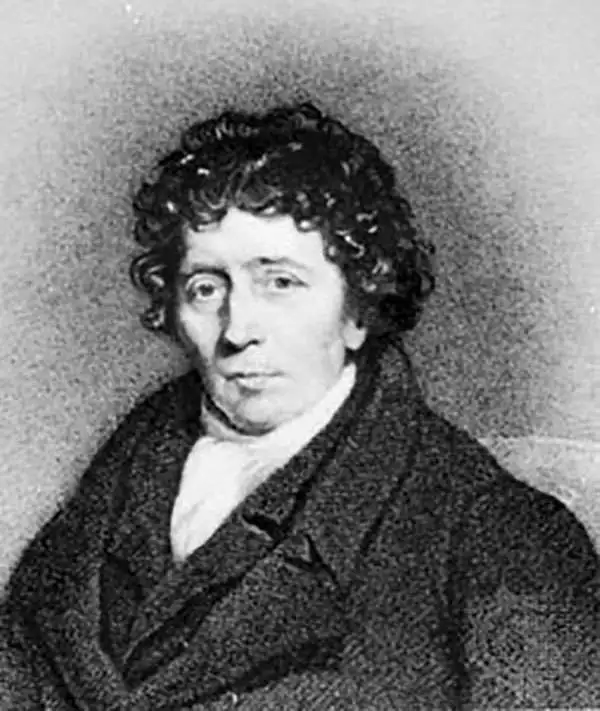
Aaron Arrowsmith (1750-1823), John Arrowsmith (1790-1873), and Samuel Arrowsmith. The Arrowsmith family were noted map engravers, publishers, geographers, and cartographers active in the late 18th and early 19th century. The Arrowsmith firm was founded by Aaron Arrowsmith, who was trained in surveying and engraving under John Cary and William Faden. Arrowsmith founded the Arrowsmith firm as a side business while employed by Cary. The firm specialized in large format individual issue maps containing the most up to date and sophisticated information available. Arrowsmith's work drew the attention of the Prince of Wales who, in 1810, named him Hydrographer to the Prince of Wales, and subsequently, in 1820, Hydrographer to the King. Aaron Arrowsmith was succeeded by two sons, Aaron and Samuel, who followed him in the map publication business. The Arrowsmith firm eventually fell to John Arrowsmith (1790-1873), nephew of the elder Aaron. John was a founding member of the Royal Geographical Society. The firm is best known for their phenomenal large format mappings of North America. Mount Arrowsmith, situated east of Port Alberni on Vancouver Island, British Columbia, is named for Aaron Arrowsmith and his nephew John Arrowsmith.
New England during the War of 1812.
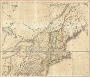
[New England].
$1,000.00
Acquire
- Digital Map Information
- Suitable for large format printing
- File Size: 36.52 MB
- File Type: ZIP / TIFF
- ICC color profile embedded
- Delivered instantly via download link
The northeastern sheet of Pierre Francois Tardieu's 1812 four-sheet map of the United States of America, based on Aaron Arrowsmith's seminal 1796 map of the same. Its publication coincided with the outbreak of the War of 1812 (1812 - 1815). Aside from its aesthetic qualities and level of detail, the map is notable for demonstrating the territorial evolution of the new republic. (more details)
Promoting European investment in the dream of a unified independent Latin America.
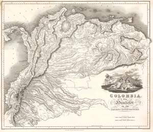
Colombia, from Humboldt and other Recent Authorities.
$2,200.00
Acquire
- Digital Map Information
- Suitable for large format printing
- Full resolution TIFF file
- ICC color profile embedded
- Delivered instantly via download link
This is the rare and important 1823' Zea Map of Colombia', one of the earliest specific maps of Gran Colombia at its height. This map was printed on behalf of the Colombian vice president under Simón Bolívar, Francisco Antonio Zea (1766 - 1822), to court European, and specifically British, investment in the new Republic, which was in dire need of financial support. The title references the naturalist Alexander von Humboldt, not for any cartographic contributions, as the map is based on the maps of John Arrowsmith, but rather for his unwavering support of an independent Gran Colombia and his promotion of its natural wealth. (more details)
First lithograph map of Central India.
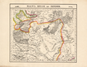
Malwa, Berar et Beeder. Asie no. 94.
$500.00
Acquire
- Digital Map Information
- Suitable for large format printing
- DPI: 600
- File Size: 66.84 MB
- File Type: ZIP / TIFF
- ICC color profile embedded
- Delivered instantly via download link
This is the 1827 Vandermaelen map of the central Indian provinces of Malwa, Berar, and Bidar. It is the first large-scale atlas map to focus on the area, and the first to be executed in lithography. It includes the cities of Bhopal (Bopaul) and Nagpur (Nagpoor), and extends as far east as the coastal province of Odisha. It extends as far north as Sagar in Madhya Pradesh and as far south as the Northern Circars of the Madras Presidency. Topography is pictorial, illustrating the mountains of the province with vigorous hachuring. Vandermaelen appears to have drawn heavily, but not universally, from the maps of Aaron Arrowsmith to inform his work here. (more details)
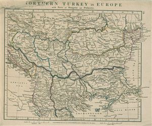
Northern Turkey in Europe with parts of Hungary and Dalmatia.
$100.00
Acquire
- Digital Map Information
- Suitable for large format printing
- DPI: 300
- File Size: 5.22 MB
- File Type: ZIP / TIFF
- ICC color profile embedded
- Delivered instantly via download link
This is a rare example of Aaron Arrowsmith's 1828 map of Turkey in Europe. The map covers Turkey or the Ottoman Empire as it extended into Europe during the early 19th century and includes the Balkan regions of Bosnia, Herzegovina, Monde Negro, Albania, Thessaly, ... (more details)
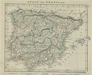
Spain and Portugal.
$100.00
Acquire
- Digital Map Information
- Suitable for large format printing
- DPI: 300
- File Size: 4.6 MB
- File Type: ZIP / TIFF
- ICC color profile embedded
- Delivered instantly via download link
This is a rare example of Aaron Arrowsmith's 1828 map of Spain and Portugal. The map covers the Iberian Peninsula from the Bay of Biscay in the north to the Strait of Gibraltar in the south and from Algarve in Portugal to Catalonia in the East. Includes the ... (more details)
First Edition of Long-Standard British Map of the East Indies.
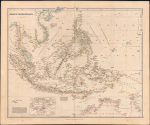
Asiatic Archipelago.
$1,200.00
Acquire
- Digital Map Information
- Suitable for large format printing
- Full resolution TIFF file
- ICC color profile embedded
- Delivered instantly via download link
This is the 1832 first edition of John Arrowsmith's map of Southeast Asia and the East Indies, which would become the standard British map of the region for decades afterward. It is notable for its early inclusion and focus on the 'commercial emporium' of Singapore as the emerging crux of Britain's lucrative China Trade. (more details)
Foregrounding the Newly Recognized United Provinces.
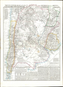
Provincie Unite del Rio de la Plata, Argentina, Chili, Uruguay, e Paraguay.
$550.00
Acquire
- Digital Map Information
- Suitable for large format printing
- File Size: 28.46 MB
- File Type: ZIP / TIFF
- ICC color profile embedded
- Delivered instantly via download link
This is an 1856 Benedetto Marzolla map focusing on the United Provinces of the Rio de la Plata: this included much of Chile, Uruguay, and Paraguay, as well as parts of Brazil and Bolivia. The map is characteristic of Marzolla's work in its abundant notation. (more details)
Tracking down the lost Franklin Expedition.
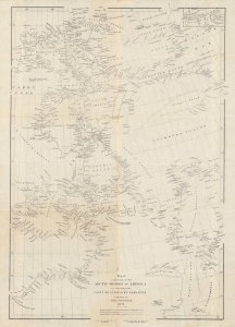
Map of a portion of the Arctic shores of America to accompany Captn. McClintock's narrative.
$600.00
Acquire
- Digital Map Information
- Suitable for large format printing
- File Size: 12.28 MB
- File Type: ZIP / TIFF
- ICC color profile embedded
- Delivered instantly via download link
An intricate map of the waters and islands of Nunavut in northeastern Canada, near Greenland, tracing the lost 'Franklin Expediton'. It was produced by John Arrowsmith in 1859 for Captain Francis McClintock's The Voyage of the 'Fox' in the Arctic Seas: A Narrative of the discovery of the fate of Sir John Franklin and his companions. (more details)
900 miles further up Yangtze than any previous Westerner.
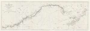
China. The Yang-Tsze Kiang, from Han-Kow to Ping-Shan; reduced from the large Chart (of which this is the Index) from the Survey of Captain T. Blakiston R.A.
$125.00
Acquire
- Digital Map Information
- Suitable for large format printing
- File Size: 6.32 MB
- File Type: ZIP / TIFF
- ICC color profile embedded
- Delivered instantly via download link
This is an 1862 John Arrowsmith map of the Yangtze River, China. Coverage extends from Hankou (Hankow) to Pingshan. The map follows 1861 Thomas Wright Blakiston (December 27, 1832 - October 15, 1891) Yangtze River Expedition. Blakiston's expedition traveled over 900 miles further up the river than any previous Western navigation. Blakiston also conducted detailed surveys of the Yangtze and produced a landmark map of the river. The present map acts as a key for Blakiston's larger map. Cities and towns of varying size are labeled throughout. Additional notations mark the now submerged Yangtze Gorges and other physical features. (more details)
Long-Lived and Updated Map.
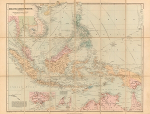
Asiatic Archipelago on Mercator's Projection.
$850.00
Acquire
- Digital Map Information
- Suitable for large format printing
- File Size: 21.47 MB
- File Type: ZIP / TIFF
- ICC color profile embedded
- Delivered instantly via download link
This is John Arrowsmith's map of Southeast Asia and the East Indies in an updated c. 1906 issue published by Stanford. This map achieved astonishing longevity via frequent updates, having first appeared in 1832. (more details)