Digital Image: 1876 Owen Map of Ancient Native American Ruins in the American Southwest
AncientRuins-owen-1876_d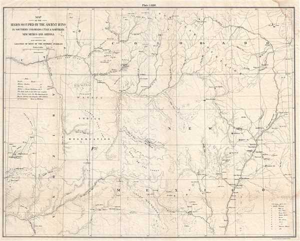

Title
Map of the Region Occupied by the Ancient Ruins in Southern Colorado, Utah and Northern New Mexico and Arizona. Also Showing the Location of Most of the Modern Pueblos.
1876 (undated) 19.5 x 24.5 in (49.53 x 62.23 cm) 1 : 760320
1876 (undated) 19.5 x 24.5 in (49.53 x 62.23 cm) 1 : 760320
Description
FOR THE ORIGINAL ANTIQUE MAP, WITH HISTORICAL ANALYSIS, CLICK HERE.
Digital Map Information
Geographicus maintains an archive of high-resolution rare map scans. We scan our maps at 300 DPI or higher, with newer images being 600 DPI, (either TIFF or JPEG, depending on when the scan was done) which is most cases in suitable for enlargement and printing.
Delivery
Once you purchase our digital scan service, you will receive a download link via email - usually within seconds. Digital orders are delivered as ZIP files, an industry standard file compression protocol that any computer should be able to unpack. Some of our files are very large, and can take some time to download. Most files are saved into your computer's 'Downloads' folder. All delivery is electronic. No physical product is shipped.
Credit and Scope of Use
You can use your digial image any way you want! Our digital images are unrestricted by copyright and can be used, modified, and published freely. The textual description that accompanies the original antique map is not included in the sale of digital images and remains protected by copyright. That said, we put significant care and effort into scanning and editing these maps, and we’d appreciate a credit when possible. Should you wish to credit us, please use the following credit line:
Courtesy of Geographicus Rare Antique Maps (https://www.geographicus.com).
How Large Can I Print?
In general, at 300 DPI, you should at least be able to double the size of the actual image, more so with our 600 DPI images. So, if the original was 10 x 12 inches, you can print at 20 x 24 inches, without quality loss. If your display requirements can accommodate some loss in image quality, you can make it even larger. That being said, no quality of scan will allow you to blow up at 10 x 12 inch map to wall size without significant quality loss. For more information, it is best consult a printer or reprographics specialist.
Refunds
If the high resolution image you ordered is unavailable, we will fully refund your purchase. Otherwise, digital images scans are a service, not a tangible product, and cannot be returned or refunded once the download link is used.
Cartographer
Frederick D. Owen (1871 - January 28, 1931) was an American cartographer, engineer, and architect active in Washington D.C. in the late 19th and early 20th centuries. Owen was born in Connecticut, Owen was a civilian contractor with the U.S. Bureau of Topographical Engineers. He worked with the First Lady Caroline Harrison (1832 - 1892), wife of President Benjamin Harrison, to plan an ambitious expansion of the White House, but it was never realized. Seven of his maps are located in the Library of Congress. He created the maps that hung in the ‘War Room’ at the White House during the Spanish-American War (‘Frank Leslie’s Popular Monthly’, Vol. L, No. 2, 113.). Later, Owen worked for the Washington D.C. Parks department. More by this mapmaker...
References
OCLC 367536889.