Digital Image: 1478 / 1490 Ptolemaic Map of the Arabian Peninsula
Arabia-ptolemy-1478_d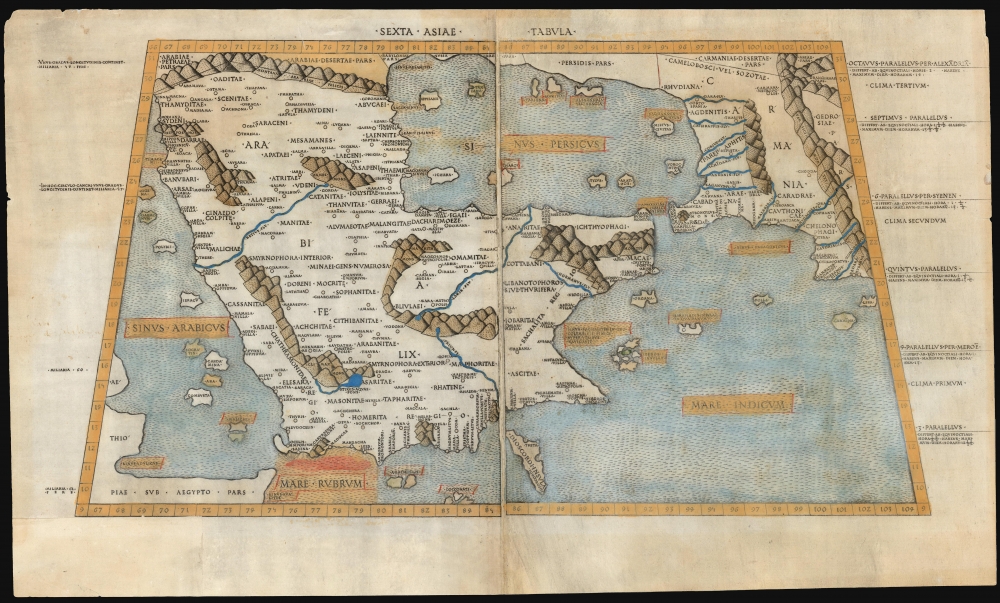

Title
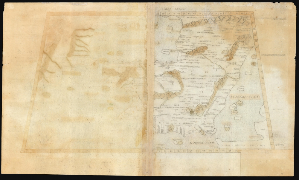
Sexta Asiae Tabula.
1478 (undated) 10.75 x 21 in (27.305 x 53.34 cm) 1 : 9600000
1478 (undated) 10.75 x 21 in (27.305 x 53.34 cm) 1 : 9600000
Description
FOR THE ORIGINAL ANTIQUE MAP, WITH HISTORICAL ANALYSIS, CLICK HERE.
Digital Map Information
Geographicus maintains an archive of high-resolution rare map scans. We scan our maps at 300 DPI or higher, with newer images being 600 DPI, (either TIFF or JPEG, depending on when the scan was done) which is most cases in suitable for enlargement and printing.
Delivery
Once you purchase our digital scan service, you will receive a download link via email - usually within seconds. Digital orders are delivered as ZIP files, an industry standard file compression protocol that any computer should be able to unpack. Some of our files are very large, and can take some time to download. Most files are saved into your computer's 'Downloads' folder. All delivery is electronic. No physical product is shipped.
Credit and Scope of Use
You can use your digial image any way you want! Our digital images are unrestricted by copyright and can be used, modified, and published freely. The textual description that accompanies the original antique map is not included in the sale of digital images and remains protected by copyright. That said, we put significant care and effort into scanning and editing these maps, and we’d appreciate a credit when possible. Should you wish to credit us, please use the following credit line:
Courtesy of Geographicus Rare Antique Maps (https://www.geographicus.com).
How Large Can I Print?
In general, at 300 DPI, you should at least be able to double the size of the actual image, more so with our 600 DPI images. So, if the original was 10 x 12 inches, you can print at 20 x 24 inches, without quality loss. If your display requirements can accommodate some loss in image quality, you can make it even larger. That being said, no quality of scan will allow you to blow up at 10 x 12 inch map to wall size without significant quality loss. For more information, it is best consult a printer or reprographics specialist.
Refunds
If the high resolution image you ordered is unavailable, we will fully refund your purchase. Otherwise, digital images scans are a service, not a tangible product, and cannot be returned or refunded once the download link is used.
Cartographer S
Claudius Ptolemy (83 - 161 AD) is considered to be the father of cartography. A native of Alexandria living at the height of the Roman Empire, Ptolemy was renowned as a student of Astronomy and Geography. His work as an astronomer, as published in his Almagest, held considerable influence over western thought until Isaac Newton. His cartographic influence remains to this day. Ptolemy was the first to introduce projection techniques and to publish an atlas, the Geographiae. Ptolemy based his geographical and historical information on the "Geographiae" of Strabo, the cartographic materials assembled by Marinus of Tyre, and contemporary accounts provided by the many traders and navigators passing through Alexandria. Ptolemy's Geographiae was a groundbreaking achievement far in advance of any known pre-existent cartography, not for any accuracy in its data, but in his method. His projection of a conic portion of the globe on a grid, and his meticulous tabulation of the known cities and geographical features of his world, allowed scholars for the first time to produce a mathematical model of the world's surface. In this, Ptolemy's work provided the foundation for all mapmaking to follow. His errors in the estimation of the size of the globe (more than twenty percent too small) resulted in Columbus's fateful expedition to India in 1492.
Ptolemy's text was lost to Western Europe in the middle ages, but survived in the Arab world and was passed along to the Greek world. Although the original text almost certainly did not include maps, the instructions contained in the text of Ptolemy's Geographiae allowed the execution of such maps. When vellum and paper books became available, manuscript examples of Ptolemy began to include maps. The earliest known manuscript Geographias survive from the fourteenth century; of Ptolemies that have come down to us today are based upon the manuscript editions produced in the mid 15th century by Donnus Nicolaus Germanus, who provided the basis for all but one of the printed fifteenth century editions of the work.
More by this mapmaker...
Konrad Sweynheim (died 1477) was a German printer and engraver. Nothing is known of his early years. It is believed that he worked with Johannes Gutenberg between 1461 and 1464 and was instrumental in the early development of printing in Europe. He, along with Arnold Pannartz, is credited with having introduced Gutenberg's invention, the mechanical movable-type printing press, to Italy. The two printers first worked in Subiaco, printing a Donatus which has not survived. The earliest surviving book printed in Italy by them was Cicero's De oratore, printed in 1465. During the course of their early works, they abandoned the German typefaces they had worked with, becoming the first to print in Roman lettering. Sweynheim and Pannartz settled in Rome in 1467, working prolifically - but unsuccessfully: nobody wanted to buy their books, until they began receiving Church assistance in the early 1470s. At this point the two parted ways, after which Sweynheym took up copperplate engraving. He engraved the maps for the superb Rome Ptolemy but did not live to see the work through to its publication. This was completed by his fellow German printer Arnold Buckinck. The Rome Ptolemy was the second to be published containing maps engraved in copper, preceded only by the Bologne Ptolemy of 1477 (though it is probable that the copperplates were completed prior to those of the 1477.) An interesting idiosyncrasy of Sweynheim's work was that the text on the maps was not engraved by hand but stamped into the printing plate with specially made letters, the oldest known use of this technique for this purpose. Learn More...
Arnold Buckinck or Bucking (fl. 1478) was a German book printer in Rome. He is remembered only for the completion and publication of Konrad Sweynheim's edition of Claudius Ptolemy's Cosmographia, a work Buckinck completed on October 10, 1478. This edition was one of the first to contain maps engraved in copper. These plates were used by Petrus de Turre for his 1490 edition of Cosmographia and again by Bernardino Vitali in 1507 and 1508. Learn More...
Bernardino Vitali or Bernardinus de Vitalibus (fl. 1494 to 1539) was an Albanian printer and publisher, active in Venice but also operating presses in Rome and Rimini. In the first half of the 16th century, he published more than 200 Venetian humanist works. His early life is not understood, although he is thought to have been a refugee - settling in Venice after northern Albania fell to the Ottoman Empire. His Venice print shop opened in 1494, later opening shops in Rome and Rimini. Among his publications were the 1507 and 1508 editions of the Rome Ptolemy, which contained several new maps added to those from the 1478-90 editions: most notably, the famous Ruysch world map. Learn More...
Source
Ptolemy, C., In hoc opere haec continentur Geographiae Cl. Ptolemaei a plurimis uiris utriusq[ue] linguae doctiss. eme[n]data, et cu[m] archetypo Graeco ab ipsis collata, (Rome: Vitalibus) 1507-08.
References
OCLC 165589824 (1508). Tibbetts, G. R., Arabia in Early Maps, pp. 16-20, #4. Skelton, R. A., Introduction to the Facsimile edition of 1478 Rome Ptolemy, v-xiii. Suarez, T., Shedding the Veil, pp. 20-23.