This item has been sold, but you can get on the Waitlist to be notified if another example becomes available, or purchase a digital scan.
1912 Berthrong Map of Arizona
Arizona-berthrong-1912$475.00


Title
State of Arizona.
1912 (dated) 37.75 x 31.25 in (95.885 x 79.375 cm) 1 : 760320
1912 (dated) 37.75 x 31.25 in (95.885 x 79.375 cm) 1 : 760320
Description
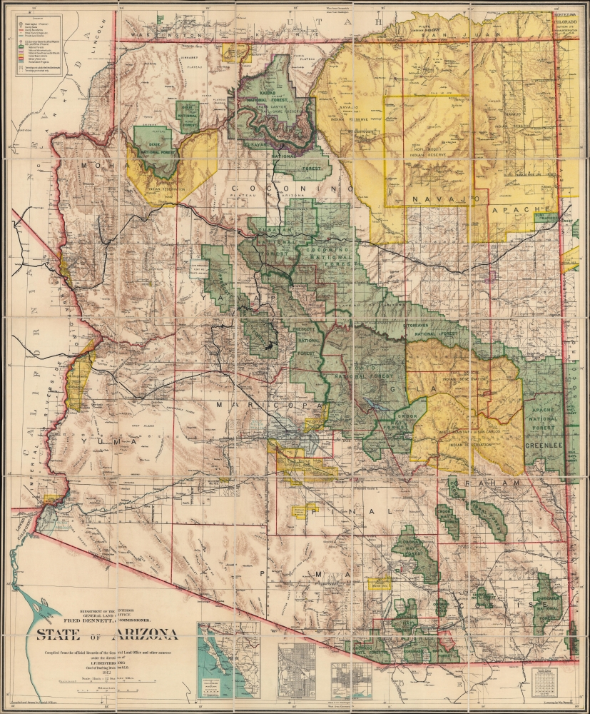
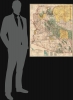
This is the 1912 Ithamar Berthrong and Daniel O'Hare map of Arizona - among the first official U.S. government maps Arizona as a state.
A Closer Look
Coverage embraces the new state in full. National forests are green, with national monuments (Grand Canyon National Monument and Petrified Forest National Monument) highlighted in purple. American Indian Reservations are shaded yellow. Railroad lines include the 'Southern Pacific Railway' and the 'Atchison, Topeka, and Santa Fe Railway', including a spur line to the Grand Canyon. Inset maps along the bottom border focus on Phoenix, Tucson, and the railroad connections between Arizona and New Mexico, Texas, and Mexico. In the lower-left, the Colorado River empties into the Gulf of California after passing through the Grand Canyon, defining the border between Arizona and California.Provenance
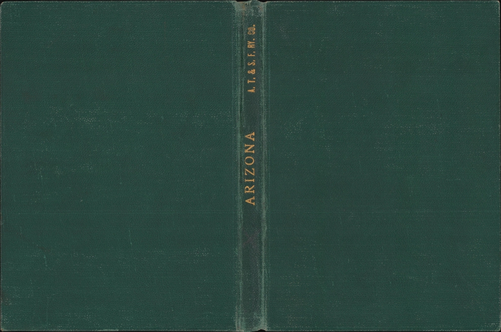
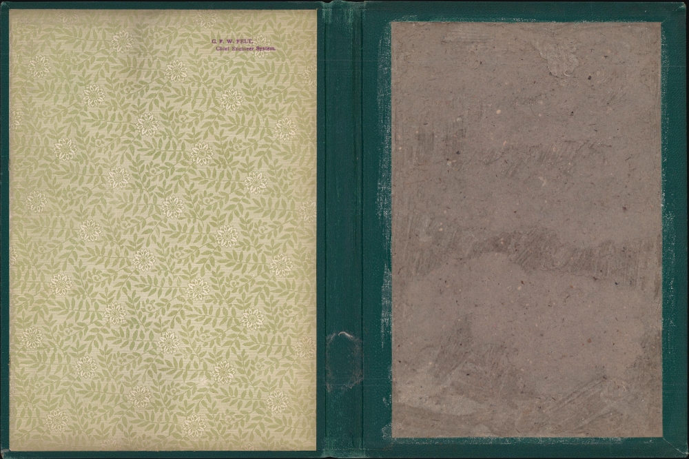
This map came out of the collection of the 'Atchison, Topeka and Santa Fe Railroad', based on the embossed label on the binder's spine and the stamp on the inside cover of the binder. That stamp references C. F. W. Felt, the System's Chief Engineer. Charles Frederick Wilson Felt (1864 - 1928) was born in Salem, Massachusetts. Felt attended the Massachusetts Agricultural College before joining the 'Atchison, Topeka and Santa Fe Railroad' in September 1886 as an axman during the railroad's construction in Kansas and Colorado. Over the following decades, Felt rose through the ranks, working in various construction and surveying jobs for the 'Atchison, Topeka, and Santa Fe Railroad,' the 'Denver and Rio Grande Railroad,' the 'Arizona and Southern Railroad,' and the 'Topolobampo Line'' in Mexico. He received his first job as an engineer with the Northern division of the 'Gulf, Colorado and Santa Fe Railway' in April 1890. Felt then worked as an engineer for the 'Rio Grande Southern Railway' and in several positions for the 'Gulf, Colorado, and Santa Fe Railway'. In November of 1909, he returned to the 'Atchison, Topeka, and Santa Fe Railway' as Chief Engineer. Felt was named Chief Engineer System of the Atchison, Topeka and Santa Fe Railway system in April 1913, a position he held until just before his death. Felt died in Colorado Springs, Colorado, and was buried in Galveston, Texas.Publication History and Census
This map was compiled and drawn in 1912 by Daniel O'Hare with lettering by William Bauman under the direction of Ithamar P. Berthrong. The 1912 edition is well-represented institutionally.CartographerS
Ithamar Parsons Berthrong (February 26, 1853 - July 29, 1936) was an American surveyor, inventor, and draftsman active with the General Land Office of the U.S. Department of the Interior. Berthrong was born in Rochester, New York. He was made chief of the drafting division on March 23 of 1907. He is associated with many of the most important early 20th century maps issued by the GLO, among them, important maps of Arizona, Colorado, Wyoming, Oregon, Washington, and more. More by this mapmaker...
The General Land Office (GLO) (1812 - 1946) was an independent agency of the United States government responsible for public domain lands in the United States. Created in 1812, it took over functions previously conducted by the Department of the Treasury. The GLO oversaw the surveying, platting, and sale of public lands in the western United States. It also administered the Preemption Act of 1841, which allowed individuals who were already living on federal land to purchase up to 160 acres of land before it was offered for sale to the general public, if they met certain requirements. Following the passage of the Homestead Act in 1862, which was also administered by the GLO, claims under the Preemption Act sharply decreased. The GLO became a part of the newly-created Department of the Interior in 1849. In 1891 Grover Cleveland and Congress created 17 forest reserves, due to public concern over forest conservation, which were initially managed by the GLO, until they were transferred to the Forest Service in 1905. In 1946 the Government Land Office was merged with the United States Grazing Service to become the Bureau of Land Management. Today the Bureau of Land Management administers the roughly 246 million acres of public land remaining under federal ownership. Learn More...
Daniel P. O'Hare (c. 1866 - April 3, 1921) was a map draftsman and engraver for the General Land Office. Born in Washington, D.C., to an Irish father and an American mother, O'Hare worked for the U.S. Geological Survey and the General Land Office until his death. He appeared in the Washington D.C. city directory as an engraver beginning in the late 1880s but was not associated with the Geological Survey until 1890, which does not necessarily mean he wasn't working for the Geological Survey before 1890. Learn More...
William Bauman Jr. (1866 - July 16, 1933) was an American draftsman. Born in Maryland, Bauman Jr. worked for the General Land Office from the 1890s through at least the mid-1920s. He married Cora Walker (March 15, 1868 - January 18, 1904) on September 12, 1899, with whom he had two children. After retiring from the General Land Office (the historical record does not tell us when he retired), he moved to Florida with his second wife, Rosa, and died in Tampa on July 16, 1933. Learn More...
Condition
Very good. Dissected and mounted on linen in 25 panels.
References
OCLC 77598242, 828122625.