1944 Chapin Map of Romania, Bulgaria, and Ukraine during World War II
BalkanBarriers-chapin-1944$300.00

Title
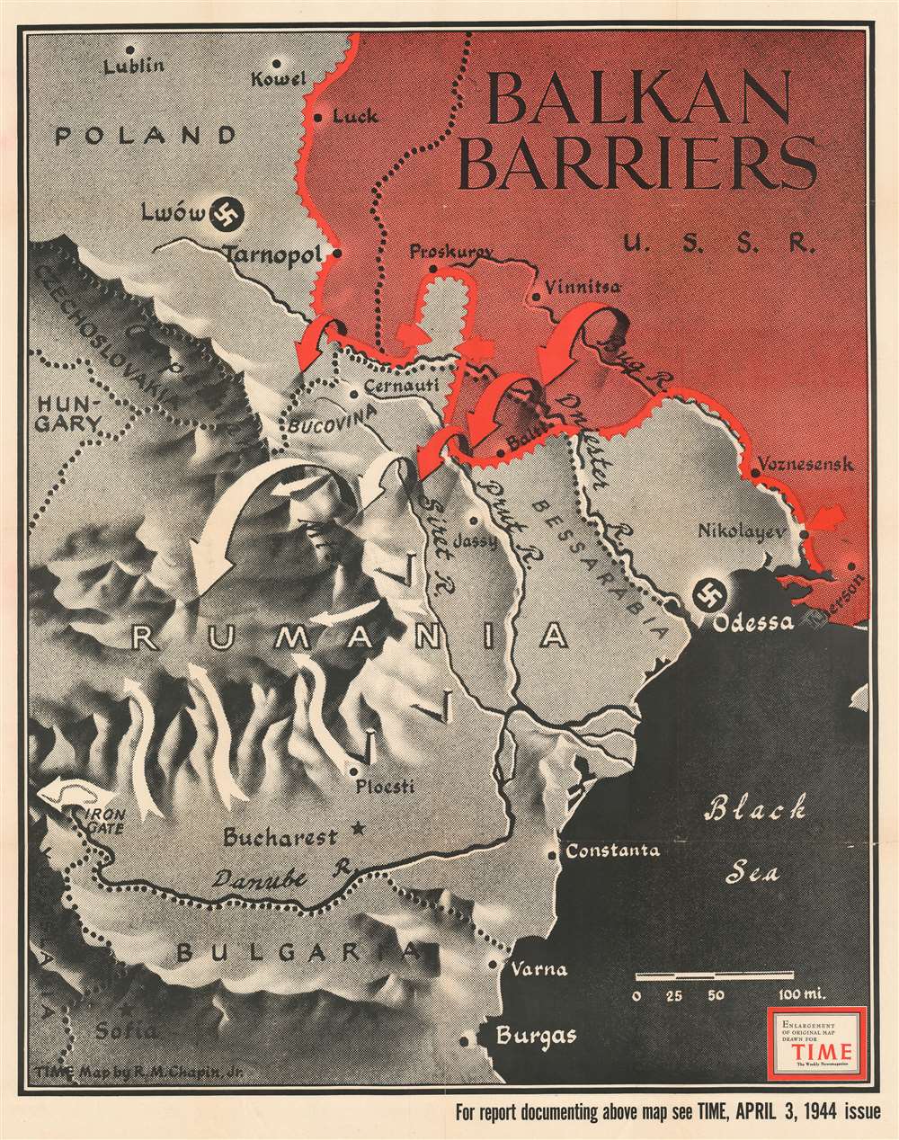
Balkan Barriers.
1944 (dated) 43 x 34 in (109.22 x 86.36 cm) 1 : 1056000
1944 (dated) 43 x 34 in (109.22 x 86.36 cm) 1 : 1056000
Description
Published during the 1944 World War II Red Army offensives on the Eastern Front, this 1944 Robert M. Chapin Jr. map of Romania, Bulgaria, and Ukraine emphasizes Soviet gains in the region. Red arrows, indicating Soviet troops, push south forcing white arrows, representing Axis forces, to retreat. Major cities, including Odessa, Lwów (now Lviv, Ukraine), Bucharest, and Sofia, stand in the Red Army's path. This map was produced to illustrate an article lauding the Red Army's impressive drive across Ukraine.
Publication History and Census
This map was drawn by Robert M. Chapin Jr. and published in the April 3, 1944 issue of TIME Magazine. One example is cataloged in OCLC and is part of the collection at Franklin and Marshall College.Cartographer
Robert M. Chapin Jr. (fl. 1933 - 1970) was a prominent architect, cartographer and illustrator active during World War II and the Cold War. Chapin graduated from the University of Pennsylvania in 1933 with a degree in architecture. Since this was the height of the Great Depression, and architects in low demand, he instead took work as a staff cartographer at Newsweek. Catching the attention of Manfred Gottfried of Time, Chapin was offered an accepted a position at the head of Time's cartography department. He remained with Time for some 33 years, from 1937 to 1970, often drawn 2 - 3 new thematic maps weekly. With an architect's gift visualizing information, Chapin became a skilled informational cartographer, heading the cartography department at Time Magazine. Chapin, like Fortune Magazine chief cartographer, Richard Edes Harrison, Chapin was at the forefront of infographic propaganda cartography, a genre that matured during the World War II Era and remains popular today. Working for Time Magazine, Chapin developed a signature style for his long run of 'War Maps.' Chapin was known for his maverick airbrush technique which lead to strong color splashes and intense shading. He also incorporated celluloid stencils to illustrate bomb explosions, flags, sinking ships, and more - generating a instantly recognizable standardized style. Chapin's Time war maps were further distinctive for their use of strong bold reds as a universal symbol of hostility. Chapin graduated from the University of Pennsylvania in 1933 with a degree in architecture. Since this was the height of the Great Depression, an d architects in low demand, he instead took work as a staff cartographer at Newsweek. Catching the attention of Manfred Gottfried of Time, Chapin was offered an accepted a position at the head of Time's cartography department. He remained with Time for some 33 years, from 1937 to 1970, often drawn 2 - 3 new thematic maps weekly. Chapin live in Sharon Connecticut. More by this mapmaker...
Condition
Very good. Exhibits minor wear along original fold lines and a few verso reinforcements. Bears collection stamp from the Ashtabula Public Library in Ohio on verso. We have contacted the library and confirmed that it was legally deaccessioned.
References
OCLC 81534009.