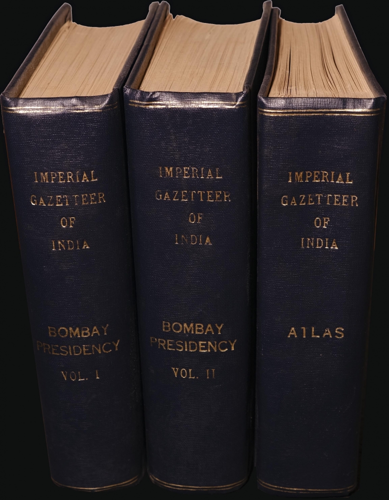
1909 Imperial Gazetteer of India, Bombay Presidency Series, with Atlas Volume
BombayPresidency-imperialgazetteer-1909$1,600.00


Title
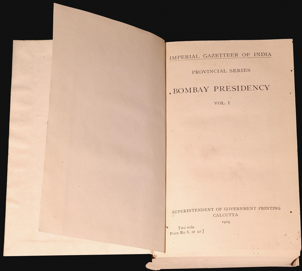
Imperial Gazetteer of India Provincial Series Bombay Presidency.
1909 (dated) 8.5 x 10 in (21.59 x 25.4 cm)
1909 (dated) 8.5 x 10 in (21.59 x 25.4 cm)
Description
A lovely example of the three-volume Bombay Presidency Series of the Imperial Gazetteer of India, detailing the geography of Bombay, Sindh, and other parts of the Subcontinent, published in 1909 by the Superintendent of Government Printing in Calcutta. This collection includes the scarce atlas volume focusing on the regions and cities, ranging from the Northwest Frontier Provinces to Burma.
A Closer Look
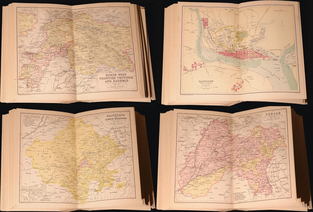
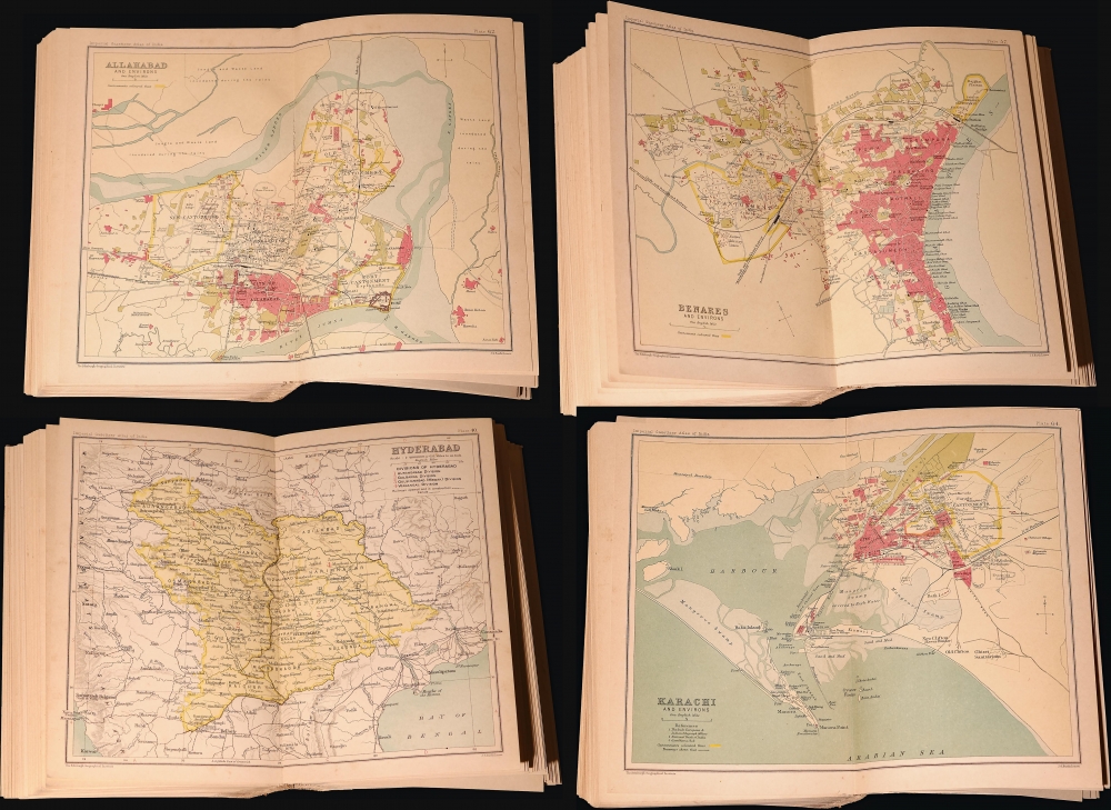
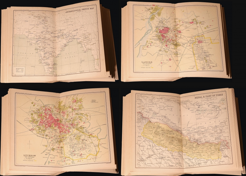
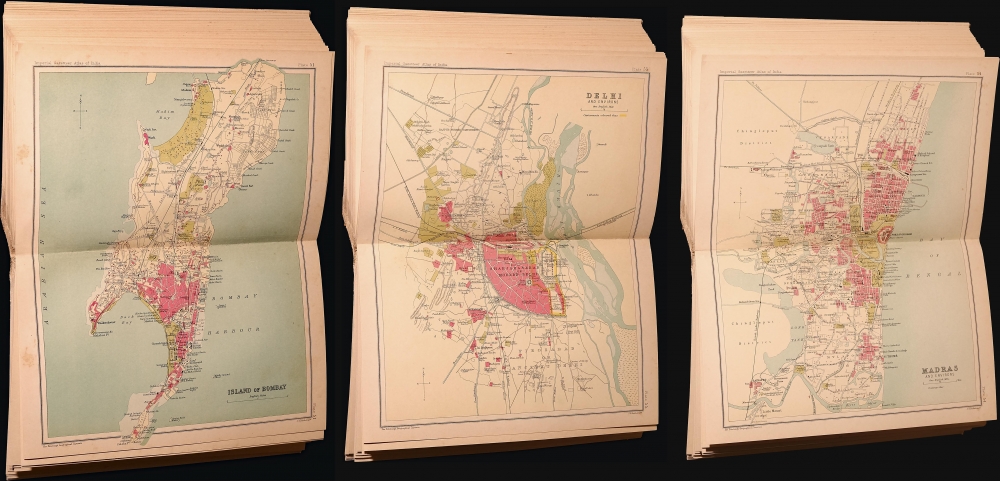
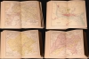
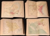
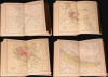
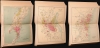
The atlas volume contains 64 plans of cities, including Bombay (Mumbai), Lahore, Karachi, Delhi, and Rangoon, as well as maps of provinces, historical and archaeological maps, railway maps, and more. The individual folio maps have a uniform size of 8.5 x 10 in. Chromolithographic printing allows for color shading to distinguish land use at the city level, or to distinguish directly administered territory from Princely States at the regional level. For the city plans, a wide range of features are illustrated and labeled, including parks, railways, docks, markets, government offices, hospitals, barracks, and forts. The regional maps denote geographic features (mountains and waterways especially) along with cities, towns, and railways.The Imperial Gazetteer of India
The Imperial Gazetteer of India was a reference work distributed throughout the British Empire. It was first published in 1881, largely the product of research by Sir William Wilson Hunter, a Scottish member of the Indian Civil Service. Being a statistician by training, Hunter aimed to standardize and expand ongoing provincial-level projects and develop statistics for the entire Subcontinent. Following the publication of the first edition, subsequent editions in 1885-87, 1908-1909, and 1931 grew the original nine volumes to nearly thirty. In addition to the national-level gazetteer, a Provincial Series was prepared, with the present Bombay Presidency Series being perhaps the most prominent. These did include data (and in this case maps) relating to other parts of India and India as a whole, but focused more on the particular province in question.Publication History and Census
This printing of the Imperial Gazetteer of India is the 'Provincial Series Bombay Presidency' issued in 1909 by the Superintendent of Government Printing in Calcutta. Interestingly, the individual maps were not reprinted from Survey of India maps (perhaps because they were deemed too detailed or sensitive for an atlas format) but were instead produced by J. G. Bartholomew and the Edinburgh Geographic Institute. Due to the multiple volumes and printings (other provincial series as well as a national, unified gazetteer) establishing a precise census of these volumes is difficult. However, in general, the atlas volume is especially rare (we are unable to find a clear reference to it in the OCLC, as catalog listings only refer to two volumes), while volumes one and two are present in a handful of academic institutions in North America, Europe, and the former British Empire.Cartographer
The Bartholomew Family (fl. c. 1810 - 1920) is clan of map publishers active in London through the 19th century. They represent one of the great names in British cartography. The cartographic story of the Bartholomew family begins with George Bartholomew (January, 8 1784 - October 23, 1871, active from 1797), an engraver in the employ of the Daniel Lizars firm of Edinburgh. George was the first of six generations in the Bartholomew map-making dynasty. It was his son, John Bartholomew Sr. (1805 - April 9, 1861) who ultimately founded John Bartholomew and Sons in 1828. The John Bartholomew firm produced thousands of maps and rose to become one of the largest and most prolific cartography firms in Scotland. John Sr. was succeeded by his son, also John Bartholomew Jr. (1831-93). John George Bartholomew (1860-1920), son of John Bartholomew (1831-93) took control of the firm at its height. John George was a charter member of the Royal Scottish Geographical Society and supported the creation of a National Institute of Geography - a good idea that never took off. John George is also reliably attributed to be the first to bring the term "Antarctica" into popular usage as a denominator for the Southern Continent. In recognition of his work, John George was awarded a warrant from the king and often used the title "Cartographer to the King" on his imprint. Among his friends and admirers he was referred to as the "Prince of Cartography". John (Ian) Bartholomew (1890 - 1962) continued the family business and oversaw publication of the Times Survey Atlas of the World in 1922 and the Mid Century Edition of the Time Atlas of the World from 1955 - 1960. John Christoper Bartholomew (1923 - 2008) continued the family business into a fifth generation and was fascinated by the natural sciences. He spearheaded the publication of many of the most detailed and popular maps of the last century. His brother Robert, a trained printer, became production director. Another brother, Peter, an accountant, started as a managing director and eventually became executive chairman. The John Bartholomew firm has been part of the HarperCollins family of publishers since 1989. The vast archive of maps and atlases produced by the Bartholomew family has since been transferred to the National Library of Scotland where it is currently in the cataloguing process. More by this mapmaker...
Condition
Good. Most maps are in good condition, with a few having centerfold splits. Some are loose from atlas, but the whole is complete. The volumes were rebound in a linen library-style binding.
References
OCLC 221306059 (lacking atlas volume).