1912 Poole Bros Map of California, w/ Pictorial Vignettes
California-poole-1912$600.00

Title
Map of California and Santa Fe Lines. / Summer Excursions California and North Pacific Coast.
1912 (dated) 27 x 24.75 in (68.58 x 62.865 cm)
1912 (dated) 27 x 24.75 in (68.58 x 62.865 cm)
Description
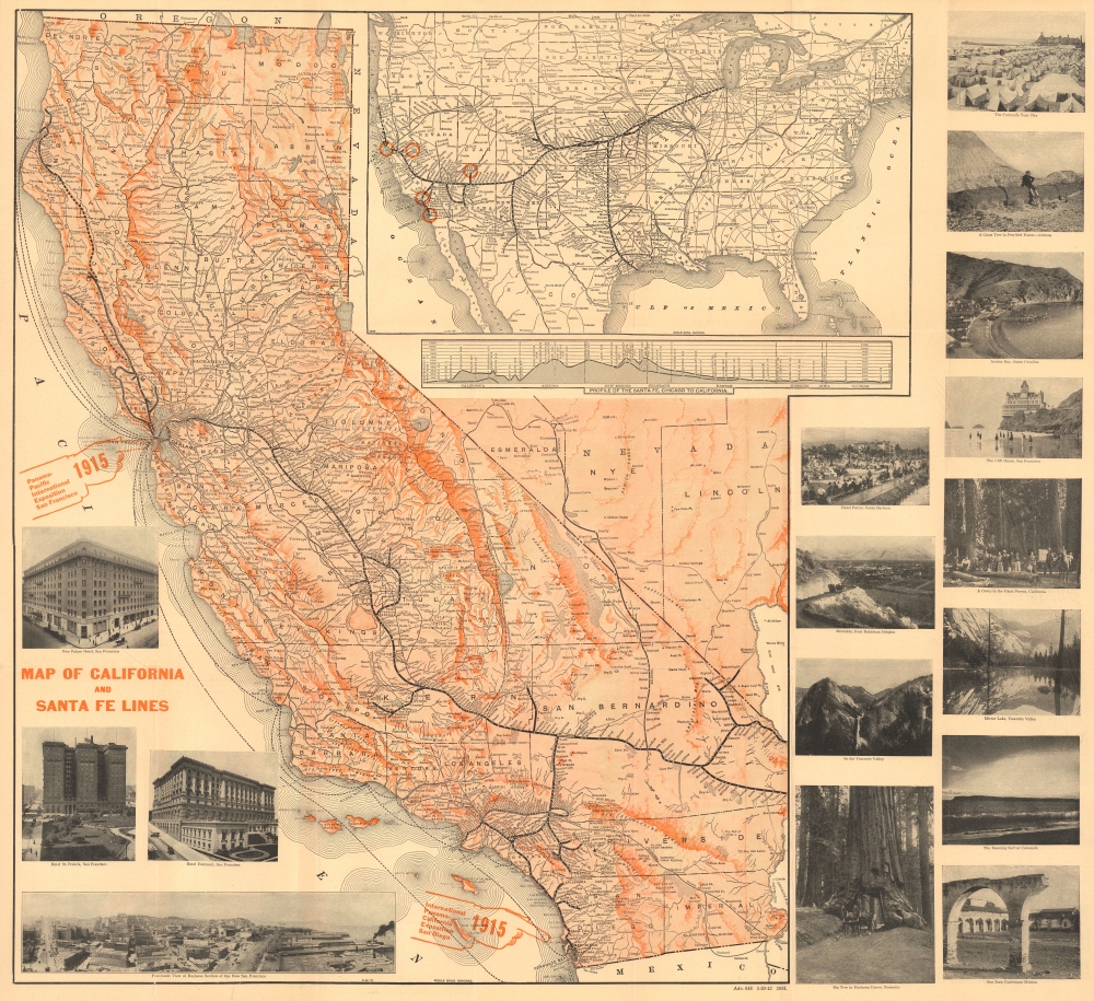
This 1912 Poole Brothers folding map of California was produced for the 'Atchison, Topeka and Santa Fe Railway' (often referred to simply as 'the Santa Fe'). It highlights the railway's transcontinental service, which brought passengers to the Grand Canyon and the upcoming Panama-Pacific and Panama-California Expositions, located in San Francisco and San Diego, respectively.
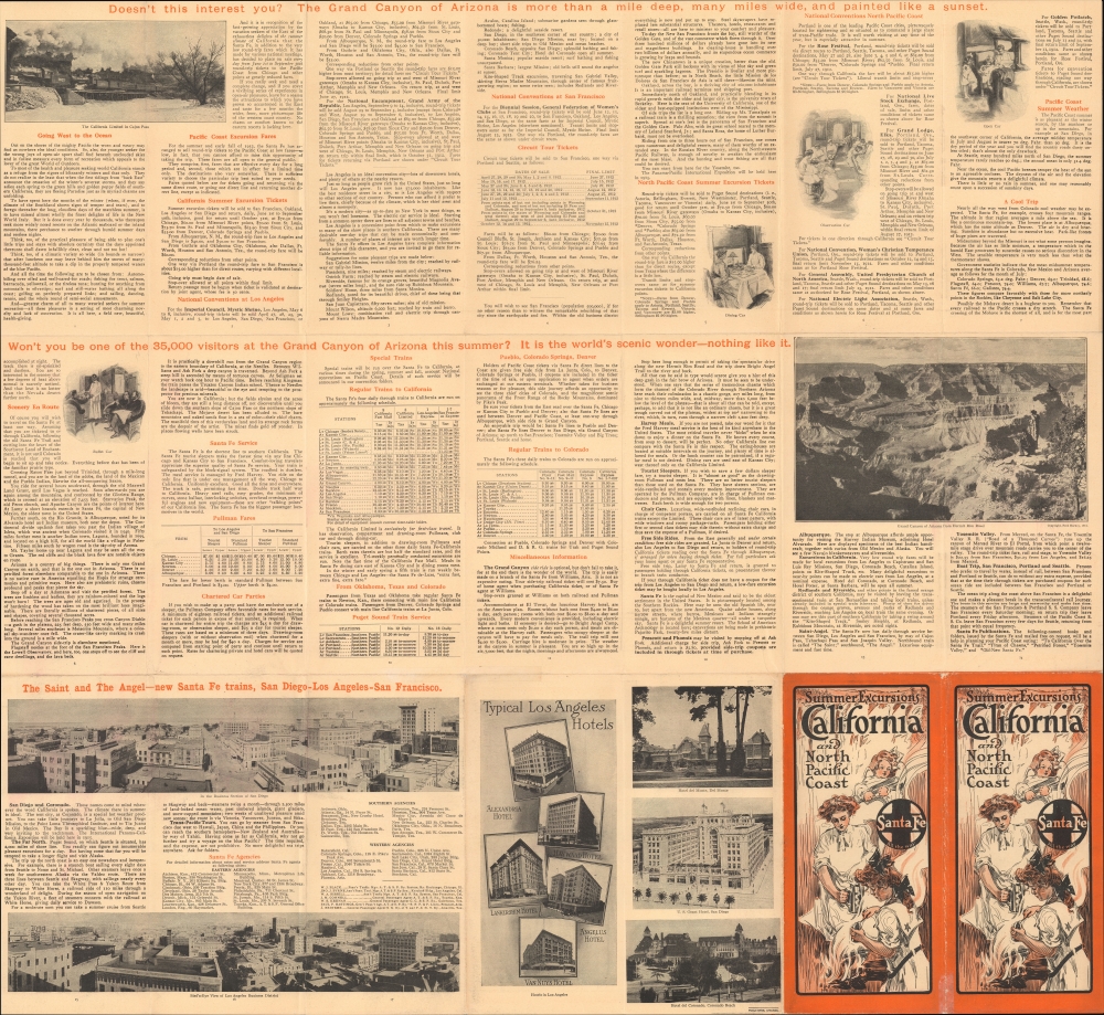
Photographs around the map present hotels and tourist attractions in San Francisco, San Diego, and elsewhere in Arizona and California. The verso contains more photographs and promotional text, as well as timetables and fares for the railway's luxurious sleeper-only Pullman service, information on weather and events taking place in California cities, the locations of Santa Fe offices in various cities, and explanations of side tours, as far as the Pacific Northwest, offered by the Santa Fe.
A Closer Look
This striking foldout map of California promotes potential stops on the Santa Fe Railroad, including the wonders of the Grand Canyon - certainly an enticing detour to any traveler of means. The main map displays the state of California and a portion of southern Nevada, shaded for relief, with cities and towns, rail lines (completed and in progress, with those of the Santa Fe and its subsidiaries bolded), steamship lines, county boundaries, and major topographic features (such as Death Valley and Lake Tahoe) noted. A large inset map at the top right displays the entire Santa Fe system between Chicago and California, with orange circles highlighting major stops and attractions (Grand Canyon, Los Angeles, San Diego, San Francisco, and Yosemite National Park). Below the inset is a profile of elevation along the route, giving a sense of the dramatic changes in landscape awaiting passengers.Photographs around the map present hotels and tourist attractions in San Francisco, San Diego, and elsewhere in Arizona and California. The verso contains more photographs and promotional text, as well as timetables and fares for the railway's luxurious sleeper-only Pullman service, information on weather and events taking place in California cities, the locations of Santa Fe offices in various cities, and explanations of side tours, as far as the Pacific Northwest, offered by the Santa Fe.
A Tale of Two Expositions
Large hand illustrations point to San Francisco and San Diego, indicating the locations of the dueling Panama-Pacific and Panama-California Expositions, both of which would be easily accessible via the Santa Fe (which had acquired the Southern California Railway in 1906) and its subsidiaries and partners. Towards the end of the first decade of the 20th century, both cities proposed plans to host an international exposition to celebrate the coming completion of the Panama Canal. The two cities were hardly comparable; San Francisco had a population ten times larger, was better known internationally, and had the added incentive of a desire to celebrate the city's recovery from the destructive earthquake and fire of 1906. But planners in San Diego pressed ahead, even while lacking the backing of both the state and federal governments that San Francisco's exposition enjoyed. In the end, however, funding from bond measures and determination by the San Diego planners resulted in an impressive event (lasting throughout 1915 and 1916), even if it has been far less remembered than its San Francisco rival (February - December 1915). Balboa Park was completely remade, and several of the exposition's structures were retained permanently (more than in San Francisco). The exposition's exotic animal displays laid the foundation for the world-renowned San Diego Zoo.The Atchison, Topeka and Santa Fe Railway
The Atchison, Topeka and Santa Fe Railway (often shortened to 'the Santa Fe') was chartered on February 11, 1859, with the stated goal of joining Atchison and Topeka, Kansas with Santa Fe, New Mexico. The Santa Fe reached Albuquerque in 1880 and began creating real estate offices to sell off the land granted to them across Kansas for settlers to make the route economically viable. Santa Fe, the original destination, was reached by a spur branch of the railway from Lamy, New Mexico. Eventually, when the Santa Fe connected with the Southern Pacific at Deming, New Mexico, it completed the second transcontinental railroad route. In 1897, when the Santa Fe traded a railroad line in Mexico with the Southern Pacific for its line from Needles to Barstow, the ATSF became the first railroad in the United States to own its own line from Chicago to the Pacific coast (leading to the railroad's memorable slogan 'Santa Fe All the Way'). The Santa Fe merged with the Burlington Northern Railroad in 1995, creating the Burlington Northern and Santa Fe Railroad (BNSF), which still operates today.Publication History and Census
This map and brochure were prepared by the Chicago firm Poole Brothers for the Atchison, Topeka and Santa Fe Railway. The map promotes the upcoming 1915 expositions, but the verso content makes clear that it was printed in 1912, likely 1-20-12, as suggested in the coding below the map. The map was first printed in an earlier 1911 edition (no known examples) and later editions in 1914 and 1920. One example of each edition (1914 and 1920) appears in the OCLC (at Yale University and the University of California Berkeley, respectively). Each edition has modifications to the photographs and text included and to the title panel (the front cover when folded) but maintains the same main map and inset overview map of the Santa Fe system at the top-right. The present edition does not appear in any institutional collections and has no known history on the market.Cartographer
Poole Brothers (1878 - 1968) were a Chicago based firm active in the late 19th and early 20th century with an initial focus on promotional railroad maps. Poole Brothers was founded by George Amos Poole (March 20, 1843 – September 7, 1918). In 1868, Poole, along with his uncle William H. Rand (1828 - 1915) and Andrew McNally (1836 - 1904), purchased the Chicago Tribune's job printing plant and formed the firm Rand McNally. In 1878, he left Rand McNally to form, with his brother William H. Poole, Poole Brothers, a direct competitor to Rand McNally for the lucrative railroad business. Like many of its competitors, Poole Brothers maintained an office on Chicago's Printer's Row (downtown Loop district). Their earliest known work is an 1880 map of Yellowstone National Park. In 1887, Poole Brothers, Andrew McNally, and several others formed the United Typothetae of America, a master printers association. In 1848, they were cited, along with Rand McNally and George Cram, by the Federal Trade Commission for price fixing. Their earliest known work is an 1880 map of Yellowstone National Park. Afterward they went on to produce a vast range of maps and other print products including tickets, cards, coupons, and restaurant menus. In time Poole Brothers merged with Newman-Randolph, which was then acquired by the American Can Company in the early 1960s. The American Can Company liquidated its printing concerns later in the same decade. More by this mapmaker...
Condition
Very good. A few minor fold spits reinforced archivally on verso.