
Poole Brothers (George Amos Poole, William H. Poole)
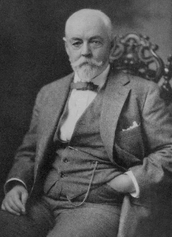
Poole Brothers (1878 - 1968) were a Chicago based firm active in the late 19th and early 20th century with an initial focus on promotional railroad maps. Poole Brothers was founded by George Amos Poole (March 20, 1843 – September 7, 1918). In 1868, Poole, along with his uncle William H. Rand (1828 - 1915) and Andrew McNally (1836 - 1904), purchased the Chicago Tribune's job printing plant and formed the firm Rand McNally. In 1878, he left Rand McNally to form, with his brother William H. Poole, Poole Brothers, a direct competitor to Rand McNally for the lucrative railroad business. Like many of its competitors, Poole Brothers maintained an office on Chicago's Printer's Row (downtown Loop district). Their earliest known work is an 1880 map of Yellowstone National Park. In 1887, Poole Brothers, Andrew McNally, and several others formed the United Typothetae of America, a master printers association. In 1848, they were cited, along with Rand McNally and George Cram, by the Federal Trade Commission for price fixing. Their earliest known work is an 1880 map of Yellowstone National Park. Afterward they went on to produce a vast range of maps and other print products including tickets, cards, coupons, and restaurant menus. In time Poole Brothers merged with Newman-Randolph, which was then acquired by the American Can Company in the early 1960s. The American Can Company liquidated its printing concerns later in the same decade.
AKA: George Amos Poole, William H. Poole
A 'Strange and Bewildering' Wonderland.
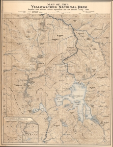
Map of the Yellowstone National Park. / Northern Pacific R.R. The Wonderland Route to the Pacific Coast / Alice's Adventures in the New Wonderland The Yellowstone National Park.
$850.00
Acquire
- Digital Map Information
- Suitable for large format printing
- Full resolution TIFF file
- ICC color profile embedded
- Delivered instantly via download link
This impressive, early promotional chromolithographic map of Yellowstone National Park was prepared by Carl J. Hals and Arvid Rydstrom in 1882 and was printed by Poole Brothers for the Northern Pacific Railroad. It coincided with the Northern Pacific's opening of a rail link to the park, the first easy means for the masses to access it, which helped boost the park's image in the popular imagination and spur Western American nature tourism. (more details)
Striking chromolithograph of Yellowstone!
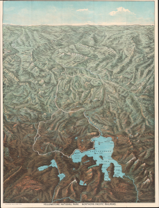
Yellowstone National Park. Northern Pacific Railway.
$1,500.00
Acquire
- Digital Map Information
- Suitable for large format printing
- Full resolution TIFF file
- ICC color profile embedded
- Delivered instantly via download link
This is an 1895 chromolithograph bird's-eye view map of Yellowstone National Park, Wyoming, prepared by Charles S. Fee, the Passenger Traffic Manager at the Northern Pacific Railroad, and printed by Poole Bros. It reflects the deep connection between the park and the railroad, which provided the first direct and relatively fast (non-stagecoach) connection between Yellowstone and the eastern United States. (more details)
President Grant invests in Mexican Railroads.
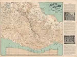
Mexican Southern Railway Ferrocarril Mexicano del Sur. / Mexican Southern Railway F.C. Mexicano del Sur to Oaxaca and Southern Mexico Only Route to the Ruins of Mitla.
$350.00
Acquire
- Digital Map Information
- Suitable for large format printing
- Full resolution TIFF file
- ICC color profile embedded
- Delivered instantly via download link
A scarce c. 1897 map of the Mexican Southern Railway and other rail lines in southern Mexico, most likely printed by Poole Brothers of Chicago. (more details)
Encouraging emigration to Oregon and Washington.
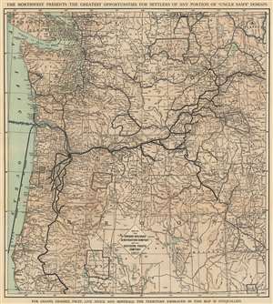
Map of the Oregon Railroad and Navigation Company and the Southern Pacific Company (Lines in Oregon).
$400.00
Acquire
- Digital Map Information
- Suitable for large format printing
- File Size: 109.21 MB
- File Type: ZIP / TIFF
- ICC color profile embedded
- Delivered instantly via download link
This is an 1898 Poole Brothers map of Washington and Oregon issued to promote Oregon emigration, land sales, and railroad travel. The map was published on behalf of the Oregon Railroad and Navigation Company and the Southern Pacific Railroad. (more details)
Aftermath of the Yukon Gold Rush.
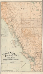
Routes of the Canadian Pacific Railway Company's Steamers, British Columbia Coast Service. / Alaska Puget Sound British Columbia...
$450.00
Acquire
- Digital Map Information
- Suitable for large format printing
- Full resolution TIFF file
- ICC color profile embedded
- Delivered instantly via download link
This is a 1907 Poole Brothers map of the Pacific Coast of British Columbia and environs, produced for the Canadian Pacific Railway. Though highlighting multiple steamship routes in the region, it was produced in the wake of the Yukon Gold Rush, the impetus for establishing most of these services. (more details)
Santa Fe All the Way.
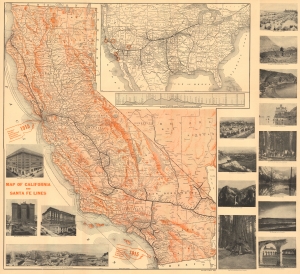
Map of California and Santa Fe Lines. / Summer Excursions California and North Pacific Coast.
$600.00
Acquire
- Digital Map Information
- Suitable for large format printing
- Full resolution TIFF file
- ICC color profile embedded
- Delivered instantly via download link
This 1912 Poole Brothers folding map of California was produced for the 'Atchison, Topeka and Santa Fe Railway' (often referred to simply as 'the Santa Fe'). It highlights the railway's transcontinental service, which brought passengers to the Grand Canyon and the upcoming Panama-Pacific and Panama-California Expositions, located in San Francisco and San Diego, respectively. (more details)
The Canadian Pacific Railway and connecting railroads.
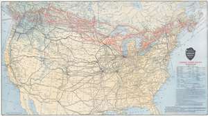
Canadian Pacific Railway and Connecting Lines.
$250.00
Acquire
- Digital Map Information
- Suitable for large format printing
- File Size: 48.38 MB
- File Type: ZIP / TIFF
- ICC color profile embedded
- Delivered instantly via download link
This 1912 Poole Brothers railroad map of the United States and Canada details the Canadian Pacific Railway and its many connections. Created with both vacationers and business travelers in mind, bright red lines highlight the Canadian Pacific Railway's network throughout southern Canada and the northern United States. These lines connect Boston, Ottawa, Montreal, Detroit, Minneapolis, Chicago, Winnipeg, and Vancouver. Canadian national parks, such as Banff, are labeled in bold. Thinner but bold black lines promote lines connecting cities further afield throughout the United States, underscoring the railroad's continental reach. Additionally, dashed lines trace steamship routes, including one between Vancouver, Victoria, and Seattle. Information concerning ticketing routes and optional routes appears in the lower right. (more details)
Weaving Rails through the Adirondack Wilderness.
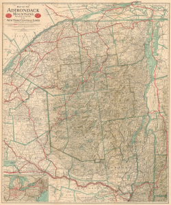
Map of the Adirondack Mountains showing How to Reach Them by the New York Central Lines / Map of the Adirondacks and List of Hotels, Boarding Houses...
$400.00
Acquire
- Digital Map Information
- Suitable for large format printing
- Full resolution TIFF file
- ICC color profile embedded
- Delivered instantly via download link
This is a large-format 1914 map of the Adirondack region, prepared by Matthews-Northrup for the New York Central Railroad. At this time, the New York Central had a near-monopoly on the Adirondacks, which had become a favorite destination for elite clientele from New York and other cities in the eastern U.S. and Canada. (more details)
One of the great National Parks.
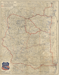
Union Pacific System Map of Rocky Mountain National (Estes) Park Denver Mountain Parks.
$400.00
Acquire
- Digital Map Information
- Suitable for large format printing
- File Size: 49.35 MB
- File Type: ZIP / TIFF
- ICC color profile embedded
- Delivered instantly via download link
An uncommon 1922 map of Estes Park and the Rocky Mountain region west of Denver and Fort Collins issued by Poole Brothers on behalf of the Union Pacific Railroad. The map promotes travel to Denver on the Union Pacific with car excursions to Rocky Mountain National Park (Estes Park). Red overprinting illustrates potential auto routes past noteworthy towns and natural wonders. (more details)
From the Midwest to Midway.
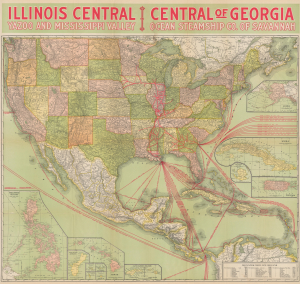
Illinois Central Yazoo and Mississippi Valley Central of Georgia Ocean Steamship Co. of Savannah.
$800.00
Acquire
- Digital Map Information
- Suitable for large format printing
- Full resolution TIFF file
- ICC color profile embedded
- Delivered instantly via download link
This is a striking, large-format 1922 Poole Brothers map of the United States produced for the Illinois Central Railroad and affiliated railroads. In addition to promoting the Illinois Central network, the map is also notable for demonstrating the increasingly global economic reach of the United States. (more details)
Take the Southern Railway to sunny Florida!
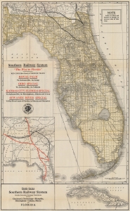
Southern Railway System. 'The Way to Florida'.
$250.00
Acquire
- Digital Map Information
- Suitable for large format printing
- Full resolution TIFF file
- ICC color profile embedded
- Delivered instantly via download link
This is a 1922 Poole Brothers railroad map of Florida highlighting the Southern Railway System. The map highlights the Southern Railway and other connected railroads, promoting railway access to Florida. (more details)
Chicago to Cuba, and Everywhere in Between.
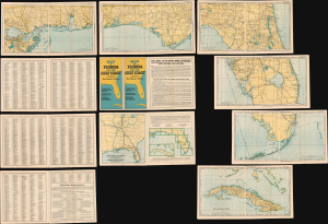
Map of Florida and the Gulf Coast including the territory from New Orleans to Havana.
$400.00
Acquire
- Digital Map Information
- Suitable for large format printing
- File Size: 127.29 MB
- File Type: ZIP / TIFF
- ICC color profile embedded
- Delivered instantly via download link
This is a 1926 map booklet or loose-leaf atlas of Florida, the Gulf Coast, and Cuba, prepared by Poole Brothers. It is designed to promote the 'Dixie Flyer,' a collaborative enterprise between three railroad companies that offered luxurious sleeper train service between Chicago and Jacksonville, with stops in St. Louis, Atlanta, and other cities. (more details)
One of the South's great rail networks.
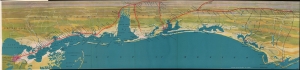
Untitled / [Gulf Coast].
$650.00
Acquire
- Digital Map Information
- Suitable for large format printing
- File Size: 19.96 MB
- File Type: ZIP / TIFF
- ICC color profile embedded
- Delivered instantly via download link
A vibrantly colored 1926 Poole Brothers bird's-eye view of the northern coast of the Gulf of Mexico, from New Orleans to Apalachicola. The view promotes the Louisville and Nashville Railroad. It appeared in the booklet New Orleans: the city of progress, beauty, charm, and romance, distributed by the railroad. (more details)
Access to Alaska's natural wealth.
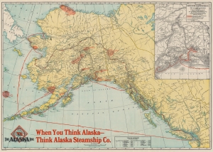
When You Think Alaska - Think Alaska Steamship Co.
$450.00
Acquire
- Digital Map Information
- Suitable for large format printing
- Full resolution TIFF file
- ICC color profile embedded
- Delivered instantly via download link
This is a 1929 Poole Brothers map of Alaska promoting the Alaska Steamship Company and their routes from the northernmost Alaska to Seattle, Washington. The map highlights American enthusiasm over the mineral wealth and natural resources of Alaska and the Yukon. (more details)
Ferry across Lake George or Lake Champlain!
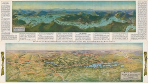
Lake George Lake Champlain.
$350.00
Acquire
- Digital Map Information
- Suitable for large format printing
- Full resolution TIFF file
- ICC color profile embedded
- Delivered instantly via download link
Featuring two views on one sheet, this is a 1932 Poole Brothers view map of Lake George and Lake Champlain, New York. It was issued to promote the Lake George Steamboat Company and the Champlain Transportation Company, and thus highlight natural beauty and transportation. (more details)