Digital Image: 1875 Roe and Colby Map of Camden and Rockport, Maine
Camden-roecolby-1875_d

Title
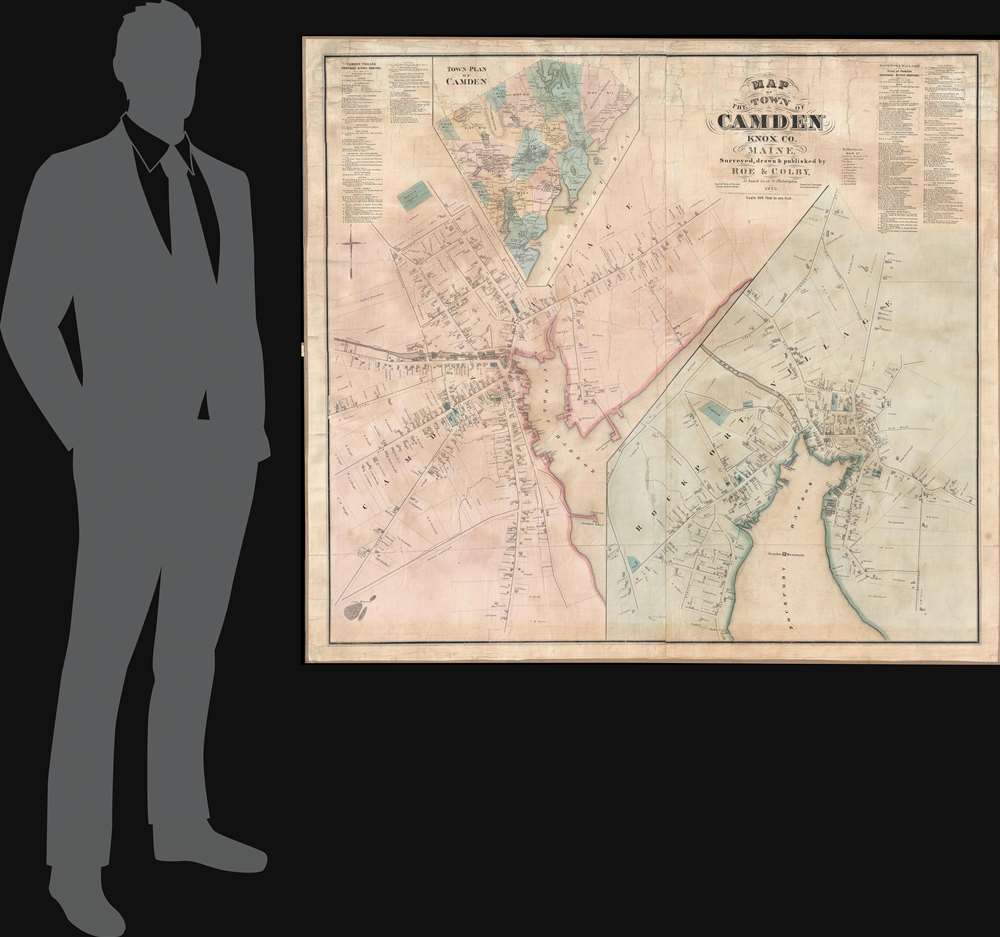
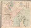
Map of the Town of Camden Knox Co. Maine.
1875 (dated) 49.5 x 44.5 in (125.73 x 113.03 cm) 1 : 2400
1875 (dated) 49.5 x 44.5 in (125.73 x 113.03 cm) 1 : 2400
Description
FOR THE ORIGINAL ANTIQUE MAP, WITH HISTORICAL ANALYSIS, CLICK HERE.
Digital Map Information
Geographicus maintains an archive of high-resolution rare map scans. We scan our maps at 300 DPI or higher, with newer images being 600 DPI, (either TIFF or JPEG, depending on when the scan was done) which is most cases in suitable for enlargement and printing.
Delivery
Once you purchase our digital scan service, you will receive a download link via email - usually within seconds. Digital orders are delivered as ZIP files, an industry standard file compression protocol that any computer should be able to unpack. Some of our files are very large, and can take some time to download. Most files are saved into your computer's 'Downloads' folder. All delivery is electronic. No physical product is shipped.
Credit and Scope of Use
You can use your digial image any way you want! Our digital images are unrestricted by copyright and can be used, modified, and published freely. The textual description that accompanies the original antique map is not included in the sale of digital images and remains protected by copyright. That said, we put significant care and effort into scanning and editing these maps, and we’d appreciate a credit when possible. Should you wish to credit us, please use the following credit line:
Courtesy of Geographicus Rare Antique Maps (https://www.geographicus.com).
How Large Can I Print?
In general, at 300 DPI, you should at least be able to double the size of the actual image, more so with our 600 DPI images. So, if the original was 10 x 12 inches, you can print at 20 x 24 inches, without quality loss. If your display requirements can accommodate some loss in image quality, you can make it even larger. That being said, no quality of scan will allow you to blow up at 10 x 12 inch map to wall size without significant quality loss. For more information, it is best consult a printer or reprographics specialist.
Refunds
If the high resolution image you ordered is unavailable, we will fully refund your purchase. Otherwise, digital images scans are a service, not a tangible product, and cannot be returned or refunded once the download link is used.
Cartographer S
George Nehemiah Colby (January 13, 1846 - 1890) was an American civil engineer and map publisher active in Houlton, Maine in the late 19th century. Colby was born in South Berwick Maine and was married to Julie Gertrude Ganong (1853 – 1889). Colby's corpus of work consists primarily of Maine focused wall maps, county and state atlases, and more specific regional maps, for which he personally compiled surveys and sold by subscription. Colby initially worked with the U.S. Coast Survey, where his work contributed to the survey's important 1881 map of Mount Desert Island, Maine. In the private market Colby published Maine centered material in the style of Massachusetts cartographer Henry Walling. That is to say, he issued highly detailed maps on a large scale that he sold by subscription to local institutions and land owners. Colby's maps, like Walling's, are exceptionally desirable for anyone interested in family history, as they often list individual family names and land holdings. Colby pwartnered Frederick B. Roe in 1873 to issue wall maps of several Maine towns including New Brunswick, Thomaston, Bath, and Camden. This partnership lasted until about 1878 and maintained offices in Philadelphia at 31 South 6th Street. Colby later partnered with Joseph Harry Stuart (1855 - 183?) to similarly publish subscription-based maps and atlases of Maine counties and communities. When Colby retired in the 1890s, Stuart fully took over his business, continuing to publish as J. N Stuart into the 1930s. Colby and his wife had three children, George Nehemiah, Frederik Franklin, and Mary Gertrude. More by this mapmaker...
Frederick B. Roe (1845 – April, 1905) was an American civil engineer and map publisher. Roe was born in Brookfield, Connecticut. Roe was of a generation of cartographers, along with Henry Walling, Frederick Beers, George Colby, J. N Stuart, and others who, taking advantage of the lithography printing revolution, traveled throughout the United States mapping and publishing large scale town and county maps. These were generally sold by subscription and were often printed only in very small runs. Roe seems to have been primarily based in Philadelphia, which was then an important map printing center, but he traveled extensively. He also lived for a time in Reading Pennsylvania, where he served a term on the Common Council. He also lived for a time in Wilmington, Delaware, where he lived while working on a detailed wall map of that region. Roe partnered with George N. Colby in 1873 to issue wall maps of several towns in Maine including New Brunswick, Thomaston, Bath, and Camden. This partnership lasted until about 1878 and maintained offices in Philadelphia at 31 South 6th Street. Later he moved his offices to 17 North 6th Street, Philadelphia. Among his more important works is a detail city plan of Duluth, Minnesota, published with Albertson and Chamberlain. He died in Cincinnati in the last week of April, 1905. Learn More...
References
Camden Public Library, CHRC 2011.4.6