1944 Army Map Service Road Map of the Central and Southern Philippines
CentralSouthernPhilippines-ams-1944$300.00

Title
Central and Southern Philippines.
1944 (dated) 38.25 x 27.75 in (97.155 x 70.485 cm) 1 : 1000000
1944 (dated) 38.25 x 27.75 in (97.155 x 70.485 cm) 1 : 1000000
Description
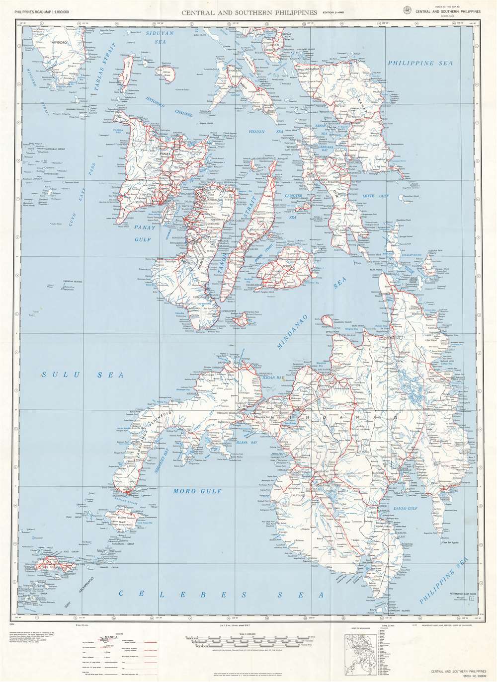
This is a 1944 Army Map Service map of the central and southern Philippines. The map depicts the region from the Mindoro Strait to Mindanao and the Philippine Sea and from Luzon and Mindoro to the Celebes Sea and the Sulu Archipelago. Created as a road map for U.S. and Allied armed forces, bright red lines highlight the 'surface, all-weather, regularly maintained roads throughout the illustrated islands. Other depicted roads decline in grade, from those that are only partly surfaced and could be relied upon only in dry weather to simple trails, are identified by different symbols which are explained in detail in a legend situated along the bottom border. Roads that were under construction as of 1941 are marked by two parallel dashed lines. Apart from the roads, myriad cities, towns, and villages are labeled throughout, with many of the smallest islands not having any identified settlements. Seas, straits, passages, gulfs, and sounds are all identified as well with blue block lettering.
Publication History and Census
This map was created and published by the Army Map Service of the United States Army in 1944. It is well represented in institutional collections but is scarce on the private market today.Cartographer
The Army Map Service (AMS) (1941 - 1968) was the military cartographic agency of the U.S. Department of Defense and part of the U.S. Army Corps of Engineers. The AMS compiled, published, and distributed military topographical maps and other related materials for use by the U.S. Armed Forces. They also prepared maps for space exploration, intelligence reports, and the establishment of world geodetic control networks. Formed during World War II, by the end of the war the Army Map Service had prepared 40,000 maps. 3,000 different maps were created for the Normandy invasion alone. The AMS was instrumental in the Korean War and the Vietnam War, and during all three of these conflicts distributed tens of millions of maps to U.S. servicemen. On September 1, 1968, the AMS was resdesignated the U.S. Army Topographic Command, and continued under this name as an independent organization until January 1, 1972 when it was merged with the new Defense Mapping Agency and renamed the DMA Topographic Center. The Defense Mapping Agency was added to the National Imagery and Mapping Agency on October 1, 1996, which was redesigned the National Geospatial-Intelligence Agency in 2003. More by this mapmaker...
Condition
Very good. Light wear along original fold lines. Blank on verso.
References
OCLC 929858895.