Digital Image: 1892 Melville Panoramic View of Chicago
ChicagoPanorama-melville-1892_d

Title
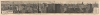
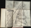
Grand Panoramic View of the Heart of Chicago. Overlooking the entire Business Portion of the City, lake Michigan, and the Columbian Exposition.
1892 (dated) 8.5 x 55.75 in (21.59 x 141.605 cm)
1892 (dated) 8.5 x 55.75 in (21.59 x 141.605 cm)
Description
FOR THE ORIGINAL ANTIQUE MAP, WITH HISTORICAL ANALYSIS, CLICK HERE.
Digital Map Information
Geographicus maintains an archive of high-resolution rare map scans. We scan our maps at 300 DPI or higher, with newer images being 600 DPI, (either TIFF or JPEG, depending on when the scan was done) which is most cases in suitable for enlargement and printing.
Delivery
Once you purchase our digital scan service, you will receive a download link via email - usually within seconds. Digital orders are delivered as ZIP files, an industry standard file compression protocol that any computer should be able to unpack. Some of our files are very large, and can take some time to download. Most files are saved into your computer's 'Downloads' folder. All delivery is electronic. No physical product is shipped.
Credit and Scope of Use
You can use your digial image any way you want! Our digital images are unrestricted by copyright and can be used, modified, and published freely. The textual description that accompanies the original antique map is not included in the sale of digital images and remains protected by copyright. That said, we put significant care and effort into scanning and editing these maps, and we’d appreciate a credit when possible. Should you wish to credit us, please use the following credit line:
Courtesy of Geographicus Rare Antique Maps (https://www.geographicus.com).
How Large Can I Print?
In general, at 300 DPI, you should at least be able to double the size of the actual image, more so with our 600 DPI images. So, if the original was 10 x 12 inches, you can print at 20 x 24 inches, without quality loss. If your display requirements can accommodate some loss in image quality, you can make it even larger. That being said, no quality of scan will allow you to blow up at 10 x 12 inch map to wall size without significant quality loss. For more information, it is best consult a printer or reprographics specialist.
Refunds
If the high resolution image you ordered is unavailable, we will fully refund your purchase. Otherwise, digital images scans are a service, not a tangible product, and cannot be returned or refunded once the download link is used.
Cartographer
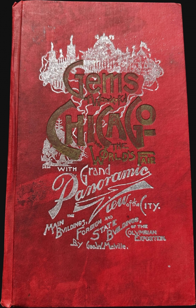
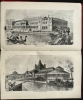
George William Melville (February 1856 - November 30, 1928) was an American engraver, artist, and designer. Born in Sandusky, Ohio, one of Melville's earliest published works is an engraving of the pump house and standpipe of the Sandusky Water Works published in the 1882 Sandusky City Directory. He moved to Chicago in the late 1880s and published a book entitled Gems of Wonderful Chicago and the World's Fair. Over the course of his career, he also published panoramas of the World's Fairs in Portland, San Francisco, and St. Louis. Late in life Melville moved to Los Angeles, California and died there in 1928. More by this mapmaker...
Source
Melville, G. W., Gems of Wonderful Chicago and Th Worlds's Fair, (Chicago: George W. Melville) 1893.
References
OCLC 2603352.