
This item below is out of stock, but another example (left) is available. To view the available item, click "Details."
Details
1905 Walker Trolley Map and View of New England Centered on Boston
1905 (dated) $700.00
1845 Ewing Map of England
England-ewing-1845$50.00

Title
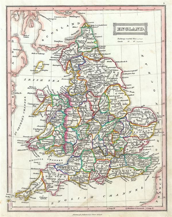
England.
1845 (undated) 10.5 x 8.5 in (26.67 x 21.59 cm) 1 : 3200000
1845 (undated) 10.5 x 8.5 in (26.67 x 21.59 cm) 1 : 3200000
Description
This is an attractive 1845 map of England and Wales by Thomas Ewing. The map covers both England and Wales from Northumberland to Cornwall, including the Isle of Man. Throughout, the map identifies various cities, towns, rivers, lakes, roadways and an assortment of additional topographical details. As this map was issued, both England and Wales were in the midst of the Industrial Revolution wherein much of the rural agricultural population relocated to urban centers. This map was published in 1845 by Oliver and Boyd as part of Ewing's New General Atlas.
Source
Oliver and Boyd, Ewing's New General Atlas: containing Distinct Maps of all the Principal States and Kingdoms throughout the World, (Edinburgh) 1845.
Condition
Very good. Minor foxing at places. Blank on verso.