1922 Southern Railway System Railroad Map of Florida
FloridaSouthernRy-poolebros-1922$250.00

Title
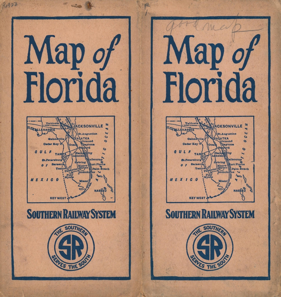
Southern Railway System. 'The Way to Florida'.
1922 (dated) 28.25 x 17.5 in (71.755 x 44.45 cm) 1 : 844800
1922 (dated) 28.25 x 17.5 in (71.755 x 44.45 cm) 1 : 844800
Description
This is a 1922 Poole Brothers railroad map of Florida highlighting the Southern Railway System. The map highlights the Southern Railway and other connected railroads, promoting railway access to Florida.
A Closer Look
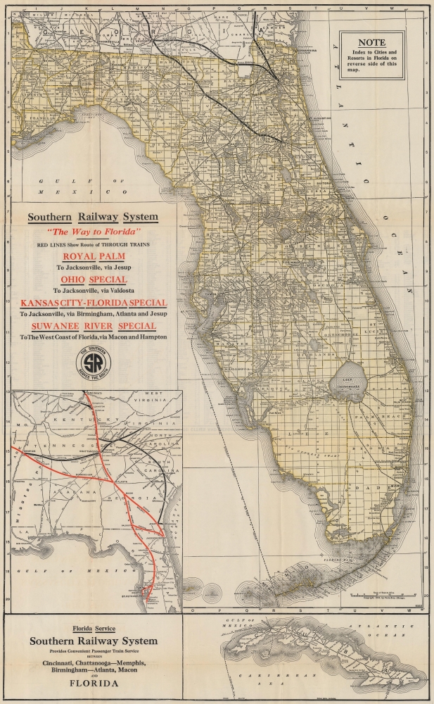
Depicting from southern Georgia to Key West and from Apalachicola east to the Atlantic. Bold lines highlight the Southern Railway System. Stops are labeled. Thinner lines illustrate the rest of Florida's railway network, including the Seaboard Air Line, the Atlantic Coast Line, and the Florida East Coast Railway. Cities and towns throughout are labeled. Canals connecting Lake Okeechobee with the Atlantic are illustrated. An inset map along the left border depicts from Cincinnati south to Sarasota and highlights Southern Railway routes to Florida. Other major railroad lines are shown as well, illustrating connections to the Southern Railway. An inset in the bottom right depicts Cuba, along with its railway network and the many steamship routes between that island and points around the Gulf of Mexico and the Caribbean.Southern Railway System
The Southern Railway System (1894 - 1982) was born in 1894 when financier J. P. Morgan consolidated the Richmond and Danville Railroad, Memphis and Charleston Railroad, East Tennessee, Virginia, and Georgia Railroad, the Alabama Great Southern Railroad, and Georgia Southern and Florida Railroad. At that point, the Southern Railway operated over 4,400 miles of track and owned two-thirds of that trackage. The Southern Railway continued to expand through the first two decades of the 20th century, eventually becoming an 8,000-mile, 13-state system that lasted for nearly 50 years. The Southern Railway resisted the railroad merger trend in the 1960s and remained an independent regional carrier. However, competition and the creation of the CSX Corporation in November 1980, forced the Southern Railway to merge with the Norfolk and Western Railway to form the Norfolk Southern Railway, which began operating in 1982 and still operates today.Publication History and Census
This map was created and copyrighted by Poole Brothers and published by the Southern Railway System in 1922. Editions of this map were published annually from 1920 until 1925 (that we know of), although the central map of Florida bears the 1915 copyright on all editions. For some unknown reason, the 1920 edition includes an updated date to 1920 on the central map, which is the only one to do so. Poole Brothers also published a 1915 railroad map of Florida that depicted the entire state, including the western panhandle, which we have previously sold (see Geographicus floridarailroads-poolebros-1915). We note an example of the present edition at the Touchton Map Library.Cartographer
Poole Brothers (1878 - 1968) were a Chicago based firm active in the late 19th and early 20th century with an initial focus on promotional railroad maps. Poole Brothers was founded by George Amos Poole (March 20, 1843 – September 7, 1918). In 1868, Poole, along with his uncle William H. Rand (1828 - 1915) and Andrew McNally (1836 - 1904), purchased the Chicago Tribune's job printing plant and formed the firm Rand McNally. In 1878, he left Rand McNally to form, with his brother William H. Poole, Poole Brothers, a direct competitor to Rand McNally for the lucrative railroad business. Like many of its competitors, Poole Brothers maintained an office on Chicago's Printer's Row (downtown Loop district). Their earliest known work is an 1880 map of Yellowstone National Park. In 1887, Poole Brothers, Andrew McNally, and several others formed the United Typothetae of America, a master printers association. In 1848, they were cited, along with Rand McNally and George Cram, by the Federal Trade Commission for price fixing. Their earliest known work is an 1880 map of Yellowstone National Park. Afterward they went on to produce a vast range of maps and other print products including tickets, cards, coupons, and restaurant menus. In time Poole Brothers merged with Newman-Randolph, which was then acquired by the American Can Company in the early 1960s. The American Can Company liquidated its printing concerns later in the same decade. More by this mapmaker...
Condition
Very good. Light wear along original fold lines. Verso repair to a fold separation. Accompanied by original binder.
References
Touchton Map Library L2019.059.021.