
This item below is out of stock, but another example (left) is available. To view the available item, click "Details."
Details
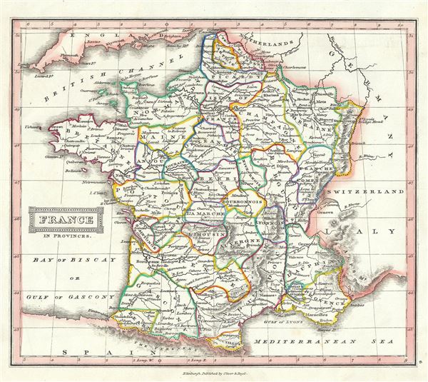
1844 Black Map of France in Provinces
1844 (undated) $100.00
1845 Ewing Map of France in Provinces
FranceProvinces-ewing-1845$50.00

Title
France in Provinces.
1845 (undated) 8.5 x 9.5 in (21.59 x 24.13 cm) 1 : 5700000
1845 (undated) 8.5 x 9.5 in (21.59 x 24.13 cm) 1 : 5700000
Description
This is a lovely example of Thomas Ewing's 1845 map of France. The map covers the Kingdom of France showing its various divisions according to province. It covers from the Flanders in the north to Roussillon in the south and from Brittany in the west to Alsace in the east. Throughout, the map identifies various cities, towns, rivers, lakes, roadways, railways and an assortment of additional topographical details.
France was organized into provinces until March 4, 1790, when the National Constituent Assembly reorganized the Provinces into Departments. The change was an attempt to eradicate local loyalties based on feudal ownership of land and focus all loyalty on the central government in Paris. There were roughly 40 provinces in France before they were abolished. Nonetheless, the province system was so engrained that most cartographers felt obliged to include two maps of France in their atlases, one showing the current department system, and another defining the defunct provinces.
This time in French history marked the rule of the July Monarchy, a liberal constitutional monarchy under King Louis-Philippe. The July Monarchy would last until the Revolution of 1848 and ultimately lead to the establishment of the Second Republic. In less than a year after the December 2, 1851 coup d'etat, the Second Republic transformed into the Second Empire, established by a referendum on November 7, 1852. President Louis-Napoleon Bonaparte, elected by the heavily Bonapartist French people, officially became Napoleon III, Emperor of the French, from the symbolic and historic date of December 2, 1852.
This map was published in 1845 by Oliver and Boyd as part of Ewing's New General Atlas.
Source
Oliver and Boyd, Ewing's New General Atlas: containing Distinct Maps of all the Principal States and Kingdoms throughout the World, (Edinburgh) 1845.
Condition
Very good. Minor foxing at places. Blank on verso.