1724 Johannes Kip View or City Map of Gloucester, England
Gloucester-kip-1724$350.00

Title
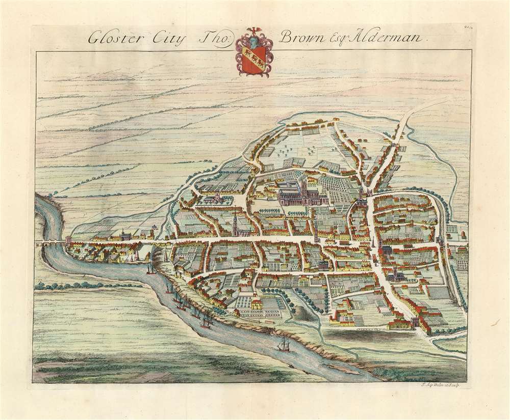
Gloster City Tho: Brown Esq. Alderman.
1724 (undated) 13.5 x 16.5 in (34.29 x 41.91 cm)
1724 (undated) 13.5 x 16.5 in (34.29 x 41.91 cm)
Description
This is an attractive 1724 bird's-eye view of Gloucester in the United Kingdom, by Johannes Kip. The northwest-oriented view is centered on the city's unmistakeable cathedral. Westgate Street, Southgate Street and the London Road can all be clearly seen, as well as the gates after which these streets were clearly named. Ships can be seen sailing the River Severn in the foreground. Though not named, St. Mary de Lode Church is identifiable as well. Not only these, but also the great manors of the city are shown, revealing their grounds and formal gardens in detail. Kip made a specialty of documenting England's noble estates, so the detail available here is unsurprising.
Publication History and Census
This view was first drawn and engraved for inclusion in Sir Robert Atkyns's 1712 The Ancient and Present State of Glostershire, for which Kip produced seventy three plates. It was also included in the 1724 Nouveau theatre de la Grande Bretagne published in London by Joseph Smith, from which this example came. The Nouveau Theatre is well represented in institutional collections, but the separate map appears in only five listings in OCLC.Cartographer
Johannes "Jan" Kip (1652 or 53 - 1722) was a Dutch draftsman, engraver and print dealer. Together with Leonard Knyff, he made a speciality of engraved views of English country houses and towns. Kip learned his trade under Stopendaal from 1668 to 1670. His own work began to appear in 1672. After producing works for the court of William ofOrange in Amsterdam, Kip relocated to London (following King William III and Queen Mary II in the 'Glorious Revolution' of 1688.) He then travelled around England documenting notable estates. to found a successful printselling business. He worked as an illustrator for other London publishers as well as his own. He is perhaps best known for the folio illustrations he produced for the 1708 Britannia Illustrata, 1708 and 65 plates he engraved for Sir Robert Atkyns' 1712 The Ancient and Present State of Glostershire, and for Le Nouveau Théâtre de la Grande Bretagne, 1715. More by this mapmaker...
Source
Smith, Joseph Nouveau theatre de la Grande Bretagne London 1724.
Condition
Very good condition. Reinforced at bottom and top of centerfold, not effecting printed image.
References
OCLC 163234524.