1727 Pontoppidan View and Map of Copenhagen, Denmark
GrundrissCopenhagen-pontoppidan-1727$950.00

Title
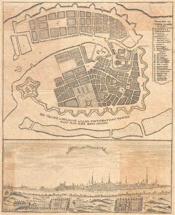
Grundriss von Copenhagen Ao 1727
1727 (dated) 17 x 13.5 in (43.18 x 34.29 cm)
1727 (dated) 17 x 13.5 in (43.18 x 34.29 cm)
Description
This is a scarce early map of the city of Copenhagen, Denmark by Erich Pontoppidan dating to 1727. Beautifully covers the capital city of Denmark within its fortified walls. Streets, and buildings are noted. A key near the right border lists the important locations marked on the map.
This map depicts the city as it stood just a year prior to the Copenhagen fire of 1728 which destroyed nearly a fourth of the city and left a large number of its population homeless. The fire would be remembered as the largest fire in the history of the city.
Below the map proper, a large view of the city is included. Beautifully rendered fields, houses, buildings and streets can be seen. The map was created by Erich Pontoppidan and engraved by Samuel Joachim.
Condition
Very good. Minor wear along original fold lines. Minor foxing and toning.
References
OCLC: 762356418.