Digital Image: 1778 Surville Map of North Brazil, East Venezuela, Guyana
GuyanaBrazil-surville-1778_d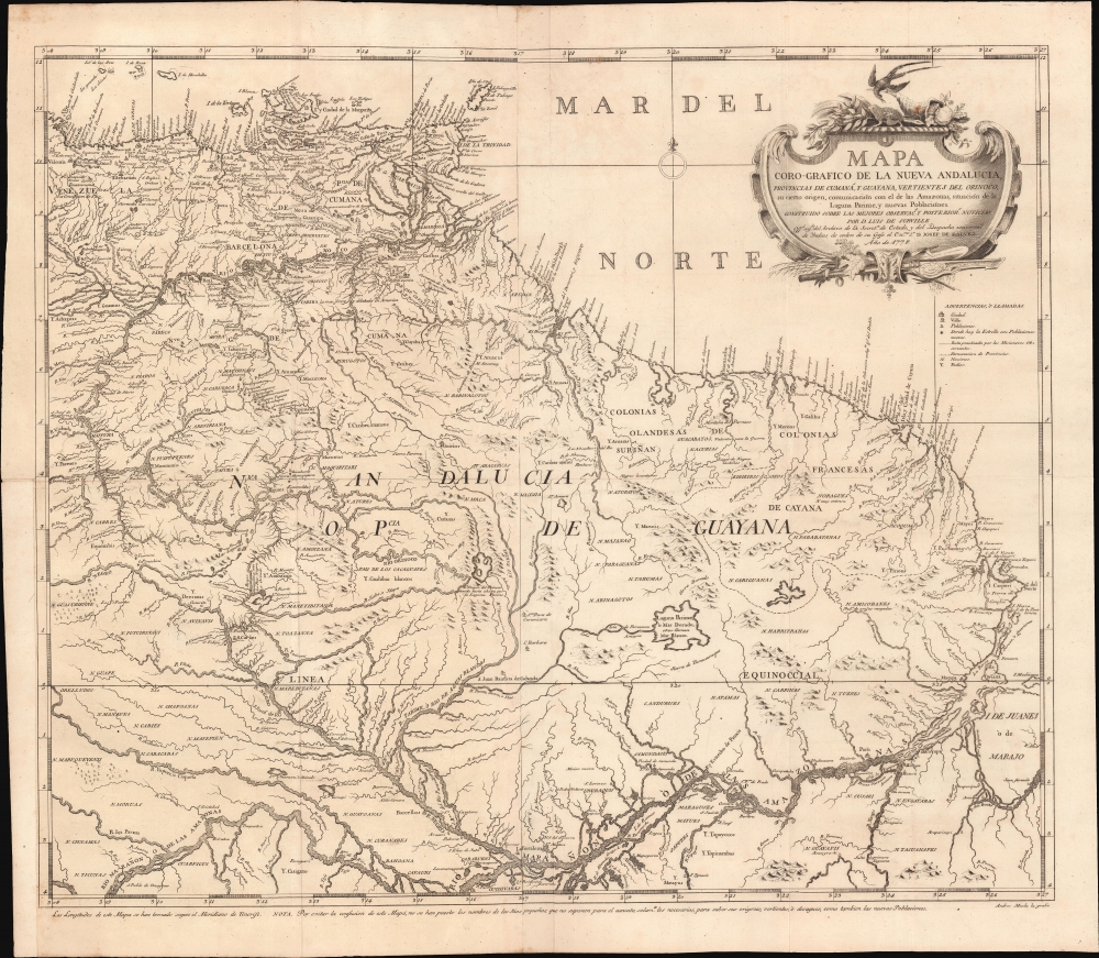

Title
Mapa Coro-Grafico de La Nueva Andalucia, Provincias de Cumaná, y Guyana, Vertientes de Orinoco, su cierto origen, Ccomunicación con el de las Amazonas, situación de la Laguna Parime, y nuevas Poblaciónes.
1778 (dated) 23 x 27 in (58.42 x 68.58 cm) 1 : 3500000
1778 (dated) 23 x 27 in (58.42 x 68.58 cm) 1 : 3500000
Description
FOR THE ORIGINAL ANTIQUE MAP, WITH HISTORICAL ANALYSIS, CLICK HERE.
Digital Map Information
Geographicus maintains an archive of high-resolution rare map scans. We scan our maps at 300 DPI or higher, with newer images being 600 DPI, (either TIFF or JPEG, depending on when the scan was done) which is most cases in suitable for enlargement and printing.
Delivery
Once you purchase our digital scan service, you will receive a download link via email - usually within seconds. Digital orders are delivered as ZIP files, an industry standard file compression protocol that any computer should be able to unpack. Some of our files are very large, and can take some time to download. Most files are saved into your computer's 'Downloads' folder. All delivery is electronic. No physical product is shipped.
Credit and Scope of Use
You can use your digial image any way you want! Our digital images are unrestricted by copyright and can be used, modified, and published freely. The textual description that accompanies the original antique map is not included in the sale of digital images and remains protected by copyright. That said, we put significant care and effort into scanning and editing these maps, and we’d appreciate a credit when possible. Should you wish to credit us, please use the following credit line:
Courtesy of Geographicus Rare Antique Maps (https://www.geographicus.com).
How Large Can I Print?
In general, at 300 DPI, you should at least be able to double the size of the actual image, more so with our 600 DPI images. So, if the original was 10 x 12 inches, you can print at 20 x 24 inches, without quality loss. If your display requirements can accommodate some loss in image quality, you can make it even larger. That being said, no quality of scan will allow you to blow up at 10 x 12 inch map to wall size without significant quality loss. For more information, it is best consult a printer or reprographics specialist.
Refunds
If the high resolution image you ordered is unavailable, we will fully refund your purchase. Otherwise, digital images scans are a service, not a tangible product, and cannot be returned or refunded once the download link is used.
Cartographer S
Luis de Surville y Villerey (c. 1737 - November 22, 1789) was Spanish military engineer and cartographer active in Madrid, Spain, in the second half of the 18th century. Surville is a second-generation engineer. He studied mathematics at the Real Seminario de Nobles de Madrid and afterwards was a cartographer and master draughtsman at the same from 1767 to 1776. Afterwards he was recommended by José de Gálvez (1720 - 1787) to post of 2nd draftsman at the Despacho de Indias (Office of the Indies). Like most cartographers in the Despacho de Indias, Surville was not himself an explorer and did not travel extensively, instead his work focused on compiling and reconciling cartographic information collected by explorers and missionaries abroad - as well as military documents associated with European Wars. He died in Madrid in 1789. More by this mapmaker...
Andrés Muela (1760 - 18xx), also known as Andrés de la Muela, was a Spanish artist, printer, and engraver active in Madrid in the second half of the 18th century and the very early years of the 19h. He is best known for his devotional ephemera, but he also produced maps, botanicals, and zoological prints. His last known work is a zoological image of an anteater dating to 1804. Learn More...
References
OCLC 556761281. National Library of Chile, MC0041363. Yale University Library, 91 1778.