1853 Dépôt de la Marine Nautical Map of the Coast of China: Hong Kong / Macau
HainanNamoa-depotmarine-1853$750.00

Title
Carte de la Mer de Chine (3ème Feuille) d'Hainan à Namoa.
1853 (dated) 23.5 x 35.25 in (59.69 x 89.535 cm) 1 : 875000
1853 (dated) 23.5 x 35.25 in (59.69 x 89.535 cm) 1 : 875000
Description
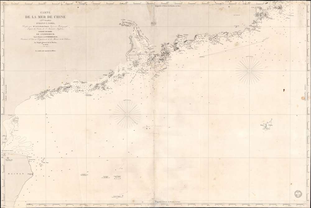
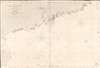
This is an 1853 French Dépôt de la Marine nautical map of the coast of China from Hainan to Nan'ao Island (Namao), including Macao, Hong Kong, and Guangzhou (Canton). The chart was issued to support growing French trade with China in the Treaty Port Era.
French Trade with China
Guangzhou (Canton) had been a center for international trade for over 1,000 years by the time this chart was published. From 1700 to the 1842 Treaty of Nanking, the 'Canton System' forced all foreign trade with China to pass through Canton. After the Treaty of Nanking, five open treaty ports (Shanghai, Canton (Guangzhou), Ningpo (Ningbo), Foochow (Fuzhou), and Amoy (Xiamen) opened, and Hong Kong was leased to the British Empire. On October 24, 1844, France signed the Treaty of Whampoa with the Chinese, which stipulated that China would grant France the same privileges it granted to Britain in 1842, including the opening of the new treaty ports to French merchants, a fixed tariff on Sino-French trade, extraterritorial privileges for French citizens in China, and the right to station consuls in China. The first French Catholic charity was founded in 1843, after which French Catholic missionaries were extremely active throughout China. This chart, published between the First and Second Opium Wars, focuses on Canton and the surrounding region, underscoring the city's continued importance to French traders.Publication History and Census
This map was created by Ferdinand Antoine Jules de la Roche-Poincié and published by the French Dépôt de la Marine in 1853 during the Second French Empire. An empty OCLC record exists for this map, suggesting that a former OCLC member institution created the entry.CartographerS
Dépôt des Cartes et Plans de la Marine (fl. 1720 - present), often called the Dépôt de Marine, was a French hydrographic mapping organization founded in 1720 under Charles-Hercule of Albert de Luynes (1674 - 1734). Much like the U.S. Coast Survey, the British Admiralty, and the Spanish Deposito Hydrografico, the Dépôt was initiated as a storehouse and distribution center of existing nautical and marine charts. Eventually the Dépôt initiated its own mapping activities in an attempt to improve and expand upon existing material. Some of the more prominent cartographers and hydrographers associated with the of Dépôt des Cartes were, Philippe Buache, Jacques-Nicholas Bellin, Giovanni Rizzi-Zannoni, Rigobert Bonne, and Jean Nicolas Buache. More by this mapmaker...
Ferdinand Antoine Jules de la Roche-Poncié (August 19, 1810 – March 30, 1881) was a French hydrographic engineer and cartographer active throughout the 19th century. Poncié was born in Vauxrenard, France. After graduating from the École Polytechnique in 1829 he joined the French navy, becoming a naval hydrographic engineer in 1832. Numerous important French surveys bear his name, including the first detailed hydrographic survey of the St. Pierre and Miquelon Islands, and numerous maps of East Asian waters. He received the Legion of Honor in 1841, ultimately attaining the grade of Commander. In 1860 he settled in Paris where he became a member of the Hydrographic Committee under Rear-Admiral Pierre Mathieu. He died in Paris in 1881. Learn More...
Condition
Good. Verso repairs to centerfold separations. Closed tear extending one-half (.5) inch into printed area from bottom margin near centerfold repaired on verso. Margins trimmed to border, with some loss to border.
References
OCLC 556906413.