1956 U.S. Air Force Aeronautical Map of Hainan Strait and Southern China
HainanStrait-usaf-1956$100.00

Title
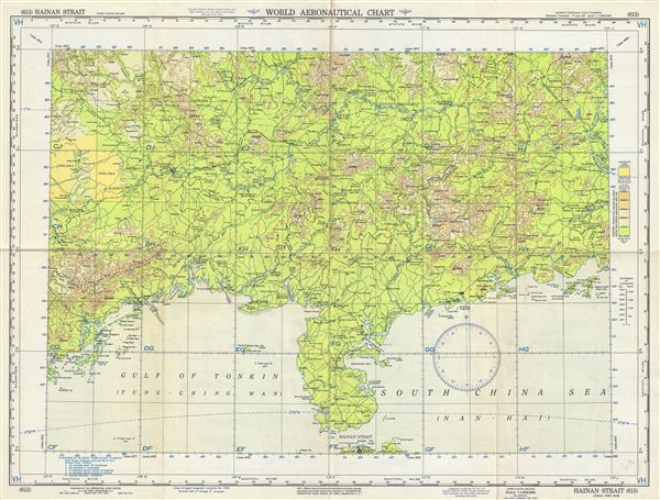
Hainan Strait China-Vietnam.
1956 (dated) 22 x 29 in (55.88 x 73.66 cm) 1 : 1000000
1956 (dated) 22 x 29 in (55.88 x 73.66 cm) 1 : 1000000
Description
This is a fine 1956 U.S. Air Force aeronautical chart or map of the Hainan Strait or Qiongzhou Strait and southern China. It covers from Hong Hai (Hon Gay) in Vietnam east to Guanghai Bay in China, inclusive of the Leizhou Peninsula and north as far as Xiangzhou. The map is highly detailed and notes important cities, towns, rivers, roads, islands as well as other hydrographical and topographical features essential for the air pilot. Verso of this chart features legends and a world aeronautical chart index. This chart was published by the USAF Aeronautical Chart and Information Service, and was issued as chart no. 615. First issued in 1946, this is the fifth edition revised to Feb 1956.
Condition
Very good. Minor wear and toning along original fold lines. Some spotting.