1721 Senex Map of Hungary
Hungary-senex-1721$400.00

Title
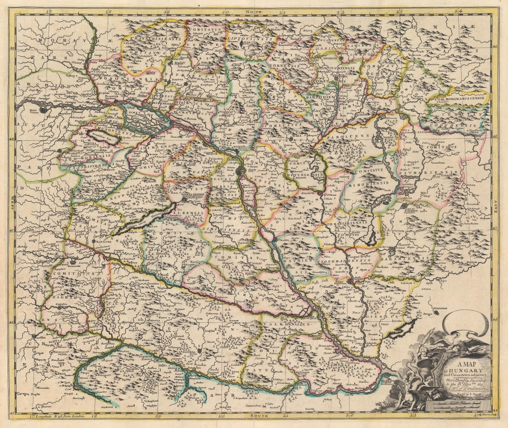
A Map of Hungary and Countries adjacent.
1721 (undated) 19 x 22.75 in (48.26 x 57.785 cm) 1 : 1050000
1721 (undated) 19 x 22.75 in (48.26 x 57.785 cm) 1 : 1050000
Description
This is a 1721 John Senex map of Hungary and the surrounding region, including parts of modern-day Austria, Slovakia, Croatia, and Serbia.
A Closer Look
Depicting from Vienna (top-left) to Belgrade (bottom-right), the Danube River immediately draws the eye. Buda and Pest are illustrated and labeled, along with numerous other towns and villages along the river and throughout the region. Mountains and trees are illustrated pictorially, and counties are outlined in various colors to allow for easy differentiation. An allegorical title cartouche occupies the lower right corner features angels fighting harpies and an eagle.Publication History and Census
This map was engraved by John Harris and updated by John Senex for inclusion in his A New General Atlas. It is derived from the 1680 map of Frederick de Wit. We note five cataloged examples of the separate map in OCLC: the University of Alabama, the Newberry Library, the National Library of Wales, Durham University, and the Bayerische Staatsbibliothek.CartographerS
John Senex (1678 - 1740) was an English engraver and map maker active in London during the first half of the 18th century. Senex was born to upper middle class parents in Shropshire, England. As a young man, he was apprenticed to Robert Clavell, a London bookseller and member of the Stationers' Company, under whom he mastered the arts of engraving and printmaking. Around 1702 Senex completed his apprenticeship and established himself as a printer and bookseller in the Strand. A year later Senex partnered with Jeremiah Seller and Charles Price, the successors to the important mapmaker John Seller, and relocated to Cornhill. This was likely Senex's first introduction to mapmaking though he seems to have taken to it with abandon. In the subsequent years Senex established himself as one of the most prominent cartographers in London, publishing a number of beautiful and important maps that today rank among the finest examples from the Golden Age of British Cartography. In addition to a large corpus of flat maps, Senex also produced a number of important and highly desirable globes. Eventually Senex dissolved his partnership with Seller and Price and relocated to Fleet Street, where he maintained offices until his death in 1740. Senex was succeeded by his widow, Mary Senex, who continued to publish and update his works until about 1755, when the remaining globe and map plates were sold to James Ferguson. More by this mapmaker...
John Harris (fl. 1686 – 1730) was a British cartographer, engraver and draughtsman active in London during the late 17th and early 18th centuries. Harris is believed to have been born in Northamponshire but little else is certain regarding his personal life as 'John Harris' was an exceedingly common name be 17th century London. Nonetheless, his known work includes engravings for Philip Lea, Robert Morden, Herman Moll, and others. Learn More...
Source
Senex, J., A New General Atlas (London: Senex) 1721.
Condition
Very good. Light wear along original centerfold.
References
OCLC 12124578, 947856223, 165347224.