1858 Manuscript Nautical Chart of the Bay of Iskenderun, Turkey
IskanderunLatakiah-unknown-1858$1,500.00

Title
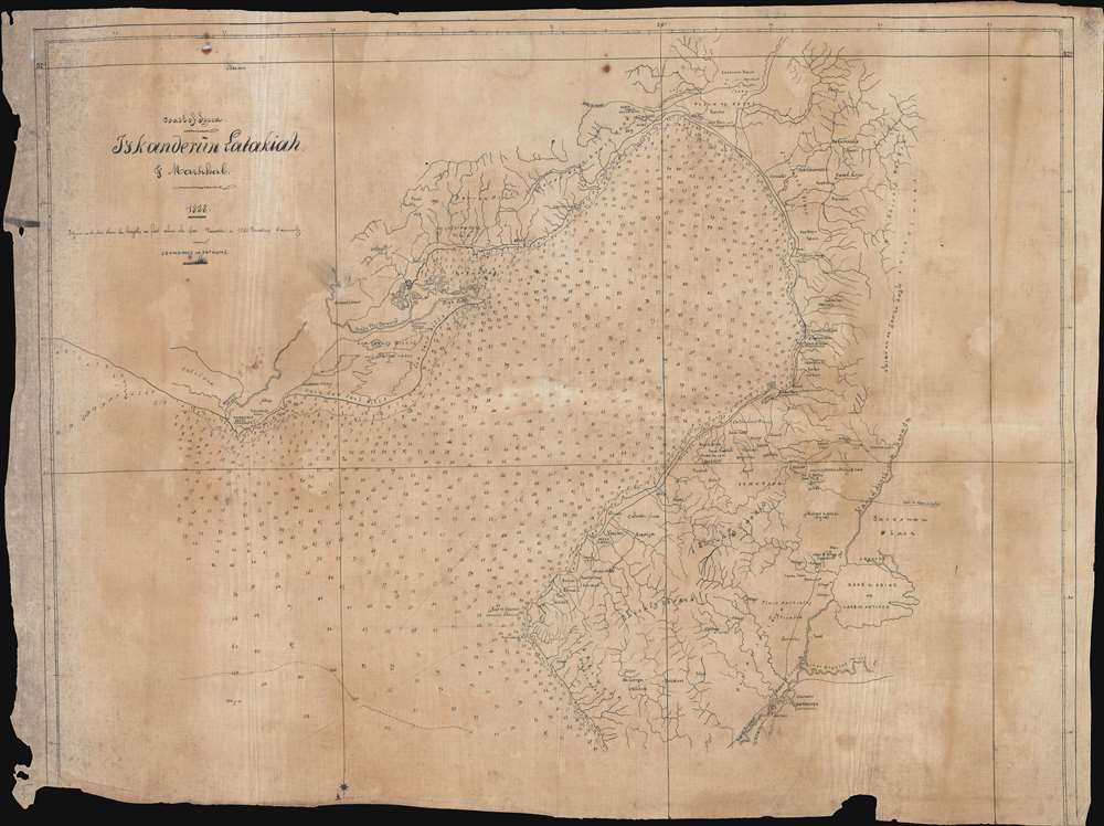
Coast of Syria. Iyskanderin Latakiah and Markhab.
1858 (dated) 20 x 26.75 in (50.8 x 67.945 cm) 1 : 240000
1858 (dated) 20 x 26.75 in (50.8 x 67.945 cm) 1 : 240000
Description
This is a c.1858 manuscript nautical chart or maritime map of the Bay of Iskenderun in modern-day Turkey. Copied by hand from a British Admiralty chart, this map's creator exhibits extreme care and attention to detail, positioning nearly every depth sounding almost precisely where it appears on the printed version. Notes along the coastline provide landmarks and understanding and identify various landscapes, including 'very low sand hills,' 'cultivated and uncultivated plains', 'low swampy ground and shallow lakes,' and 'barren hills covered with brush wood.' Alexandretta, also known as Iskenderun, appears on the right side of the bay. Villages are labeled all around the bay, and the areas extensive river and stream network is depicted in detail.
Ancient Ruins
The detailed accounting of ancient ruins encircling the bay elicits the most interest in the modern viewer. Aqueducts, 'extensive ruins,' and 'ancient fortress,' 'ruined probable Cilician Gates,' temples, and an ancient fountain are all identified and beg the question of why a nautical chart from the mid-19th century placed such importance upon these sites. It is unlikely that these ruins were large enough to act as coastal markers for mariners. Perhaps, like others before, the original chart's creators were fascinated by ancient history and dreamed of making new discoveries and further deepening society's knowledge of these great civilizations.Manuscript nautical charts
The British Admiralty produced an incredible array of nautical charts spanning the world's oceans, but could not provide enough charts for every mariner plying the Earth's vast seas. It was not uncommon for sailors to meticulously copy charts by hand to ensure that they possessed those needed for their voyages. This present map is an example of that practice. Even if making manuscript copies was a 'common practice,' that does not mean that manuscript nautical charts appear regularly. Nautical charts as a genre are rare because they were used until they disintegrated, and manuscript charts were no different. This piece represents a one-of-a-kind find, not only because it is manuscript, but it is also likely that this map's creator, whoever they were, only made one copy for their personal use. This implies that the present map's survival for over 150 years is nothing less than extraordinary.Condition
Average. Manuscript ink on linen. Linen exhibits soiling and loss along edges. No loss to manuscript.