1870 Fowles Birds Eye View Map of the Isle of Wight, England
IsleWight-fowles-1870$300.00

Title
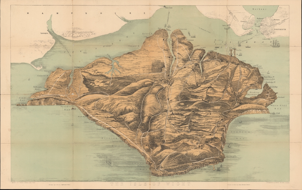
The Isle of Wight.
1870 (undated) 16.5 x 26 in (41.91 x 66.04 cm)
1870 (undated) 16.5 x 26 in (41.91 x 66.04 cm)
Description
This is a beautiful c. 1870 bird’s eye view of the Isle of Wight, England. It features the largest island of England located in the English Channel and separated from mainland Great Britain by the Solent. Notes roads, towns, rivers, railways, ferry lines and beautifully rendered topography. Ships can be seen sailing along the coast. Gosport and Portsmouth city and harbor are also noted.
Since Victorian times, the numerous resorts on the Isle of Wight have remained a holiday destination. It has also been home to Queen Victoria and the famous poets Alfred Lord Tennyson and Swinburne.
This view was created by Arthur Fowles, and engraved by Lewis Becker. Published by J. Briddon.
Since Victorian times, the numerous resorts on the Isle of Wight have remained a holiday destination. It has also been home to Queen Victoria and the famous poets Alfred Lord Tennyson and Swinburne.
This view was created by Arthur Fowles, and engraved by Lewis Becker. Published by J. Briddon.
Condition
Very good. Some wear and toning along original fold lines with some holes over fold intersections. Minor spotting. Professionally flattened and backed with archival tissue.
References
OCLC: 55000998.