1743 D'Anville Map of Italy
Italie-anville-1743$150.00
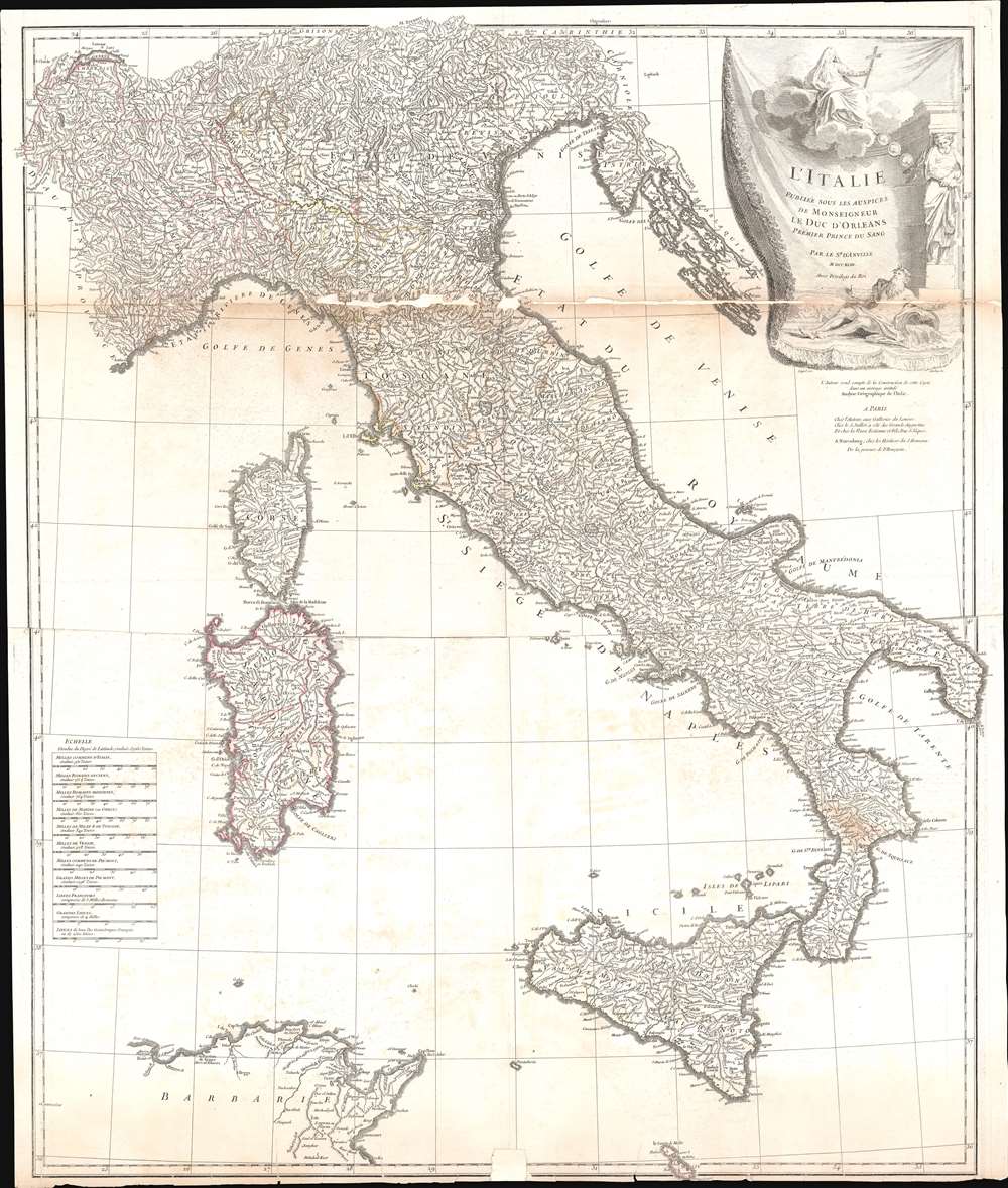

Title
L'Italie, publiee sous les auspices de Monseigneur le Duc d'Orleans, Premier Prince du Sang.
1743 (dated) 33 x 28 in (83.82 x 71.12 cm) 1 : 1500000
1743 (dated) 33 x 28 in (83.82 x 71.12 cm) 1 : 1500000
Description
This is a 1743 Jean Baptiste Bourguignon d'Anville map of Italy. D'Anville's trademark detail is present throughout, with innumerable cities, towns, and villages identified. Rivers and lakes are illustrated and labeled, including Lake Geneva and Lake Como. Mount Etna and Mount Vesuvius are labeled as well. The Dalmatian coast, including modern-day Croatia, occupy the upper right quadrant and are situated next to a decorative title cartouche which adorns the upper right corner.
Publication History and Census
This map was created by Jean Baptiste Bourguignon d'Anville and published in 1743 in Paris. It was also published by Homann Heirs in Nuremburg. The map appeared in various made-to-order D'Anville atlases as well as separately.CartographerS
Jean Baptiste Bourguignon d'Anville (1697 - 1782) was perhaps the most important and prolific cartographer of the 18th century. D'Anville's passion for cartography manifested during his school years when he amused himself by composing maps for Latin texts. There is a preserved manuscript dating to 1712, Graecia Vetus, which may be his earliest surviving map - he was only 15 when he drew it. He would retain an interest in the cartography of antiquity throughout his long career and published numerous atlases to focusing on the ancient world. At twenty-two D'Anville, sponsored by the Duke of Orleans, was appointed Geographer to the King of France. As both a cartographer and a geographer, he instituted a reform in the general practice of cartography. Unlike most period cartographers, D'Anville did not rely exclusively on earlier maps to inform his work, rather he based his maps on intense study and research. His maps were thus the most accurate and comprehensive of his period - truly the first modern maps. Thomas Basset and Philip Porter write: "It was because of D'Anville's resolve to depict only those features which could be proven to be true that his maps are often said to represent a scientific reformation in cartography." (The Journal of African History, Vol. 32, No. 3 (1991), pp. 367-413). In 1754, when D'Anville turned 57 and had reached the height of his career, he was elected to the Academie des Inscriptions. Later, at 76, following the death of Philippe Buache, D'Anville was appointed to both of the coveted positions Buache held: Premier Geographe du Roi, and Adjoint-Geographer of the Academie des Sciences. During his long career D'Anville published some 211 maps as well as 78 treatises on geography. D'Anville's vast reference library, consisting of over 9000 volumes, was acquired by the French government in 1779 and became the basis of the Depot Geographique - though D'Anville retained physical possession his death in 1782. Remarkably almost all of D'Anville's maps were produced by his own hand. His published maps, most of which were engraved by Guillaume de la Haye, are known to be near exact reproductions of D'Anville' manuscripts. The borders as well as the decorative cartouche work present on many of his maps were produced by his brother Hubert-Francois Bourguignon Gravelot. The work of D'Anville thus marked a transitional point in the history of cartography and opened the way to the maps of English cartographers Cary, Thomson and Pinkerton in the early 19th century. More by this mapmaker...
Homann Heirs (1730 - 1848) were a map publishing house based in Nuremberg, Germany, in the middle to late 18th century. After the great mapmaker Johann Baptist Homann's (1664 - 1724) death, management of the firm passed to his son Johann Christoph Homann (1703 - 1730). J. C. Homann, perhaps realizing that he would not long survive his father, stipulated in his will that the company would be inherited by his two head managers, Johann Georg Ebersberger (1695 - 1760) and Johann Michael Franz (1700 - 1761), and that it would publish only under the name 'Homann Heirs'. This designation, in various forms (Homannsche Heirs, Heritiers de Homann, Lat Homannianos Herod, Homannschen Erben, etc..) appears on maps from about 1731 onwards. The firm continued to publish maps in ever diminishing quantities until the death of its last owner, Christoph Franz Fembo (1781 - 1848). Learn More...
Condition
Below average. Exhibits significant areas of infill along the uppermost fold line and along the bottom. Exhibits wear and toning along fold lines. Closed margin tears professionally repaired on verso. Exhibits foxing. Blank on verso. Priced accordingly.
References
Rumsey 2603.018.