
Homann Heirs (Homann Erben, Heritiers de Homann, Homannianos Heredes)

Homann Heirs (1730 - 1848) were a map publishing house based in Nuremberg, Germany, in the middle to late 18th century. After the great mapmaker Johann Baptist Homann's (1664 - 1724) death, management of the firm passed to his son Johann Christoph Homann (1703 - 1730). J. C. Homann, perhaps realizing that he would not long survive his father, stipulated in his will that the company would be inherited by his two head managers, Johann Georg Ebersberger (1695 - 1760) and Johann Michael Franz (1700 - 1761), and that it would publish only under the name 'Homann Heirs'. This designation, in various forms (Homannsche Heirs, Heritiers de Homann, Lat Homannianos Herod, Homannschen Erben, etc..) appears on maps from about 1731 onwards. The firm continued to publish maps in ever diminishing quantities until the death of its last owner, Christoph Franz Fembo (1781 - 1848).
AKA: Homann Erben, Heritiers de Homann, Homannianos Heredes
Notes the legendary El Dorado.
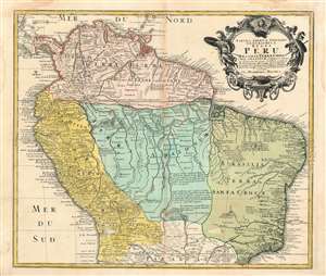
Tabula Americae Specialis Geographica Regni Peru Brasiliae, Terrae Firmae, and Reg: Amazonum.
$400.00
Acquire
- Digital Map Information
- Suitable for large format printing
- DPI: 300
- File Size: 17.41 MB
- File Type: ZIP / TIFF
- ICC color profile embedded
- Delivered instantly via download link
This is an extraordinary example of Homann Heirs’ magnificent c.1728 map of northern South America. It covers from Costa Rica and Barbados south roughly to the Tropic of Capricorn, or more precisely, 50 degrees south latitude. The map renders the entire region ... (more details)
Scarce first state.
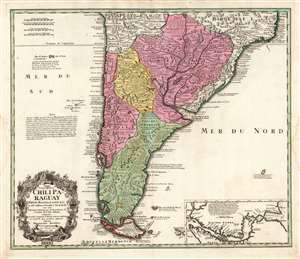
Typus Geographicus Chili Paraguay Freti Magellanici etc.
$650.00
Acquire
- Digital Map Information
- Suitable for large format printing
- DPI: 600
- File Size: 70.49 MB
- File Type: ZIP / TIFF
- ICC color profile embedded
- Delivered instantly via download link
This is an early example of the 1733 Homann Heirs map of southern South America, in a rare first state example. It covers roughly from 18 degrees south latitude south to Tierra del Fuego, and includes the modern-day nations of Paraguay, Chile, Uruguay, and Argentina, along with the southern portions of Brazil and Bolivia. The map renders the entire region in extraordinary detail offering both topographical and political information with forest and mountains beautifully rendered in profile. (more details)
Quelling the Corsica's rebellion.
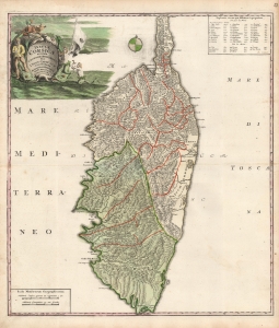
Insulae Corsicae accurata Chorographia Tradita per I. Vogt Capit. S.C.M. et excusa Studio Homannian Heredum Norib. MDCCXXXV Cum Priv. S.C.M.
$850.00
Acquire
- Digital Map Information
- Suitable for large format printing
- Full resolution TIFF file
- ICC color profile embedded
- Delivered instantly via download link
This is a 1735 Homann Heirs map of Corsica. The map's outline and detail are considerably advanced over maps of the island prior to 1734. It thus significantly represents the first major improvement in the mapping of Corsica since Jansson's 1644 map - which was the dominant model for throughout the 18th century. The firm of Homann Heirs themselves produced a map of Corsica in 1732 based on the Jansson model, making it all the more striking that they should update it with the present map so soon after. (more details)
Forgotten Austro-Turkish War of 1737-39.
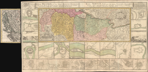
Theatrum belli inter imperat. Carol VI et sult. Achmet IV in partibus regnorum Serviae et Bosniae ex authenticis subsidys delineatum a Ioh. Fr. Ottingero. / Regnum Bosniae, una cum finitimis Croatiae, Damatiae, Slavoniae, Hung et Servia partibus… / Regni Servia una cum finitimis Valachiae et Bulgariae partibus…
$1,000.00
Acquire
- Digital Map Information
- Suitable for large format printing
- DPI: 600
- File Size: 83.1 MB
- File Type: ZIP / TIFF
- ICC color profile embedded
- Delivered instantly via download link
This is an uncommon large-format c. 1739 Homann Heirs map of the Balkans drawn by the royal military engineer Johann Friedrich (Franz) Ottinger (fl. c. 1736 - 1765). It is superbly detailed and includes two dozen insets of cities and fortifications, illustrating the events of the Austro-Turkish War of 1737 - 1739. (more details)
Paris, the Enlightenment City.
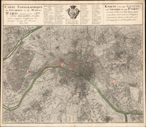
Carte Topographique des Environs et du Plan de Paris leveé par Msr. l'Abbé Delagrive, et Copiée selon l'original Parisien par les Heritiers de fus Dr. Homann Anno 1739. / Karte von der Gegend und Grundris der Stadt Paris, von dem Herrn Abt Delagrive verzeichnet und nach dem Parisischen Original ins kleine gebracht und her ausgegeben von Homoenischen Erben.
$1,100.00
Acquire
- Digital Map Information
- Suitable for large format printing
- File Size: 42.14 MB
- File Type: ZIP / TIFF
- ICC color profile embedded
- Delivered instantly via download link
This is the scarce 1739 Homann Heirs edition of the seminal Jean Delagrive map of Paris, France, and its environs. It illustrates Paris under the reign of King Louis XV, at its peak as a center of Enlightenment thought, with Parisian intellectuals, philosophers, and artists shaping the cultural and political discourse of Europe. (more details)
A beautifully engraved educational map of France.
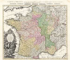
Regni Galliae seu Franciae et Navarrae Tabula Geographica in usum Elementorum Geographiae Schaziano rum accomodata Per Homannianos Heredes 1741. / Carte de France dressee par Guillaume de L'Isle et accommodee par les Heritiers d'Homann a l'instruction de la Jeunesse Norimb. 1741.
$450.00
Acquire
- Digital Map Information
- Suitable for large format printing
- Full resolution TIFF file
- ICC color profile embedded
- Delivered instantly via download link
A beautifully detailed 1741 Homann Heirs map of France, specially engraved for inclusion in Johann Schatz's school atlas. Depicting the Kingdoms of France and Navarre, along with parts of Italy, Switzerland, Spain, and Germany, the map offers excellent detail, illustrating fortified cities, villages, roads, bridges, forests, and castles. Topography is illustrated pictorially. (more details)
Comets Color Coded in Mansucript w/Marginalia.
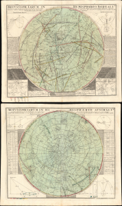
Motus Cometarum in Hemisphaerio Boreali... / Motus Cometarum in Hemisphaerio Australi...
$3,500.00
Acquire
- Digital Map Information
- Suitable for large format printing
- File Size: 53.6 MB
- File Type: ZIP / TIFF
- ICC color profile embedded
- Delivered instantly via download link
This is a striking pair of 1742 Doppelmayr celestial maps illustrating comets recorded over 210 years between 1530 and 1740. We are aware of no earlier cartographic work that attempts to synthesize all known comet sightings, marking this map as a significant step forward in the study of astronomy. The present example offers additional manuscript annotation of considerable interest, including color coding in each hemisphere that associates the depicted comets with the dates on which they were recorded. (more details)
An innovative battle for Prague fought during the War of the Austrian Succession.
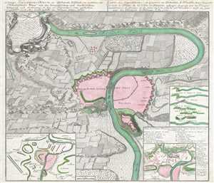
Kriegs - Expeditions - Karte in Böhmen I. Blat, in welchem die Haubtstadt PRAG mit des Französsischen und Sæchsischen Belagerūg und Eroberung, So den 26 Novembre 1741. geschehen, vor gestellet wird. Ans Licht gestellt von Homæn Erben. A1743. / Carte des Expeditions de Guerre en Boheme, I. Feuille, dans laquelle se voit le Plan de la Ville de PRAGUE, assiegeé et prise par les Troupes auxiliaires de France et de Saxe en l'An 1741, le 26 Novembre. mise au jour par les Heritiers de Homan. l'An 1743.
$675.00
Acquire
- Digital Map Information
- Suitable for large format printing
- DPI: 300
- File Size: 17.16 MB
- File Type: ZIP / TIFF
- ICC color profile embedded
- Delivered instantly via download link
This is a 1743 Homann Heirs map of Prague or Praha. Created as the first in a series of maps illustrating events during the War of the Austrian Succession, the map depicts the walled city of Prague at its center along with the surrounding territory. Beautifully ... (more details)
Detailing a Projected Annular Solar Eclipse.
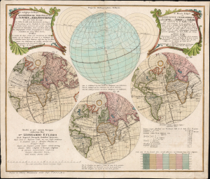
Die verfinsterte Erdkugel d. i. Geographische Vorstellung der Sonnen- od. Erd-Finsternis den 25ten Iulii Ao. 1748/ Le Monde Eclipse ou Representation Geographique de l'Eclipse De La Terre Ou Du Soleil qui arrivera le 25. Iuillet 1748.
$1,650.00
Acquire
- Digital Map Information
- Suitable for large format printing
- File Size: 25.93 MB
- File Type: ZIP / TIFF
- ICC color profile embedded
- Delivered instantly via download link
This is Georg Moritz Lowitz's 1747 celestial chart, projecting the annular solar eclipse of July 25, 1748. Published by the Nuremberg map printing house of Homann Heirs, this bilingual chart detailed the parts of the world from which the event would be visible, using a series of stereographic projections of the world to illustrate the track of the eclipse. An additional hemisphere illustrates the path of the center of the eclipse around the globe. (more details)
Detailing a Projected Lunar Eclipse.
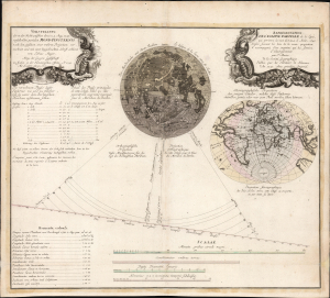
Vorstellung der in der Nacht zwischen den 8. u. 9. Aug. 1748 vorfallenden partialen Mond-Finsternis/ Représentation de l'Eclipse partiale de la Lune, qui arrivera la nuit du 8 au 9 d'Août, 1748.
$1,500.00
Acquire
- Digital Map Information
- Suitable for large format printing
- File Size: 25.94 MB
- File Type: ZIP / TIFF
- ICC color profile embedded
- Delivered instantly via download link
This is Tobias Mayer's 1748 celestial chart projecting the partial lunar eclipse of August 8 and 9, 1748. Published by the Nuremberg map printing house of Homann Heirs, this bilingual chart detailed the phases of the eclipse and the parts of the world from which the event would be visible. (more details)
A little known region mapped.
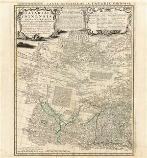
Tartariae Sinensis mappa Geographica...
$750.00
Acquire
- Digital Map Information
- Suitable for large format printing
- Full resolution TIFF file
- ICC color profile embedded
- Delivered instantly via download link
This is a handsome 1749 Homann Heirs map of western China, Mongolia and the extreme southeastern border with Russia. It was produced in order to accompany a German translation of P. Du Halde's 1732 Description de la Chine. As such, it is a faithful copy of J. B. D'Anville's Carte Generale de la Tartarie Chinoise which accompanied Du Halde's original text and the definitive mapping of this little-known and ill-mapped region. D'Anville's map - and Du Halde's data - were derived from Jesuit sources. Jesuits, with the blessing of the Qing Emperor Kangxi, produced at a map of the Chinese Empire's frontiers between 1708 and 1717. (more details)
Homann Heirs map of the Strait of Gibraltar from an unusual southern orientation.
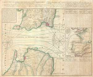
Carte Topographique des Pays et Côtes Maritimes Qui Forment le Détroit de Gilbraltar / Topographische Carte der Länder und Küsten welche die Meer-Enge von Gibraltar.
$550.00
Acquire
- Digital Map Information
- Suitable for large format printing
- DPI: 300
- File Size: 12.94 MB
- File Type: ZIP / TIFF
- ICC color profile embedded
- Delivered instantly via download link
This is a 1756 Homann Heirs map of the Strait of Gibraltar. The map is oriented to the south, thus depicting the Strait from Morocco to Spain, labeled Andalusia (Andalousie). Both Spain and Morocco are illustrated in detail. Different locations are noted in ... (more details)
Revealing a separate Asia and America.
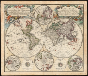
Planiglobii Terrestris/ Mappe-Monde.
$1,500.00
Acquire
- Digital Map Information
- Suitable for large format printing
- File Size: 29.97 MB
- File Type: ZIP / TIFF
- ICC color profile embedded
- Delivered instantly via download link
This is an elegant and detailed 1759 world map by Johann Matthias Hase and Georg Maurice Lowitz, contributors to the firm of Homann Heirs. The map was first issued in 1746, reflecting the best available cartographic detail of the day both from French and Russian sources. The present example was updated c. 1759 to reflect the discoveries of Bering and Chirikov according to the 1754 Müller map, confirming the separation of the continents of Asia and North America. (more details)