1852 Levasseur Mpa of the Department De La Loire, France (Loire Valley Region)
Loire-levasseur-1852-2$150.00

Title
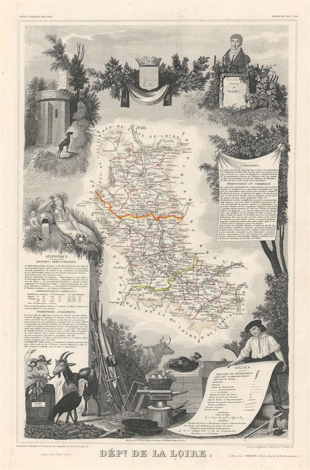
Dept. de la Loire.
1852 (undated) 17.5 x 11.5 in (44.45 x 29.21 cm) 1 : 570000
1852 (undated) 17.5 x 11.5 in (44.45 x 29.21 cm) 1 : 570000
Description
This is a fascinating 1852 map of the French department of Loire, France. This area of France is part of the Loire Valley wine growing region. The area includes 87 appellations under the Appellation d'origine contrôlée, Vin Délimité de Qualité Superieure, and Vin de pays systems. The map proper is surrounded by elaborate decorative engravings designed to illustrate both the natural beauty and trade richness of the land. There is a short textual history of the regions depicted on both the left and right sides of the map.
Publication History and Census
Published by V. Levasseur in the 1852 edition of his Atlas Nationale illustré. The elaborate surround was engraved by Aristide Michel Perrot.CartographerS
Victor Levasseur (1800 - 1870), an important French engineer, cartographer, and engraver of the mid 19th century, held a number of important cartographically related political and educations posts in France. He is most famous for his Atlas National Illustré des 86 Départements et des Possessions de La France, a large decorative atlas of France, including his Planisphere and five important continental maps. Levasseur's maps are distinctive for their wide decorative margins containing elaborate depictions of the scenery, peoples, and trade goods of the areas he mapped. Levasseur maps are also known to offer a wealth of statistical data. Until recently, very few Levasseur Atlases migrated out of France where they were mostly used in public libraries and town halls. His work represents some of the last great decorative atlases of the 19th century. More by this mapmaker...
Aristide Michel Perrot (1793 - 1879) was a French geographer, cartographer, and essayist active during the 19th century. Perrot specialized in miniature maps that appear in numerous French atlases. Perrot was also a prolific writer and his works include geographic lexicons and several essays. Learn More...
Source
Levassuer, V., Atlas Nationale illustré des 86 Departements et des Possessions de La France Divise par Arrondissements, Cantons et Communea avec La Trace de Toutes Les Routes, Chemins,de fer et Canaux., (Paris) 1852.
Condition
Very good. Blank on verso. Wide clean margins.
References
Phillips (Atlases) 3003. OCLC 1075044384.