Digital Image: 1844 Black Map or Chart of the World showing Magnetic Curves
MagneticCurves-black-1844-2_d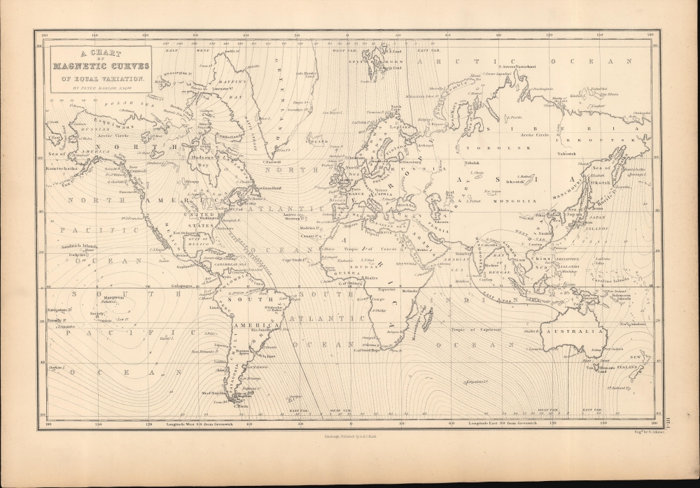

Title
A Chart of Magnetic Curves of Equal Variation.
1844 (undated) 10.5 x 16 in (26.67 x 40.64 cm) 1 : 86000000
1844 (undated) 10.5 x 16 in (26.67 x 40.64 cm) 1 : 86000000
Description
FOR THE ORIGINAL ANTIQUE MAP, WITH HISTORICAL ANALYSIS, CLICK HERE.
Digital Map Information
Geographicus maintains an archive of high-resolution rare map scans. We scan our maps at 300 DPI or higher, with newer images being 600 DPI, (either TIFF or JPEG, depending on when the scan was done) which is most cases in suitable for enlargement and printing.
Delivery
Once you purchase our digital scan service, you will receive a download link via email - usually within seconds. Digital orders are delivered as ZIP files, an industry standard file compression protocol that any computer should be able to unpack. Some of our files are very large, and can take some time to download. Most files are saved into your computer's 'Downloads' folder. All delivery is electronic. No physical product is shipped.
Credit and Scope of Use
You can use your digial image any way you want! Our digital images are unrestricted by copyright and can be used, modified, and published freely. The textual description that accompanies the original antique map is not included in the sale of digital images and remains protected by copyright. That said, we put significant care and effort into scanning and editing these maps, and we’d appreciate a credit when possible. Should you wish to credit us, please use the following credit line:
Courtesy of Geographicus Rare Antique Maps (https://www.geographicus.com).
How Large Can I Print?
In general, at 300 DPI, you should at least be able to double the size of the actual image, more so with our 600 DPI images. So, if the original was 10 x 12 inches, you can print at 20 x 24 inches, without quality loss. If your display requirements can accommodate some loss in image quality, you can make it even larger. That being said, no quality of scan will allow you to blow up at 10 x 12 inch map to wall size without significant quality loss. For more information, it is best consult a printer or reprographics specialist.
Refunds
If the high resolution image you ordered is unavailable, we will fully refund your purchase. Otherwise, digital images scans are a service, not a tangible product, and cannot be returned or refunded once the download link is used.
Cartographer S
Charles and Adam Black (fl. 1807 - present) were map and book publishers based in Edinburgh. Charles and his uncle, Adam, both of Edinburgh, Scotland, founded their publishing firm in 1807. They published a series of maps and atlases throughout the 19th century. In addition to an array of atlases, the Black firm is known for their editions of the Encyclopedia Britannica (1817 - 1826) and the first publishing of Sir Walter Scott's novels in 1854. In 1889 the A. & C. Black publishing house moved to London where it remains in operation to this day. More by this mapmaker...
George Aikman (December 28, 1788 - October 16, 1865) was a Scottish printer, lithographer, and engraver active in the early 19th century. Aikman most likely apprenticed with his father of the same name, also an engraver, before joining the Edinburgh map and atlas firm of William Lizars. Several years later Aikman established himself independently as "George Aikman and Sons, Engravers and Lithographers", publishing numerous maps and prints in conjunction with the larger firm of William and Charles Black, and others. George Aikman's son, also George (1830 - 1905), became an apprentice with the firm around 1842, and eventually a journeyman engraver in Manchester and London, before returning to Edinburgh to take up a full partnership in the family business. Upon the elder Aikman's death in 1865, George became the sole proprietor of the firm and continued to publish until 1876 when he sold the business to pursue a passion for landscape painting. Learn More...
Source
Black, A. and C., Black's General Atlas, (Edinburgh) 1844.
References
Rumsey 2305.006 (1854 edition). Philips (atlases) 4334.