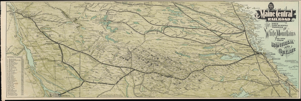
An impressive 1901 view of northern New England and Quebec, prepared by F. E. Boothby and printed by Rand Avery, displaying the lines of the Maine Central Railroad. These lines operated steady freight and passenger services, carrying timber and other resources south to the populous coast and bringing vacationers from urban areas northwards during the summer.
A Closer Look
Adopting an unusual perspective, this view is oriented towards the northeast, with Montreal, the St. Lawrence River, and Quebec City at left and Rockland and Portland, Maine, and Portsmouth, New Hampshire, and Lake Winnipesaukee at right. The White Mountains take prominence at center, likely as this map and its accompanying book were intended for tourists. Mount Washington and other White Mountains peaks are labeled with elevations, while others are marked with numbers corresponding to an index at bottom-left. Thick black lines trace the routes of the Maine Central and associated railways, along with a ferry service on Sebago and Long Lakes. Other railways are traced with thinner black lines and abbreviated. Lakes, ponds, cities, towns, islands, and other features are illustrated and labeled throughout.The Maine Central Railroad
The Maine Central Railroad was chartered in 1856 and began operations in 1862, merging the Androscoggin and Kennebec Railroad with the Penobscot and Kennebec Railroad. Over the next several decades, it expanded to link up with Portland, Maine, where it met the Boston and Maine Railroad. (The Maine Central was initially built with a wider 'Canadian' or 'Portland' gauge and had to retrofit its line to facilitate such connections with other railways). Portland became a great meeting point of railways (used for both freight and passengers) heading northwards into northern New England and Canada, and therefore was a logical place for the company to move its main office. By the late 19th century, the railroad's lines extended to New Brunswick and Newfoundland. In 1888, the company leased the Portland and Ogdensburg Railway, which ran through the White Mountains via Crawford Notch to St. Johnsbury, Vermont, where it linked with the Canadian Pacific-owned Southeastern Railway, providing a connection to Montreal. Two years later, it leased the Quebec Division, which connected the White Mountains and the Quebec Central Railway, terminating in Quebec City. Although the company ran into the same problems as other American railroads in the mid-20th century, it was able to remain independent for longer due to more steady demand for its freight services. Still, it was forced to sell its operations to Guilford Transportation Industries (now Pan Am Railways) in 1981. Pan Am still operates some portions of the former network for freight purposes. At the same time, the Conway Scenic Railroad utilizes a portion for its heritage trains, including the distinctive Frankenstein Trestle through Crawford Notch (named for local artist Godfrey Frankenstein, not the literary character).Publication History and Census
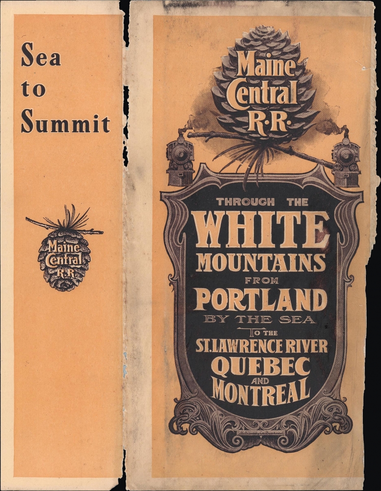
This view was prepared by F. E. Boothby, the General Manager of the railroad's General Offices in Portland, Maine, and printed by the Rand Avery Supply Company in Boston in 1901. Due to uncertainties over the title and the fact that it appeared in a booklet (Through the White Mountains from Portland by the Sea to the St. Lawrence River, Quebec and Montreal), the cataloging of this map is not entirely consistent. We do not locate any examples of the map independently cataloged, while the booklet is recorded at the New York Public Library and the University of Connecticut. Both the map and book are quite scarce today.
Cartographer
Rand, Avery, and Company (1851 – 1886) was a Boston based book and map printer active in the late 19th century. The company was founded in 1851 by George Curtis Rand (December 13, 1819 – December 30, 1878) and his brother-in-law Abraham Avery (November 15, 1824 - April 3, 1893). George C. Rand was a brother to William H. Rand of Rand, McNally, and Company of Chicago. George C. Rand was born in Woodstock, Vermont, to Baptist minister John Rand (1781 – 1855) and his wife. Rand began working in the printing industry from at least the 1840s, wherein he mostly produced religious tracts. He married Julia Avery in 1851 and brought his brother-in-law, Abraham Avery, into the business, renaming the firm Rand, Avery, and Company. Avery was born in Wibraham, Massachusetts and studied at Wesleyan University, which his father helped to found. Rand, Avery, and Company was based in Cornhill, Boston, and was, for a time, they were the largest printers in New England. Such works as Uncle Tom's Cabin were included in their catalog. Avery retired when Rand died in 1878, but the firm continued to publish under another generation of managers, including Rand's son, Avery L. Rand, until at least 1886. They also took on a fourth partner, Orrin F. Frye, and published as Rand, Avery, and Frye. After retiring Avery moved to Los Angeles where he died in 1893. It appears that this firm also published under the name the Rand Avery Supply Company. More by this mapmaker...
Source
Maine Central Railroad, Through the White Mountains from Portland by the Sea to the St. Lawrence River, Quebec and Montreal, (Boston: Rand Avery Supply) 1901.
Very good. Light wear along folds. Accompanied by original cover.
OCLC 41074115 (booklet), 494962528 (BnF).