1933 Auto Club of Southern California Map of Southern California and Nevada
MojaveColoradoDeserts-autoclub-1933$300.00

Title
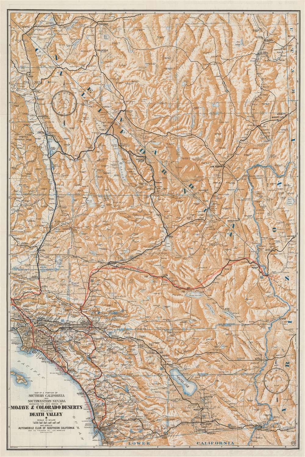
Map of a Portion of Southern California and Southwestern Nevada Embracing the Arid Region of Mojave and Colorado Deserts Including Death Valley.
1933 (undated) 32.5 x 21.75 in (82.55 x 55.245 cm) 1 : 800000
1933 (undated) 32.5 x 21.75 in (82.55 x 55.245 cm) 1 : 800000
Description
This is a c. 1933 Automobile Club of Southern California map of southern California and southwestern Nevada. Depicting the region from Tonopah, Nevada to Baja California and from the Sequoia National Park to Arizona and Utah, the region's major highways snake their way across the barren landscape. Cities and towns are labeled throughout, along with rivers and lakes. Its many mountain ranges are illustrated artistically and identified, but elevations are not indicated. Red and blue manuscript notations, which appear to be drawn in crayon, trace what are presumably road trip itineraries, but that is unclear. Perhaps this particular map was used to keep a child entertained while their parents explored the area during two separate trips.
Publication History and Census
This map was created for and published by the Automobile Club of Southern California c. 1933. As this map is undated, and was published in multiple editions, it is difficult to know exactly when this map was published. The University of Nevada Las Vegas catalogs an edition of this map dating to the early 1930s, while other institutions, including Cornell University, the University of Chicago, the Colorado School of Mines, and the University of Arizona, catalog their examples as dating from the early 1940s.Cartographer
The Automobile Club of Southern California (1900 - Present) is an auto club based in Los Angeles, California and an affiliate of the American Automobile Association (AAA). Founded in 1900, it was one of the first auto clubs in the United States and was dedicated to proposing traffic laws, improving road conditions, and the overall improvement of driving conditions. The Auto Club began producing its own maps in 1910, when it sent out its own team of cartographers to survey the state's roads. Its main office at the corner of Figueroa Street and Adams Boulevard was completed in 1923. Numbering nearly 8 million members in its home territory alone, today it is the largest single member of the AAA federation More by this mapmaker...
Condition
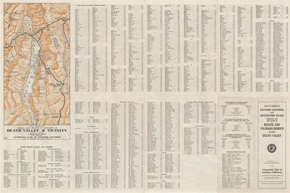
Very good. Exhibits slight wear along original fold lines. Map of Death Valley and index on verso.
References
OCLC 60693909 (1942).