1884 Thomas Johnson / Colton Pocket Map of New England
NewEngland-johnsonthomas-1884$750.00


Title
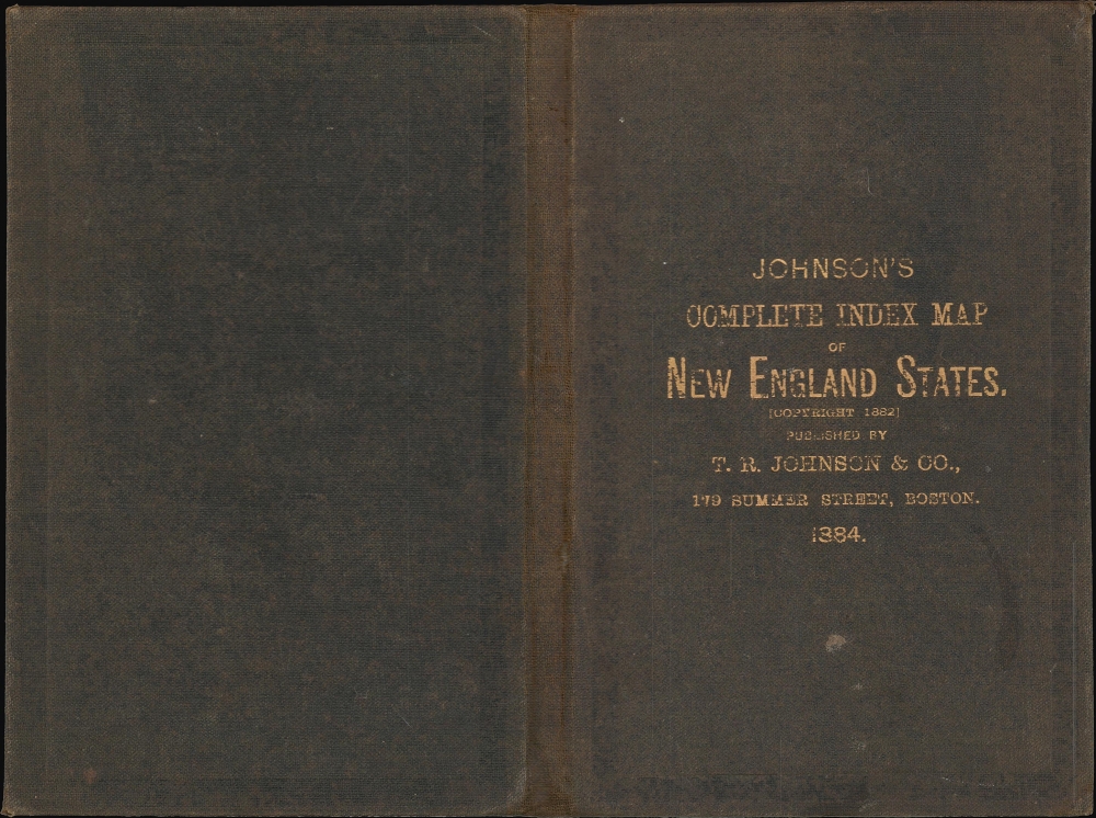
'Johnson's' Section Map and Index of the New England States. / Johnson's Complete Index Map of the New England States.
1884 (dated) 36.5 x 26.5 in (92.71 x 67.31 cm) 1 : 900000
1884 (dated) 36.5 x 26.5 in (92.71 x 67.31 cm) 1 : 900000
Description
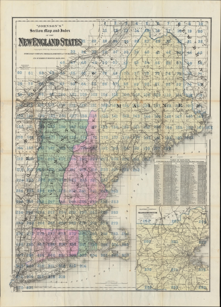
A detailed large-format sectional pocket map of New England, based on an 1883 map by G.W. and C.B. Colton and published in 1884 by Thomas R. Johnson in Boston.
The table of distances and density of rail lines reflect their dominance as a means of transportation at this time, even into mountainous and heavily forested parts of northern New England, which supported a growing tourism industry in the late 19th century.
A Closer Look
Covering the entirety of New England, along with portions of New York and Canada, states are color-shaded for easy distinction. County and town boundaries are drawn with both labeled; in northern Maine, much of the land remains unincorporated. Mountains, waterways, railways, islands, and other features are indicated throughout. A grid overlays the map, creating 321 squares representing 20 square miles each. At right is a table of distances by rail from towns throughout New England and Upstate New York to New York City, Hartford, Providence, Boston, Montpelier, Concord (New Hampshire), and Augusta. A large inset map at right displays the eastern portion of Massachusetts, including Boston, on an enlarged scale (350,000). Longitude lines are provided from both Greenwich and Washington, D.C.The table of distances and density of rail lines reflect their dominance as a means of transportation at this time, even into mountainous and heavily forested parts of northern New England, which supported a growing tourism industry in the late 19th century.
Publication History and Census
This map was drawn, engraved, and printed by G.W. and C.B. Colton in New York and published by Thomas R. Johnson in Boston in 1884. It is noted in the OCLC among the holdings of the American Antiquarian Society, the University of Illinois at Urbana Champaign, Northwestern University, and Duke University.CartographerS
Thomas R. Johnson (f. c. 1878 - 1890) was a map publisher in Boston, Massachusetts. His two known works include an 1884 'Section Map and Index of New England States' (based on a map by G.W. and C.B. Colton) and an 1881 'Section Map and Street Index of the city of Boston' in 1881 (engraved and printed by George H. Walker and Co., an early work from the firm which became prolific in the following decades). Otherwise, little is known about Johnson's life and work; Boston city directories throughout the late 1870s and 1880s list Thomas R. Johnson as either a salesman or bookkeeper. More by this mapmaker...
Joseph Hutchins Colton (July 5, 1800 - July 29, 1893), often publishing as J. H. Colton, was an important American map and atlas publisher active from 1833 to 1897. Colton's firm arose from humble beginnings when he moved to New York in 1831 and befriended the established engraver, Samuel Stiles. He worked under Stiles as the 'Co.' in Stiles and Co. from 1833 to 1836. Colton quickly recognized an emerging market in railroad maps and immigrant guides. Not a cartographer or engraver himself, Colton's initial business practice mostly involved purchasing the copyrights of other cartographers, most notably David H. Burr, and reissuing them with updated engraving and border work. His first maps, produced in 1833, were based on earlier Burr maps and depicted New York State and New York City. Between 1833 and 1855, Colton proceeded to publish a large corpus of guidebooks and railroad maps, which proved popular. In the early 1850s, Colton brought his two sons, George Woolworth Colton (1827 - 1901) and Charles B. Colton (1832 - 1916), into the map business. G. W. Colton, trained as a cartographer and engraver, was particularly inspired by the idea of creating a large and detailed world atlas to compete with established European firms for the U.S. market. In 1855, G.W. Colton issued volume one of the impressive two-volume Colton's Atlas of the World. Volume two followed a year later. Possibly because of the expense of purchasing a two-volume atlas set, the sales of the Atlas of the World did not meet Colton's expectations, and so, in 1856, the firm also issued the atlas as a single volume. The maps contained in this superb work were all original engravings, and most bear an 1855 copyright. All of the maps were surrounded by an attractive spiral motif border that would become a hallmark of Colton's atlas maps well into the 1880s. In 1857, the slightly smaller Colton's General Atlas replaced the Atlas of the World. Most early editions of the General Atlas published from 1857 to 1859 do not have the trademark Colton spiral border, which was removed to allow the maps to fit into a smaller format volume. Their customers must have missed the border because it was reinstated in 1860 and remained in all subsequent publications of the atlas. There were also darker times ahead; in 1858, Colton was commissioned at a sum of 25,000 USD by the government of Bolivia to produce and deliver 10,000 copies of a large format map of that country. Although Colton completed the contract in good faith, delivering the maps at his own expense, he was never paid by Bolivia, which was at the time in the midst of a series of national revolutions. Colton would spend the remainder of his days fighting with the Bolivian and Peruvian governments over this payment, and in the end, after a congressional intervention, he received as much as 100,000 USD in compensation. Nonetheless, at the time, it was a disastrous blow. J. H. Colton and Company is listed as one of New York's failed companies in the postal record of 1859. This led Colton into the arms of Alvin Jewett Johnson and Ross C. Browning. The 1859 edition of Colton's General Atlas lists Johnson and Browning as the 'Successor's to J. H. Colton' suggesting an outright buyout, but given that both companies continued to publish separately, the reality is likely more complex. Whatever the case may have been, this arrangement gave Johnson and Browning access to many of Colton's map plates and gave birth to Johnson's New Illustrated (Steel Plate) Family Atlas. The Johnson's Atlas was published parallel to Colton's atlases well into the 1880s. The Colton firm itself subsequently published several other atlases including an Atlas of America, the Illustrated Cabinet Atlas, the Octavo Atlas of the Union, and Colton's Quarto Atlas of the World. They also published a large corpus of wall maps, pocket maps, and guides. The last known publications of the Colton firm date to 1897 and include a map and a view, both issued in association with the Merchant's Association of New York. Alice M. Colton married August R. Ohman (May 3, 1859 - April 22, 1934) on January 5, 1897. In 1898, Ohman joined the Colton firm, which continued to publish as Colton, Ohman & Co. until 1901. Learn More...
Condition
Good. Wear and toning along original fold lines. Verso reinforcements to separations at fold intersections. Slight loss at a few fold intersections. Accompanied by original binder.
References
OCLC 11125496.