Digital Image: 1795 Roussel City Plan or Map of Paris, France and Environs
Paris-roussel-1795_d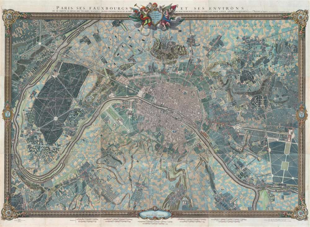

Title
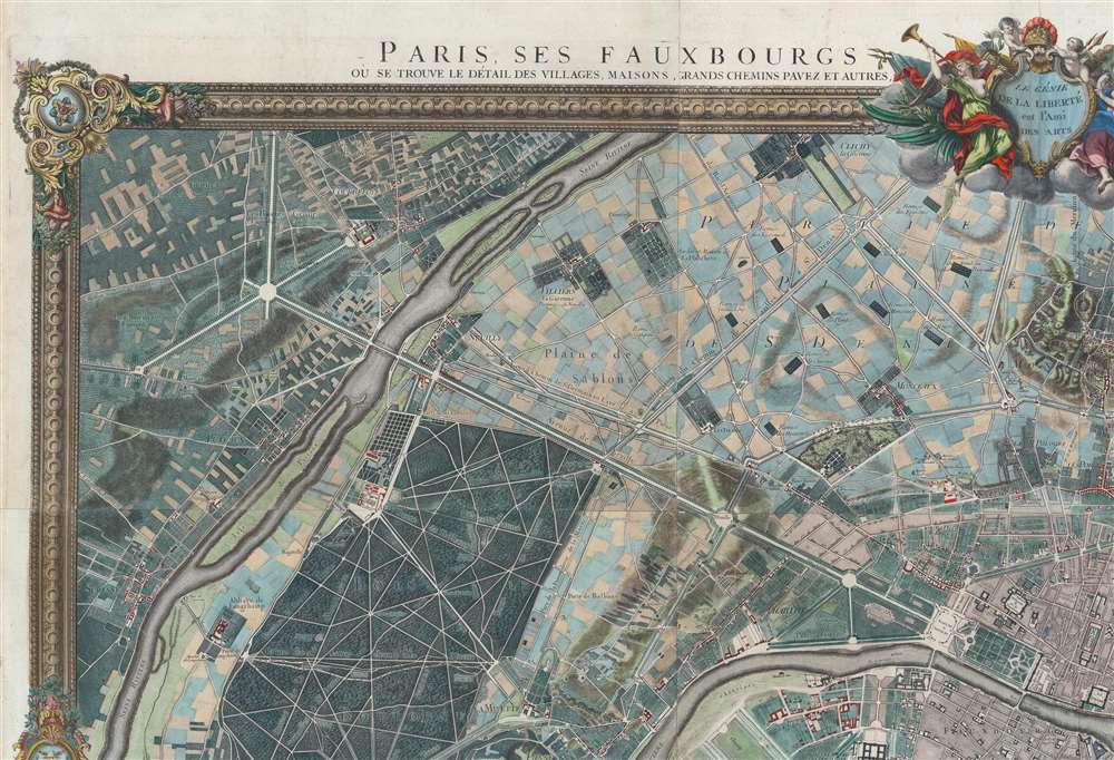
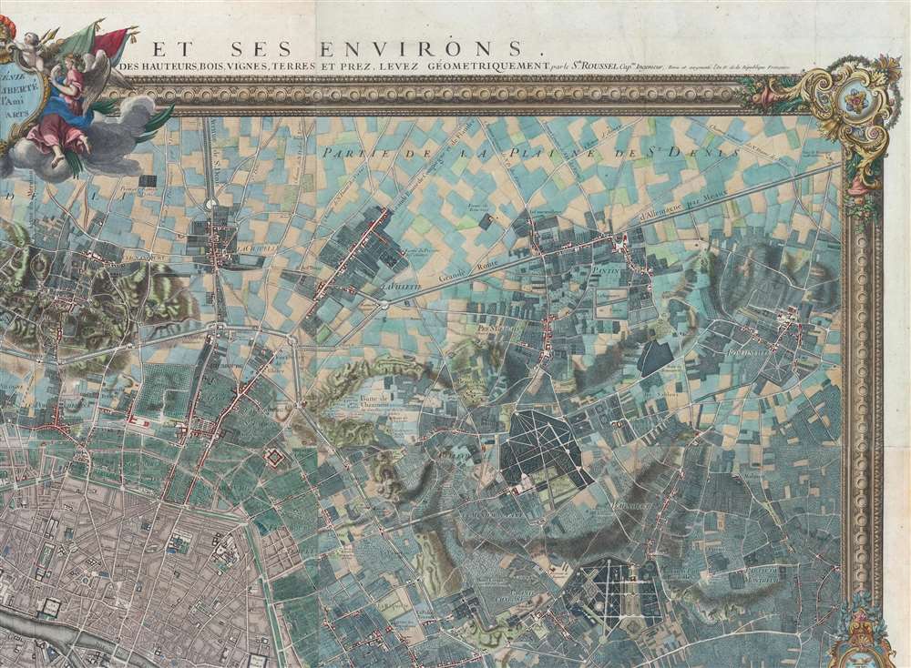
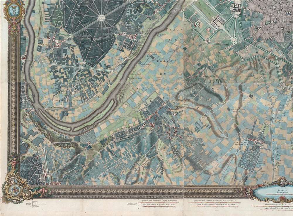
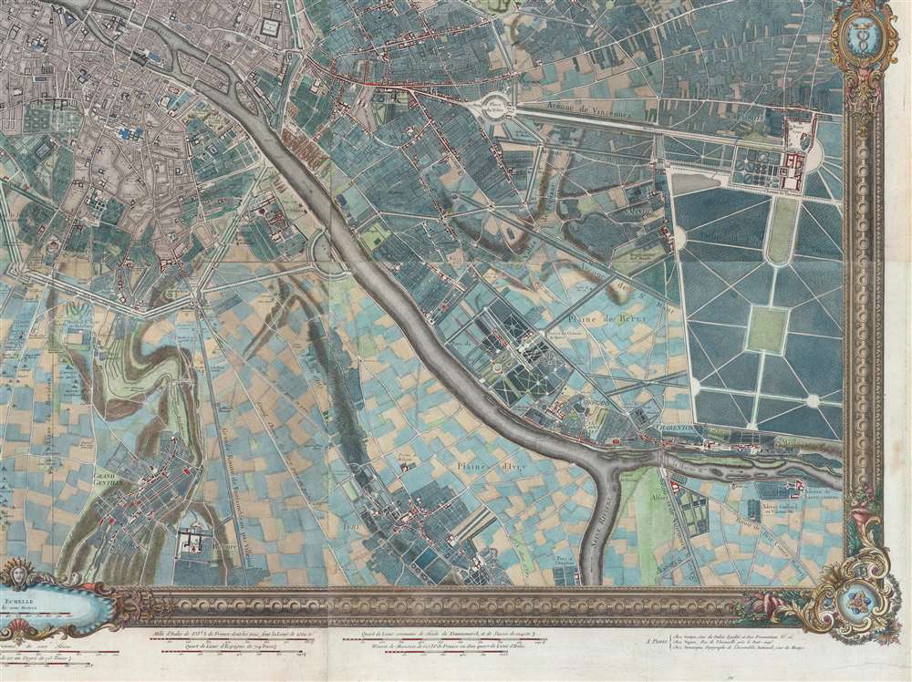
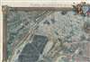
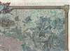
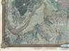
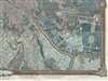
Paris, ses Fauxbourgs, et ses Environs.
1795 (dated) 52 x 71.25 in (132.08 x 180.975 cm) 1 : 9800
1795 (dated) 52 x 71.25 in (132.08 x 180.975 cm) 1 : 9800
Description
FOR THE ORIGINAL ANTIQUE MAP, WITH HISTORICAL ANALYSIS, CLICK HERE.
Digital Map Information
Geographicus maintains an archive of high-resolution rare map scans. We scan our maps at 300 DPI or higher, with newer images being 600 DPI, (either TIFF or JPEG, depending on when the scan was done) which is most cases in suitable for enlargement and printing.
Delivery
Once you purchase our digital scan service, you will receive a download link via email - usually within seconds. Digital orders are delivered as ZIP files, an industry standard file compression protocol that any computer should be able to unpack. Some of our files are very large, and can take some time to download. Most files are saved into your computer's 'Downloads' folder. All delivery is electronic. No physical product is shipped.
Credit and Scope of Use
You can use your digial image any way you want! Our digital images are unrestricted by copyright and can be used, modified, and published freely. The textual description that accompanies the original antique map is not included in the sale of digital images and remains protected by copyright. That said, we put significant care and effort into scanning and editing these maps, and we’d appreciate a credit when possible. Should you wish to credit us, please use the following credit line:
Courtesy of Geographicus Rare Antique Maps (https://www.geographicus.com).
How Large Can I Print?
In general, at 300 DPI, you should at least be able to double the size of the actual image, more so with our 600 DPI images. So, if the original was 10 x 12 inches, you can print at 20 x 24 inches, without quality loss. If your display requirements can accommodate some loss in image quality, you can make it even larger. That being said, no quality of scan will allow you to blow up at 10 x 12 inch map to wall size without significant quality loss. For more information, it is best consult a printer or reprographics specialist.
Refunds
If the high resolution image you ordered is unavailable, we will fully refund your purchase. Otherwise, digital images scans are a service, not a tangible product, and cannot be returned or refunded once the download link is used.
Cartographer
Roussel (16xx - August 30, 1733) was a French engineer whose first name has been lost to history and about whom very little is known. He was named chief engineer in 1719 and a knight of the Order of Saint-Louis in 1718. He was part of the team of engineers sent to the French borders by Louis XIV beginning in 1691. Over the course of his career, he made many city maps, including Turin, Asti, Toulon, and Briançon, along with regional maps of the French border regions. Among these regional maps is a famous map of the Pyrenees border region. When he was named chief of engineers, he was the first geographic engineer to be named to the position since the corps was founded in 1713. More by this mapmaker...
References
Boutier, J., Les Plan de Paris des origines (1493) à la fin du XVIIIe siècle, #206E. OCLC 63550802; 980448901; 71595650; 496750757.