Digital Image: 1789 Hunter Nautical Map of Port Jackson, Sydney, Australia
PortJackson-hunter-1789_d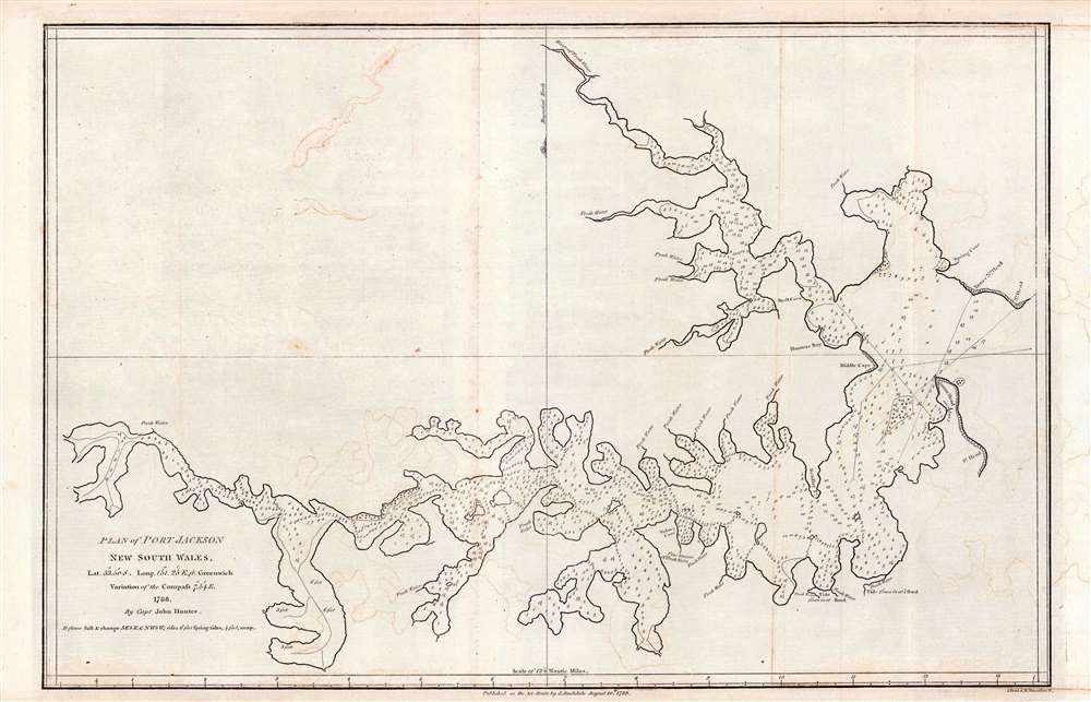

Title
Plan of Port Jackson, New South Wales.
1789 (dated) 10 x 17 in (25.4 x 43.18 cm) 1 : 21120
1789 (dated) 10 x 17 in (25.4 x 43.18 cm) 1 : 21120
Description
FOR THE ORIGINAL ANTIQUE MAP, WITH HISTORICAL ANALYSIS, CLICK HERE.
Digital Map Information
Geographicus maintains an archive of high-resolution rare map scans. We scan our maps at 300 DPI or higher, with newer images being 600 DPI, (either TIFF or JPEG, depending on when the scan was done) which is most cases in suitable for enlargement and printing.
Delivery
Once you purchase our digital scan service, you will receive a download link via email - usually within seconds. Digital orders are delivered as ZIP files, an industry standard file compression protocol that any computer should be able to unpack. Some of our files are very large, and can take some time to download. Most files are saved into your computer's 'Downloads' folder. All delivery is electronic. No physical product is shipped.
Credit and Scope of Use
You can use your digial image any way you want! Our digital images are unrestricted by copyright and can be used, modified, and published freely. The textual description that accompanies the original antique map is not included in the sale of digital images and remains protected by copyright. That said, we put significant care and effort into scanning and editing these maps, and we’d appreciate a credit when possible. Should you wish to credit us, please use the following credit line:
Courtesy of Geographicus Rare Antique Maps (https://www.geographicus.com).
How Large Can I Print?
In general, at 300 DPI, you should at least be able to double the size of the actual image, more so with our 600 DPI images. So, if the original was 10 x 12 inches, you can print at 20 x 24 inches, without quality loss. If your display requirements can accommodate some loss in image quality, you can make it even larger. That being said, no quality of scan will allow you to blow up at 10 x 12 inch map to wall size without significant quality loss. For more information, it is best consult a printer or reprographics specialist.
Refunds
If the high resolution image you ordered is unavailable, we will fully refund your purchase. Otherwise, digital images scans are a service, not a tangible product, and cannot be returned or refunded once the download link is used.
Cartographer S
John Hunter (August 29, 1737 – March 13 1821) was an officer of the Royal Navy, surveyor, and scholar, who served as the second governor of New South Wales, Australia from 1795 to 1800. He was instrumental in a number of early explorations of Australia, including the production of the first chart of Port Jackson. He was born in Scotland to a captain in the merchant service; he received the classical education of the time and was sent to the University of Edinburgh, but soon left it to join the navy as a captain's servant. The onset of the Seven Years' War found him an able seaman on HMS Centaur. He soon became a midshipman and would see action during the 1757 Raid on Rochefort, and the 1759 capture of Quebec. He served as midshipman on several of Admiral Philip Durell's flagships throughout the war, and passed his examinations to qualify for promotion to lieutenant in February 1760. Despite his apparent ability and qualifications, he was not appointed lieutenant, instead serving as master's mate, and eventually as ship's master in the West Indies. There he would produce a number of charts and plans of Spanish harbors and fortifications at Havana. During the American Revolution, he served under Admiral Howe, effectively acting as master of the fleet. Despite serving well, his association with Howe would not serve him well on the Admiral's recall: Hunter was still refused promotion to lieutenant. Undeterred, he continued in service as a volunteer - being appointed lieutenant in the field only to have the Admiralty refuse to confirm the appointment. Finally, in 1782 Howe appointed him third lieutenant of his flagship HMS Victory, swiftly advancing to first lieutenant: this time, the honor was confirmed. He would be promoted to post captain in 1786, and appointed to command HMS Sirius, under the overall command of Commodore Arthur Phillip for the founding of the colony of New South Wales. On arrival in Port Jackson in January 1788, Hunter explored and charted the harbor and the Parramatta River, resulting in the first European chart of those waters. He would go on to circumnavigate the globe, and would publish his journal of the Australia expedition. The first edition of his work contains the earliest reference to the existence of a strait between the mainland and Tasmania. During The French Revolutionary Wars Hunter was present at the Glorious First of June (the Fourth Battle of Ushant, in 1794) and remained in service until 1795. Following Phillip's resignation from the governorship of New South Wales in July 1793, Hunter would take up the office - encouraging exploration of the continent during his tenure and continuing his engagement with Australia long after he left office. The discovery of the platypus was announced in with a pelt and sketch sent back to the United Kingdom by John Hunter. More by this mapmaker...
John Stockdale (March 25, 1750 - June 21, 1814) was an English book and map publisher active in London in the late 18th and early 19th centuries. Stockdale, born in Caldbeck, England, was trained by his father in the family trade of blacksmithing. Blacksmithing must not have been his cup of tea, for as soon as he was able, he left this trade in favor of a number of minor service positions, working at various times as a porter and a valet. One such position put him in the service of the bookseller John Almon. Having learnt the book trade by observing Almon, Stockdale opened his own bookshop and began publishing various historic and scientific works. Fellow publishers, perhaps reacting to his social status at birth, wrote of him, "being a man of natural parts, he soon became conspicuous in business in spite of much eccentricity of conduct and great coarseness of manners." Never quite accepted in the trade, Stockdale's fellow London publishers derogatorily referred to him as "The Bookselling Blacksmith". Nonetheless, Stockdale had a number of important works to his name, including several geographies, most notably the 1794American Geography 1794 and, with John Cary, the 1805 New British Atlas. Learn More...
Source
Phillip, Arthur, The Voyage of Governor Phillip to Botany Bay, etc. (London) 1789.
References
OCLC 221431718.