Digital Image: 1900 Chias Map of Sinaloa, Mexico
Sinaloa-chias-1900_d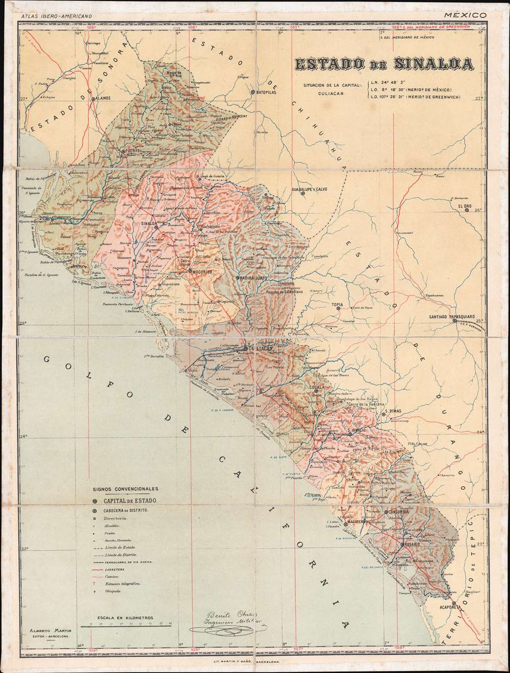

Title
Estado de Sinaloa.
1900 (undated) 18.125 x 13.75 in (46.0375 x 34.925 cm) 1 : 1417320
1900 (undated) 18.125 x 13.75 in (46.0375 x 34.925 cm) 1 : 1417320
Description
FOR THE ORIGINAL ANTIQUE MAP, WITH HISTORICAL ANALYSIS, CLICK HERE.
Digital Map Information
Geographicus maintains an archive of high-resolution rare map scans. We scan our maps at 300 DPI or higher, with newer images being 600 DPI, (either TIFF or JPEG, depending on when the scan was done) which is most cases in suitable for enlargement and printing.
Delivery
Once you purchase our digital scan service, you will receive a download link via email - usually within seconds. Digital orders are delivered as ZIP files, an industry standard file compression protocol that any computer should be able to unpack. Some of our files are very large, and can take some time to download. Most files are saved into your computer's 'Downloads' folder. All delivery is electronic. No physical product is shipped.
Credit and Scope of Use
You can use your digial image any way you want! Our digital images are unrestricted by copyright and can be used, modified, and published freely. The textual description that accompanies the original antique map is not included in the sale of digital images and remains protected by copyright. That said, we put significant care and effort into scanning and editing these maps, and we’d appreciate a credit when possible. Should you wish to credit us, please use the following credit line:
Courtesy of Geographicus Rare Antique Maps (https://www.geographicus.com).
How Large Can I Print?
In general, at 300 DPI, you should at least be able to double the size of the actual image, more so with our 600 DPI images. So, if the original was 10 x 12 inches, you can print at 20 x 24 inches, without quality loss. If your display requirements can accommodate some loss in image quality, you can make it even larger. That being said, no quality of scan will allow you to blow up at 10 x 12 inch map to wall size without significant quality loss. For more information, it is best consult a printer or reprographics specialist.
Refunds
If the high resolution image you ordered is unavailable, we will fully refund your purchase. Otherwise, digital images scans are a service, not a tangible product, and cannot be returned or refunded once the download link is used.
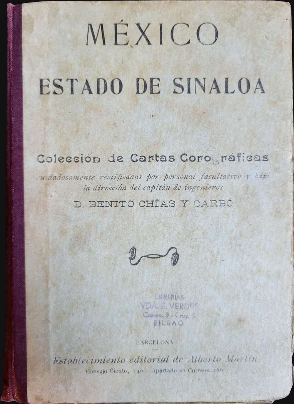
Cartographer S
Benito Chías y Carbó (1864 - 1925) was a Spanish military engineer and cartographer. Chías y Carbó created numerous maps and atlases, the most renowned of which are part of the 'Regional Spain' series. Among his other most respected works are the Atlas Geográfico Pedagógico de España which included 240 maps, the Atlas Geográfico de Portugal, the Atlas Geográfico de México and the Atlas Geográfico Ibero-Americano. All of his works were published by the Editorial Alberto Martín. More by this mapmaker...
Alberto Martín (18xx - 1917) was a Spanish publisher in Barcelona in the late 19th and early 20th century. He founded the Editorial Alberto Martín, which specialized in publishing works of a geographical, folkloric, and touristic nature. His goal was to disseminate information about the art, archaeology, history, and geography of the Iberian Peninsula. Works published by the Editorial Alberto Martín were known for quality photographic illustrations. After Martín's death in 1917, his daughter Dolores Martín Zamora took over the publishing firm. Learn More...
References
Biblioteca Nacional de España GMG/785 MAPA 31.