Digital Image: 1705 Renneville Map of the Strait of Magellan, Tierra del Feugo
StraitsofMagellan-renneville-1705_d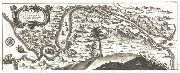

Title
Typus Freti Magellanici quod Giorguis Spilbergius cum classe lustgravit.
1705 (undated) 5.5 x 14 in (13.97 x 35.56 cm) 1 : 3500000
1705 (undated) 5.5 x 14 in (13.97 x 35.56 cm) 1 : 3500000
Description
FOR THE ORIGINAL ANTIQUE MAP, WITH HISTORICAL ANALYSIS, CLICK HERE.
Digital Map Information
Geographicus maintains an archive of high-resolution rare map scans. We scan our maps at 300 DPI or higher, with newer images being 600 DPI, (either TIFF or JPEG, depending on when the scan was done) which is most cases in suitable for enlargement and printing.
Delivery
Once you purchase our digital scan service, you will receive a download link via email - usually within seconds. Digital orders are delivered as ZIP files, an industry standard file compression protocol that any computer should be able to unpack. Some of our files are very large, and can take some time to download. Most files are saved into your computer's 'Downloads' folder. All delivery is electronic. No physical product is shipped.
Credit and Scope of Use
You can use your digial image any way you want! Our digital images are unrestricted by copyright and can be used, modified, and published freely. The textual description that accompanies the original antique map is not included in the sale of digital images and remains protected by copyright. That said, we put significant care and effort into scanning and editing these maps, and we’d appreciate a credit when possible. Should you wish to credit us, please use the following credit line:
Courtesy of Geographicus Rare Antique Maps (https://www.geographicus.com).
How Large Can I Print?
In general, at 300 DPI, you should at least be able to double the size of the actual image, more so with our 600 DPI images. So, if the original was 10 x 12 inches, you can print at 20 x 24 inches, without quality loss. If your display requirements can accommodate some loss in image quality, you can make it even larger. That being said, no quality of scan will allow you to blow up at 10 x 12 inch map to wall size without significant quality loss. For more information, it is best consult a printer or reprographics specialist.
Refunds
If the high resolution image you ordered is unavailable, we will fully refund your purchase. Otherwise, digital images scans are a service, not a tangible product, and cannot be returned or refunded once the download link is used.
Cartographer
René Auguste Constantin de Renneville (October 9, 1650 - March 13, 1723), was a French Protestant scholar and historian. He was born at Caen, but because of his Protestant faith, Renneville fled France for the more tolerant Netherlands in 1699. On his return three years later he was denounced as a spy and imprisoned in the Bastille, where he remained until 1713. Renneville was freed through the intercession of Queen Anne, and made his way to England. There he wrote his Histoire de la Bastille, most likely his most significant work. From a cartographic perspective, however, his other important work, Recueil des voyages qui ont servi a l'etablissement de la Compagnie des Indes Orientales aux Provinces Unies is far more significant. At the time of his death in 1723 Renneville was a major of artillery in the service of the elector of Hesse. More by this mapmaker...
Source
Renneville, Constantin de, Recueil des voyages qui ont servi a l'établissement de la Compagnie des Indes Orientales aux Provinces Unies, 1705.