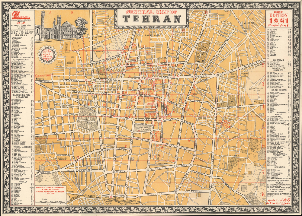
This is a 1961 Abbas Sahab city plan or map of central Tehran, Iran. Composed primarily in English, with some streets also labeled in Farsi. Locations identified include the Sahab Geographical and Drafting Institute, Air Force Headquarters, the Doshan-Tappeh Airport, Pahlavi Hospital, and the U.S. and Soviet Embassies, among many others. Numbers in red circles mark 218 other locations, including book shops, travel agencies, hotels, museums, banks, government ministries and departments, and embassies. These correspond with indexes along the left and right borders.
Pre-Revolution Tehran
Tehran in the 1960s was a bustling cosmopolitan city. Population surged, as citizens from rural areas migrated to the urban center in search of better opportunities. This influx led to an expansion of the city's infrastructure, including new roads, buildings, and public transportation. The 1960s also marked a period of cultural awakening, with a broad emergence of new artists, writers, and musicians, and an increasing interest in Western lifestyles. However, political tensions were also rising in the country, which would eventually lead to the Iranian Revolution in 1979.Publication History and Census
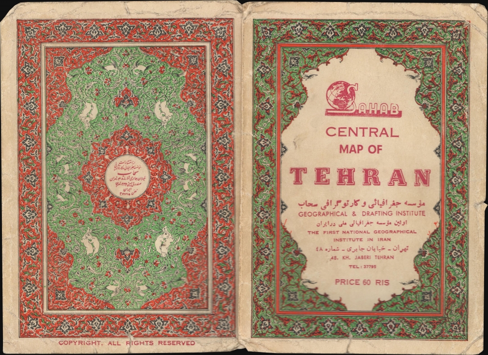
This map was created and published by Abbas Sahab in 1961. Nine examples are cataloged in OCLC: Ohio State University, the University of Chicago, the University of Minnesota Minneapolis, California State Univeristy Sacramento, the National Library of Scotland, the University of Oxford, the Bibliotheek Universiteit van Amsterdam, the Universiteitsbibliotheek Leiden, and the Staats-und Universitätsbibliothek Hamburg. Scarce on the market.
Cartographer
Abbas Sahab (1921 – April 2, 2000) was an Iranian cartographer and publisher active in Terhan in middle part of the 20th century. He is considered the 'Father of Iranian Cartography.' Sahab was born in Fam, Tafresh district, Iran. He was the son of Ostad Abolghasem Sahab Tafreshi, an Iranian writer, publisher and, from 1935, founder of the Sahab Drafting and Geographic Institute.This was the first private geographical publisher in modern Iran. The company was soon passed to Abbas, under whose guidance the company published over 1500 works, including maps, atlases, prints, and scientific and medical illustrations. Abbas himself traveled throughout Iran, often mapping individual towns and adding his own artistic flair to the maps. His most important maps illustrate Tehran, Esfahan, and Mazandaran. He also traveled extensively abroad, producing maps of Afghanistan, Pakistan, Iraq, and Turkey. After his death, the Sahab Drafting and Geographic Institute was taken over by his sons and remains an active concern to this day. More by this mapmaker...
Very good. Exhibits light wear along original fold lines, with some verso reinforcement. Blank on verso. Attached to original binder.
OCLC 48603654.