Digital Image: 1844 Wallis Game Map of South America: Wanderers in the Wilderness
WanderersintheWilderness-wallis-1844_d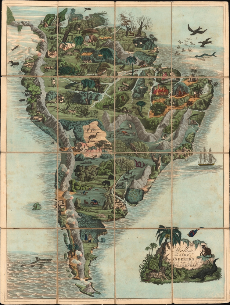

Title
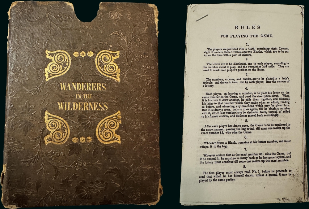
Wallis's New Game of Wanderers in the Wilderness.
1844 (undated) 27 x 20.25 in (68.58 x 51.435 cm)
1844 (undated) 27 x 20.25 in (68.58 x 51.435 cm)
Description
FOR THE ORIGINAL ANTIQUE MAP, WITH HISTORICAL ANALYSIS, CLICK HERE.
Digital Map Information
Geographicus maintains an archive of high-resolution rare map scans. We scan our maps at 300 DPI or higher, with newer images being 600 DPI, (either TIFF or JPEG, depending on when the scan was done) which is most cases in suitable for enlargement and printing.
Delivery
Once you purchase our digital scan service, you will receive a download link via email - usually within seconds. Digital orders are delivered as ZIP files, an industry standard file compression protocol that any computer should be able to unpack. Some of our files are very large, and can take some time to download. Most files are saved into your computer's 'Downloads' folder. All delivery is electronic. No physical product is shipped.
Credit and Scope of Use
You can use your digial image any way you want! Our digital images are unrestricted by copyright and can be used, modified, and published freely. The textual description that accompanies the original antique map is not included in the sale of digital images and remains protected by copyright. That said, we put significant care and effort into scanning and editing these maps, and we’d appreciate a credit when possible. Should you wish to credit us, please use the following credit line:
Courtesy of Geographicus Rare Antique Maps (https://www.geographicus.com).
How Large Can I Print?
In general, at 300 DPI, you should at least be able to double the size of the actual image, more so with our 600 DPI images. So, if the original was 10 x 12 inches, you can print at 20 x 24 inches, without quality loss. If your display requirements can accommodate some loss in image quality, you can make it even larger. That being said, no quality of scan will allow you to blow up at 10 x 12 inch map to wall size without significant quality loss. For more information, it is best consult a printer or reprographics specialist.
Refunds
If the high resolution image you ordered is unavailable, we will fully refund your purchase. Otherwise, digital images scans are a service, not a tangible product, and cannot be returned or refunded once the download link is used.
Cartographer S
Edward Wallis (1787 - 1868) was a British publisher, mapmaker, and game manufacturer. The son of publisher John Wallis (1745 - 1818), Wallis joined his father's business in 1813, operating as Wallis and Son or John and Edward Wallis. Wallis and his brother John divided their father's business after his 1818 death. Edward continued creating, publishing, and selling maps, games, and other printed material until he also retired in 1847, at which point he sold his business to John Passmore. His brother, John Wallis II, established a separate publishing business, which he ran for a few years before closing down and moving to Sidmouth, where he opened the Marine Library, a circulating library and reading room. More by this mapmaker...
John Henry Banks (January 7, 1816 - 1879) was a British engraver active in London in the mid-19th century. Banks was born in the Marylebone district of London. He engraved extensively for the game and print publisher Edwards Wallis. His best-known works are likely A Panoramic View of London (1845) and Baloon View of London (1851). Despite being a skilled engraver, his life was troubled by financial duress. He declared bankruptcy at least four times and was twice imprisoned for debt. He married Eliza Charlotte Jewell in 1837 and had six children. Banks died in Battersea, London, in 1979. Learn More...
References
Yale Center for British Art, #GV1199 W355. OCLC 177769993.