Digital Image: 1917 Appalachian Mountain Club Guide w/ Maps of White Mountains, Mount Washington
WhiteMountains-amc-1917_d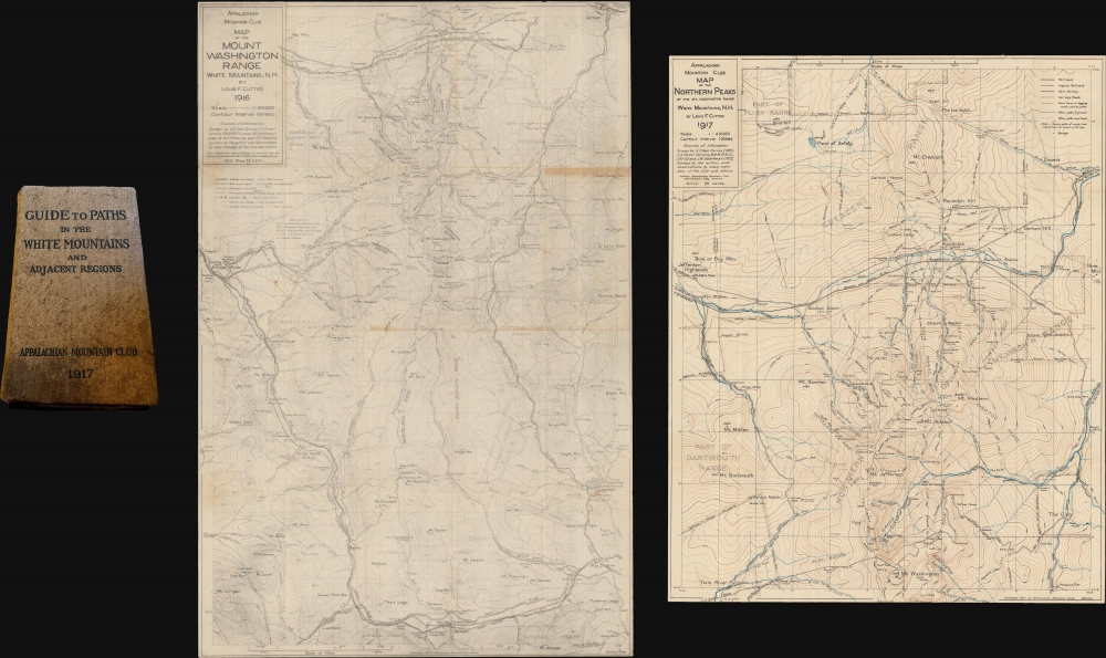


Title
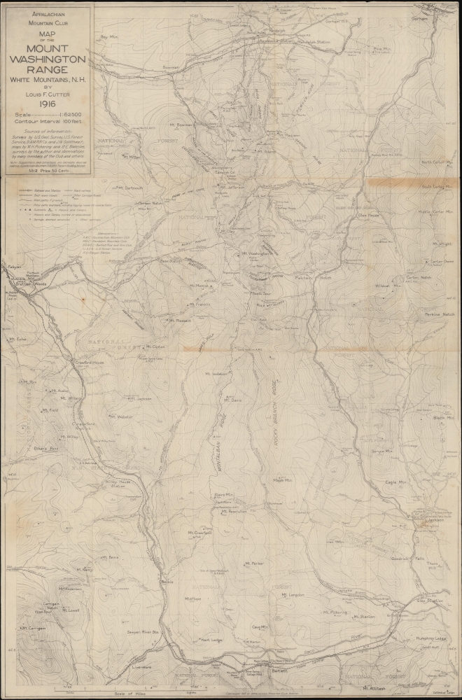
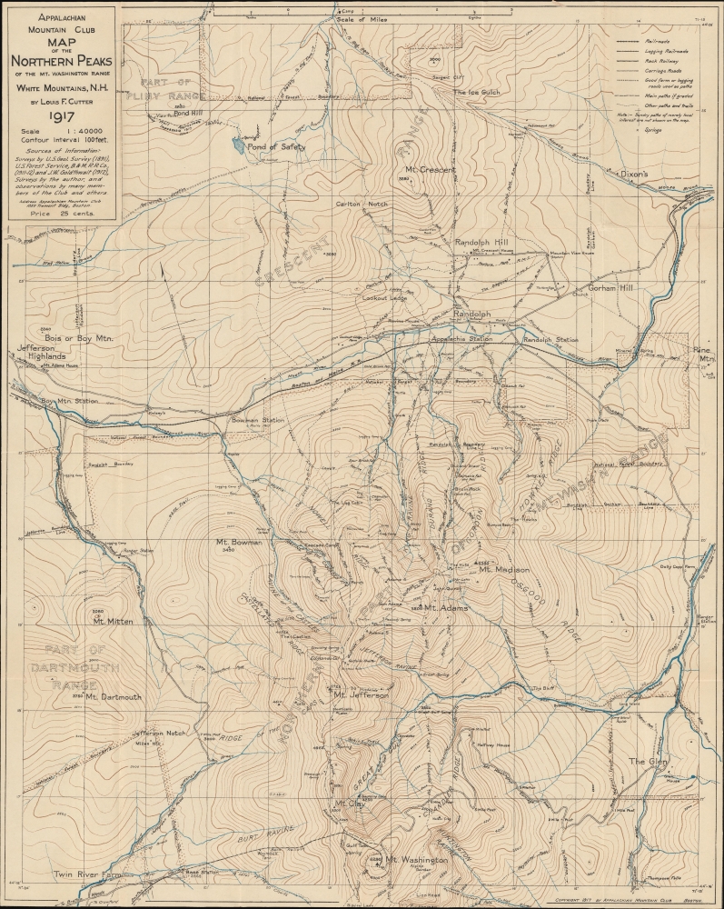
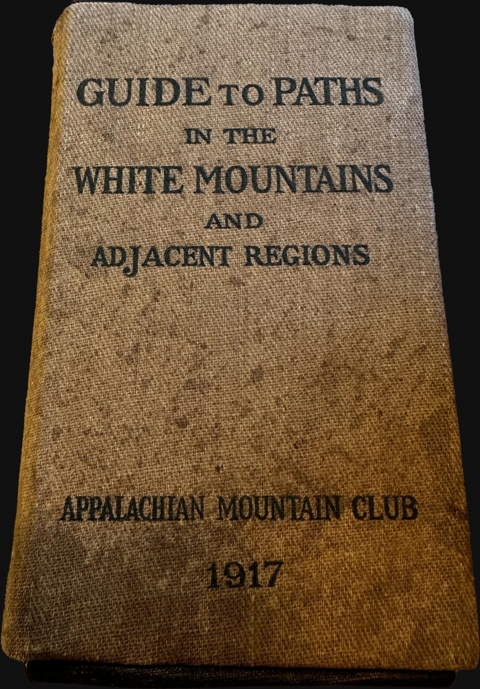
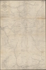
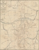
Guide to Paths in the White Mountains and Adjacent Regions. / Map of the Mount Washington Range. Part 1. / Map of the Northern Peaks.
1917 (dated) 6.25 x 3.25 in (15.875 x 8.255 cm)
1917 (dated) 6.25 x 3.25 in (15.875 x 8.255 cm)
Description
FOR THE ORIGINAL ANTIQUE MAP, WITH HISTORICAL ANALYSIS, CLICK HERE.
Digital Map Information
Geographicus maintains an archive of high-resolution rare map scans. We scan our maps at 300 DPI or higher, with newer images being 600 DPI, (either TIFF or JPEG, depending on when the scan was done) which is most cases in suitable for enlargement and printing.
Delivery
Once you purchase our digital scan service, you will receive a download link via email - usually within seconds. Digital orders are delivered as ZIP files, an industry standard file compression protocol that any computer should be able to unpack. Some of our files are very large, and can take some time to download. Most files are saved into your computer's 'Downloads' folder. All delivery is electronic. No physical product is shipped.
Credit and Scope of Use
You can use your digial image any way you want! Our digital images are unrestricted by copyright and can be used, modified, and published freely. The textual description that accompanies the original antique map is not included in the sale of digital images and remains protected by copyright. That said, we put significant care and effort into scanning and editing these maps, and we’d appreciate a credit when possible. Should you wish to credit us, please use the following credit line:
Courtesy of Geographicus Rare Antique Maps (https://www.geographicus.com).
How Large Can I Print?
In general, at 300 DPI, you should at least be able to double the size of the actual image, more so with our 600 DPI images. So, if the original was 10 x 12 inches, you can print at 20 x 24 inches, without quality loss. If your display requirements can accommodate some loss in image quality, you can make it even larger. That being said, no quality of scan will allow you to blow up at 10 x 12 inch map to wall size without significant quality loss. For more information, it is best consult a printer or reprographics specialist.
Refunds
If the high resolution image you ordered is unavailable, we will fully refund your purchase. Otherwise, digital images scans are a service, not a tangible product, and cannot be returned or refunded once the download link is used.
Cartographer
Louis Fayerweather Cutter (June 20, 1864 - June 26, 1945) was a Massachusetts based Civil Engineer. Cutter was born in Cambridge, Massachusetts and studied Civil Engineering at MIT. Cutter is best known for his contribution to the trail mapping of the White Mountains of New Hampshire. Cutter was born in Cambridge, Massachusetts. Cutter specialized in maps of the White Mountains, which he made from 1885 to 1945. Cutter's first map, published in 1885, detailed King's Ravine, Mt. Adams, and Mt. Madison. He measured distances using a handmade odometer wheel crafted from a bicycle tire and took barometric readings to determine altitude. He eventually expanded his coverage to include all of the White Mountains, becoming the official cartographer of the Appalachian Mountain Club in 1907. His maps served as the definitive resource for trekkers in the White Mountains until his death in 1945. More by this mapmaker...
References
OCLC 39736690.