This item has been sold, but you can get on the Waitlist to be notified if another example becomes available, or purchase a digital scan.
1917 Appalachian Mountain Club Guide w/ Maps of White Mountains, Mount Washington
WhiteMountains-amc-1917$625.00


Title
Guide to Paths in the White Mountains and Adjacent Regions. / Map of the Mount Washington Range. Part 1. / Map of the Northern Peaks.
1917 (dated) 6.25 x 3.25 in (15.875 x 8.255 cm)
1917 (dated) 6.25 x 3.25 in (15.875 x 8.255 cm)
Description
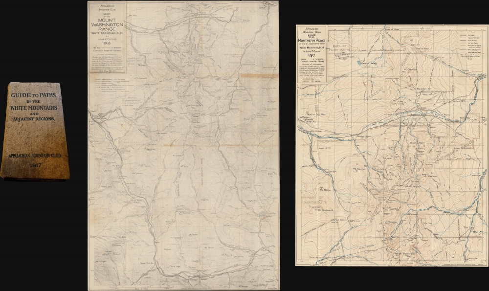
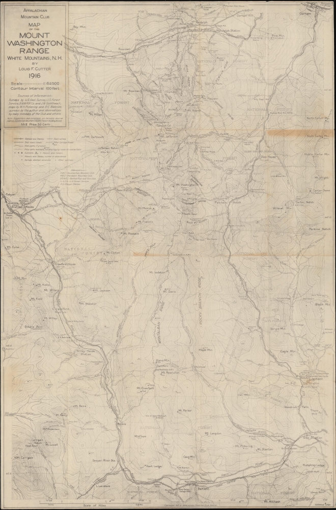
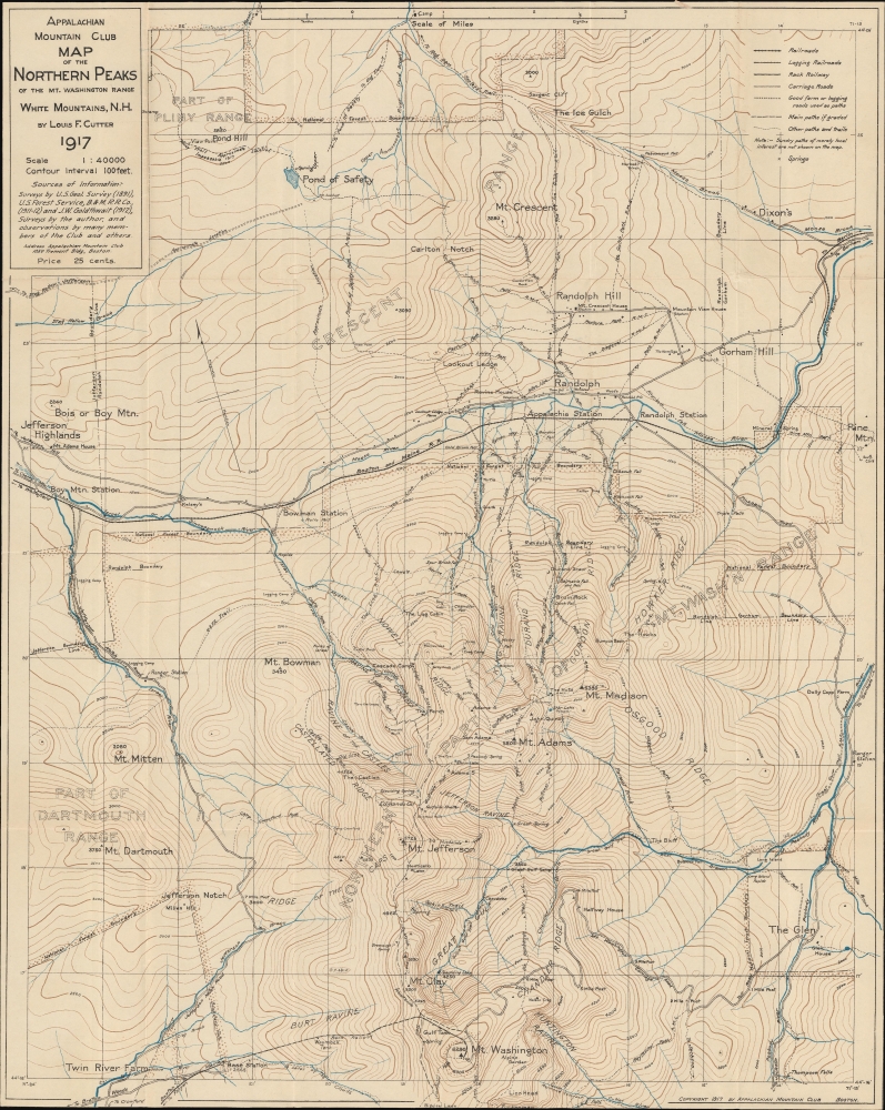
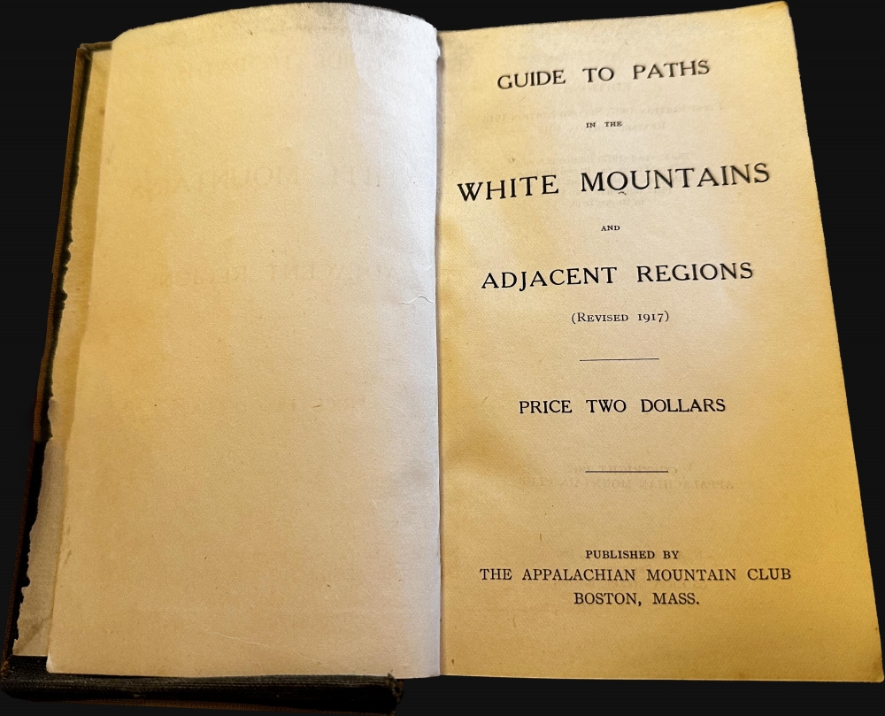
This is part one of the rare third 1917 third edition of the Appalachian Mountain Club guide to the White Mountains, with the two important enclosed foldout maps by Louis F. Cutter: Map of the Mount Washington Range (1916) and Map of the Northern Peaks of the Mt. Washington Range (1917).
The Guide
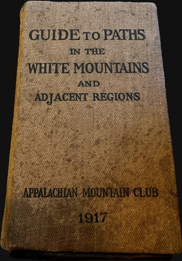
This is part 1 of the third edition of the AMC guide. This is part 1 of the 2 part field edition in 'brown drill' covers. Part two is not present. The volume contains a pocket at front with two maps, as noted below. It also contains several other maps tipped into the pages. There are a total of 183 pages, plus an 8-page supplement issued in June of 1918.Mount Washington Map
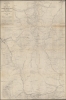
Most examples of the guide lack the Louis F. Cutter 'Mount Washington Range' map, which has become exceedingly rare. The map was issued for the 1916 edition, but examples were added to the 1917 edition of the guide until supplies ran out and a new edition emerged in 1818. Set at a scale of 1:62500 (23 x 15.25 in), the map is roughly centered on Mt. Washington, but covers from Gorham to Bartlett, and from Bretton Woods to Perkins Notch and, further south, Jackson. Topographical contours are set at 100-foot intervals throughout. Trails and peaks throughout are marked.Norther Peaks Map
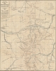
Louis F. Cutter's 'Northern Peaks' map was fully revised for this 1917 edition of the Appalachian Mountain Club guide. The scale is set at 1:40000 (19 x 15.5 in), with coverage extending north from Mt. Washington to Mt. Crescent. Topographical contours are set at 100-foot intervals throughout. Trails, streams, rivers, springs, and other points of interest are meticulously detailed. The track of the Boston and Maine Railroad roughly bisects the map horizontally, passing through Randolph, just north of center.Publication History and Census
The AMC guide to the White Mountains was first published in 1907, with follow-up editions in 1916 and, as here, 1917. Additional editions followed in 1920, 1922, 1925, 1928, and 1931 … to at least 2012. Early editions are extremely rare to the market but well represented in institutions.Cartographer
Louis Fayerweather Cutter (June 20, 1864 - June 26, 1945) was a Massachusetts based Civil Engineer. Cutter was born in Cambridge, Massachusetts and studied Civil Engineering at MIT. Cutter is best known for his contribution to the trail mapping of the White Mountains of New Hampshire. Cutter was born in Cambridge, Massachusetts. Cutter specialized in maps of the White Mountains, which he made from 1885 to 1945. Cutter's first map, published in 1885, detailed King's Ravine, Mt. Adams, and Mt. Madison. He measured distances using a handmade odometer wheel crafted from a bicycle tire and took barometric readings to determine altitude. He eventually expanded his coverage to include all of the White Mountains, becoming the official cartographer of the Appalachian Mountain Club in 1907. His maps served as the definitive resource for trekkers in the White Mountains until his death in 1945. More by this mapmaker...
Condition
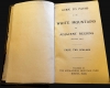
Good. Binding loose, stained. Two maps fold into interior pocket. Maps in good condition, slight wear on old fold lines. This is Part 1 only.
References
OCLC 39736690.