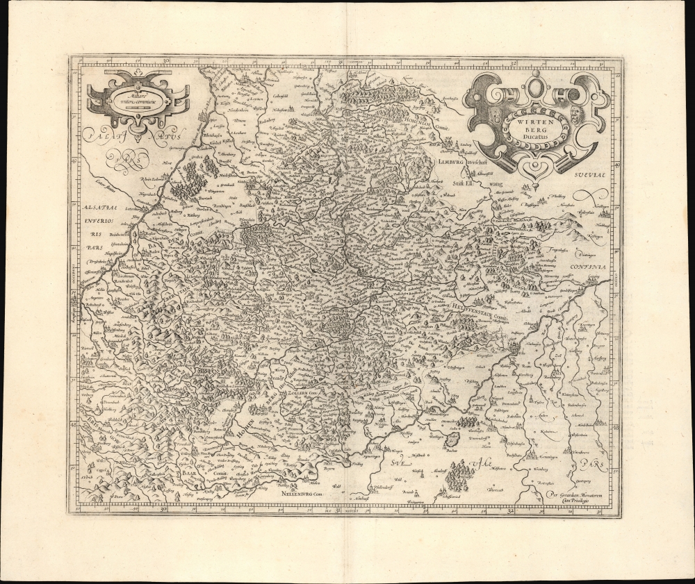
1595 Mercator Map of Wurttemberg, Germany, First Edition, First State
Wirtenberg-mercator-1595$500.00


Title
Wirtenberg Ducatus.
1595 (undated) 14.75 x 17.75 in (37.465 x 45.085 cm) 1 : 500000
1595 (undated) 14.75 x 17.75 in (37.465 x 45.085 cm) 1 : 500000
Description
This is a c. 1595 Gerard Mercator first edition, first state map of the Duchy of Württemberg in today's Germany.
A Closer Look
The map covers the Duchy of Württemberg in today's southwestern Germany, then a part of the Holy Roman Empire. Cities, towns, regions, counties, waterways, mountains, forests, and other features are illustrated and labeled throughout. The Rhine River flows diagonally at top-left, while several tributaries (the Neckar, Murg, and Kinzig, among others) are noted throughout the map. At bottom-right, the Danube River also flows diagonally, fed by its own tributaries (Brenz, Rot, and Iller, among others). Among the cities featured prominently are the university cities of Heidelberg, Freiburg (im Breisgau), Tübingen, and Ulm. Stuttgart, now the most populous city in the area and the capital of the federal state of Baden-Württemberg, appears near center as 'Stuttgard.' The Black Forest (Schwartzwald) is notable at bottom-left.Reformation and Revolution
When this map was published, the region seen here was in the midst of a decades-long series of wars, uprisings, and unrest that left large parts of it devastated. The ambitious but volatile Duke Ulrich of Württemberg (r. 1503 - 1550) feuded with the Holy Roman Emperor and his supporters in Swabian League, and alienated his own people with tyrannical rule and unpopular policies (including high taxation). Eventually, the duchy was occupied by the Swabian League and turned over to the Habsburgs, who reformed its systems of governance and political relationships. But the exiled Ulrich schemed for a return, which was successful when he joined an anti-Habsburg coalition in 1534 and was restored to his rule, before being defeated again in 1546 and effectively disempowered. Aside from, or perhaps because of, these maneuverings, the countryside was rife with unrest, most evident in the German Peasants War of 1524-1525. Moreover, the Protestant Reformation swept through the region at the same time, which became entangled with the internecine power struggles of the Holy Roman Empire. Unfortunately, the situation only deteriorated further in the 17th century, with the region being ground zero during the Thirty Years War. The duchy was the single worst-affected part of Europe, losing more than half (as much as three-quarters) of its population to death or flight.Publication History and Census
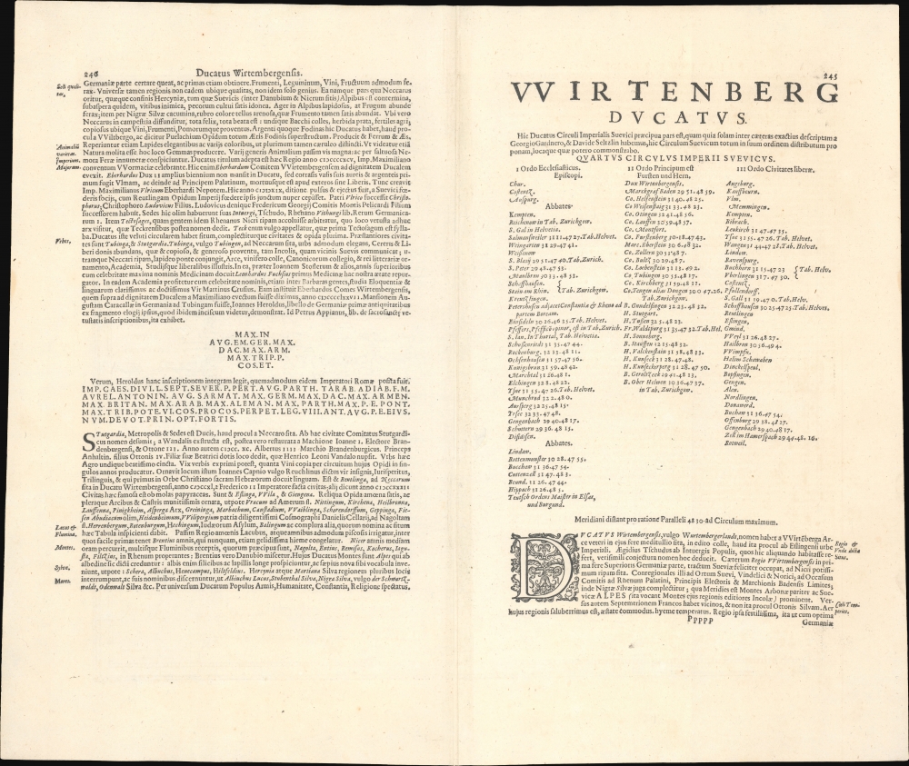
This map was prepared by Gerard Mercator and appeared in the Atlas sive Cosmographicae. This is the first state of this map, which then appeared in later issues of the Mercator-Hondius atlas, with the title cartouche and scale cartouche elaborated in later editions. In various editions, examples appear on the market from time to time, and the map is reasonably well-represented in institutional collections.Cartographer
Gerard Mercator (March 5, 1512 - December 2, 1594) is a seminal figure in the history of cartography. Mercator was born near Antwerp as Gerard de Cremere in Rupelmonde. He studied Latin, mathematics, and religion in Rupelmonde before his Uncle, Gisbert, a priest, arranged for him to be sent to Hertogenbosch to study under the Brothers of the Common Life. There he was taught by the celebrated Dutch humanist Georgius Macropedius (Joris van Lanckvelt; April 1487 - July 1558). It was there that he changed him name, adapting the Latin term for 'Merchant', that is 'Mercator'. He went on to study at the University of Louvain. After some time, he left Louvain to travel extensively, but returned in 1534 to study mathematics under Gemma Frisius (1508 - 1555). He produced his first world map in 1538 - notable as being the first to represent North America stretching from the Arctic to the southern polar regions. This impressive work earned him the patronage of the Emperor Charles V, for whom along with Van der Heyden and Gemma Frisius, he constructed a terrestrial globe. He then produced an important 1541 globe - the first to offer rhumb lines. Despite growing fame and imperial patronage, Mercator was accused of heresy and in 1552. His accusations were partially due to his Protestant faith, and partly due to his travels, which aroused suspicion. After being released from prison with the support of the University of Louvain, he resumed his cartographic work. It was during this period that he became a close fried to English polymath John Dee (1527 - 1609), who arrived in Louvain in 1548, and with whom Mercator maintained a lifelong correspondence. In 1552, Mercator set himself up as a cartographer in Duisburg and began work on his revised edition of Ptolemy's Geographia. He also taught mathematics in Duisburg from 1559 to 1562. In 1564, he became the Court Cosmographer to Duke Wilhelm of Cleve. During this period, he began to perfect the novel projection for which he is best remembered. The 'Mercator Projection' was first used in 1569 for a massive world map on 18 sheets. On May 5, 1590 Mercator had a stroke which left him paralyzed on his left side. He slowly recovered but suffered frustration at his inability to continue making maps. By 1592, he recovered enough that he was able to work again but by that time he was losing his vision. He had a second stroke near the end of 1593, after which he briefly lost speech. He recovered some power of speech before a third stroke marked his end. Following Mercator's death his descendants, particularly his youngest son Rumold (1541 - December 31, 1599) completed many of his maps and in 1595, published his Atlas. Nonetheless, lacking their father's drive and genius, the firm but languished under heavy competition from Abraham Ortelius. It was not until Mercator's plates were purchased and republished (Mercator / Hondius) by Henricus Hondius II (1597 - 1651) and Jan Jansson (1588 - 1664) that his position as the preeminent cartographer of the age was re-established. More by this mapmaker...
Source
Mercator, G., Atlas sive Cosmographicae, (Amsterdam: Mercator) 1595.
Mercator's Atlas is one of the most important works in the history of cartography. Although in fact Ortelius was the first to publish a proper atlas, the Teatrum Orbis Terrarum, Mercator's work the first book to employ the term Atlas for a collection of maps. The term is derived both from the mythical titan, Atlas, who was forced to bear the world upon his shoulders, and the Libyan king, philosopher, and astronomer of the same name that, so the legend goes, constructed the first globe. Mercator dedicated the final 25 years of his life to compile the Atlas. He published two parts during his lifetime in 1585 and 1589, but the final part published posthumously by his son Rumold Mercator, in 1595. The map plates for the Atlas were later acquired by Jodocus Hondius who published the most complete and well known edition in 1606. It was Jodocus who popularized the Atlas and who did the most to elevate Gerard Mercator's name.
Condition
Fine.
References
Rumsey 10501.327.