
Mercator, Gerard
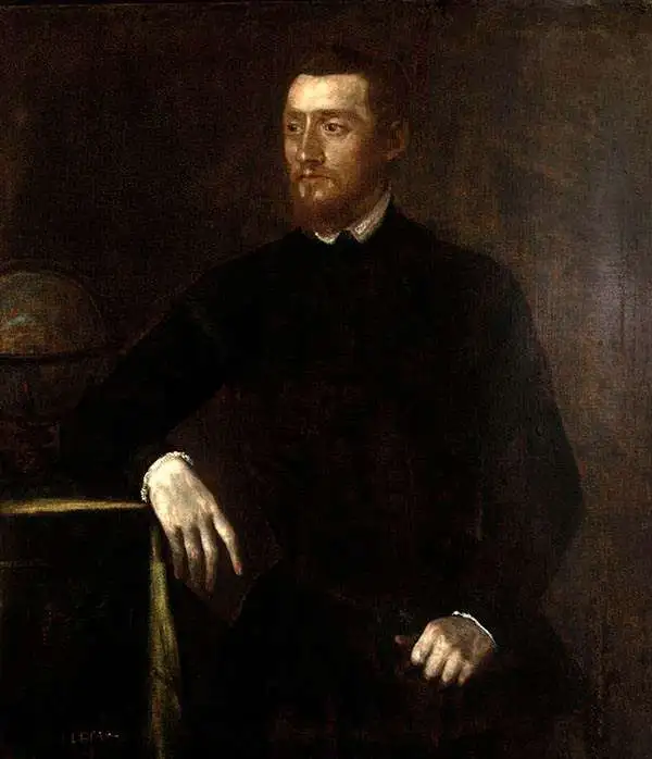
Gerard Mercator (March 5, 1512 - December 2, 1594) is a seminal figure in the history of cartography. Mercator was born near Antwerp as Gerard de Cremere in Rupelmonde. He studied Latin, mathematics, and religion in Rupelmonde before his Uncle, Gisbert, a priest, arranged for him to be sent to Hertogenbosch to study under the Brothers of the Common Life. There he was taught by the celebrated Dutch humanist Georgius Macropedius (Joris van Lanckvelt; April 1487 - July 1558). It was there that he changed him name, adapting the Latin term for 'Merchant', that is 'Mercator'. He went on to study at the University of Louvain. After some time, he left Louvain to travel extensively, but returned in 1534 to study mathematics under Gemma Frisius (1508 - 1555). He produced his first world map in 1538 - notable as being the first to represent North America stretching from the Arctic to the southern polar regions. This impressive work earned him the patronage of the Emperor Charles V, for whom along with Van der Heyden and Gemma Frisius, he constructed a terrestrial globe. He then produced an important 1541 globe - the first to offer rhumb lines. Despite growing fame and imperial patronage, Mercator was accused of heresy and in 1552. His accusations were partially due to his Protestant faith, and partly due to his travels, which aroused suspicion. After being released from prison with the support of the University of Louvain, he resumed his cartographic work. It was during this period that he became a close fried to English polymath John Dee (1527 - 1609), who arrived in Louvain in 1548, and with whom Mercator maintained a lifelong correspondence. In 1552, Mercator set himself up as a cartographer in Duisburg and began work on his revised edition of Ptolemy's Geographia. He also taught mathematics in Duisburg from 1559 to 1562. In 1564, he became the Court Cosmographer to Duke Wilhelm of Cleve. During this period, he began to perfect the novel projection for which he is best remembered. The 'Mercator Projection' was first used in 1569 for a massive world map on 18 sheets. On May 5, 1590 Mercator had a stroke which left him paralyzed on his left side. He slowly recovered but suffered frustration at his inability to continue making maps. By 1592, he recovered enough that he was able to work again but by that time he was losing his vision. He had a second stroke near the end of 1593, after which he briefly lost speech. He recovered some power of speech before a third stroke marked his end. Following Mercator's death his descendants, particularly his youngest son Rumold (1541 - December 31, 1599) completed many of his maps and in 1595, published his Atlas. Nonetheless, lacking their father's drive and genius, the firm but languished under heavy competition from Abraham Ortelius. It was not until Mercator's plates were purchased and republished (Mercator / Hondius) by Henricus Hondius II (1597 - 1651) and Jan Jansson (1588 - 1664) that his position as the preeminent cartographer of the age was re-established.
First Modern Atlas Map of the British Isles.
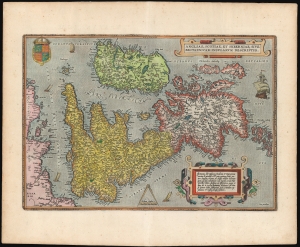
Angliae, Scotiae, et Hiberniae, Sive Britannicar: Insularum Descriptio.
$1,750.00
Acquire
- Digital Map Information
- Suitable for large format printing
- Full resolution TIFF file
- ICC color profile embedded
- Delivered instantly via download link
This is Abraham Ortelius' 1570 map of the British Isles, the first atlas map of the British Isles, in a beautiful example of the third state. (more details)
Earliest Detailed Mapping of the Bernese Alps.
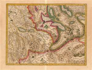
[Bernese Alps and the Swiss Lake District]
$450.00
Acquire
- Digital Map Information
- Suitable for large format printing
- DPI: 600
- File Size: 22.15 MB
- File Type: ZIP / TIFF
- ICC color profile embedded
- Delivered instantly via download link
This is Gerard Mercator's 1585 map of the Bernese Oberland and the Lake District of central Switzerland, in a warmly-colored Hondius edition. It is the earliest acquirable map to detail this specific region and is the earliest derivative of Thomas Schöpf's groundbreaking 1578 map of the Canton of Bern. It is the only acquirable early map of the Bernese Alps to name multiple peaks. (more details)
Modeling the Mapping of Switzerland for Two Centuries
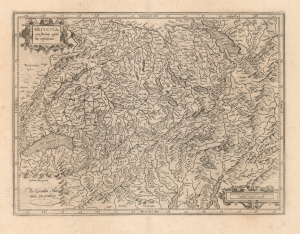
Helvetia cum finitimis regionibus confederatis.
$700.00
Acquire
- Digital Map Information
- Suitable for large format printing
- DPI: 600
- File Size: 45.8 MB
- File Type: ZIP / TIFF
- ICC color profile embedded
- Delivered instantly via download link
This is Gerard Mercator's 1585 map of Switzerland, the second map of the Confederation to appear in a modern atlas. It sharply improves upon its precursor, by Ortelius, both in overall delineation and detail. (more details)
Advancing the map of Germany.
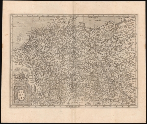
Germania.
$500.00
Acquire
- Digital Map Information
- Suitable for large format printing
- Full resolution TIFF file
- ICC color profile embedded
- Delivered instantly via download link
This is Gerard Mercator's 1585 map of Germany. It marks a significant transition in the mapping of German lands and is far advanced over earlier maps, such as those of Munster. Moreover, it is one of Mercator's earliest obtainable maps. (more details)
Early edition of the most accurate map of Scandinavia of its day.
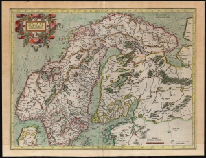
Suecia Et Norvegia cum confinijs.
$1,750.00
Acquire
- Digital Map Information
- Suitable for large format printing
- File Size: 21.56 MB
- File Type: ZIP / TIFF
- ICC color profile embedded
- Delivered instantly via download link
An attractive example of Gerard Mercator's 1595 map of Scandinavia, in its first French atlas edition of 1609. Among the maps of the northern parts of Europe produced in the sixteenth century, this is the first to focus narrowly on Scandinavia. Ginsberg, typically laconic in praise, notes that the map 'gave the Scandinavian peninsula its correct form' and 'became the model for nearly all subsequent maps of Scandinavia.' This basic model would stand until supplanted in the mid-17th century by the work of Anders Bure. (more details)
The only America map of the Mercator Atlas.
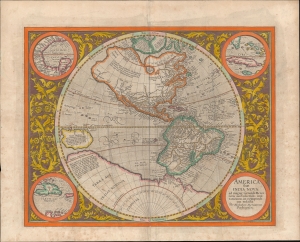
America, siue, India Nova. Ad magnae Gerardi Mercatoris aui vniversalis imitationem in compendium redacta.
$3,000.00
Acquire
- Digital Map Information
- Suitable for large format printing
- Full resolution TIFF file
- ICC color profile embedded
- Delivered instantly via download link
This is a vivid 1628 Hondius edition of Mercator's 1595 America, one of the most visually arresting early maps of the Western Hemisphere. (more details)
Holy Grail Map - 1st Map of the North Pole.
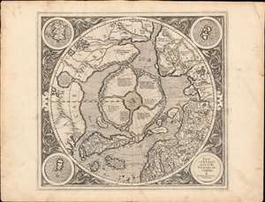
Septentrionalium Terrarum descriptio.
$30,000.00
Acquire
- Digital Map Information
- Suitable for large format printing
- Full resolution TIFF file
- ICC color profile embedded
- Delivered instantly via download link
This is the first edition, first state of Gerard Mercator's seminal 1595 map of the Arctic, the great cartographer's most interesting and important atlas map. In this first edition, it is the scarcest of Mercator's atlas maps and a holy grail for any Arctic collector. For all its flaws and inaccuracies, it is a schematized interpretation of factual voyages between Norway, England, Iceland, Greenland, and Labrador (Markland). (more details)
Ireland during the Nine Years' War.
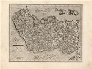
Irlandia regnum.
$1,750.00
Acquire
- Digital Map Information
- Suitable for large format printing
- Full resolution TIFF file
- ICC color profile embedded
- Delivered instantly via download link
This is a superb, 1595 first atlas edition of Gerard Mercator's map of Ireland. It is one of the earliest maps of Ireland, the second to appear in an atlas, and the first produced by Mercator. Oriented to the west, the map covers the Emerald Isle in detail, noting towns, rivers, lakes, forests, mountains, and a host of additional topographic features. Mountains and forests are beautifully rendered in profile. The map divides Ireland into the four provinces of Ulster, Connaught, Leinster, and Munster. (more details)
First Edition Mercator Map of Southeast England in the Elizabethan Era.
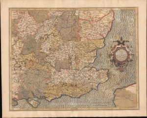
Warwicum, Northhamtonia, Huntingdonia, Cantabrigia, Suffolcia, Oxonium, Buckinghamia Bedfordia, Hartfordia, Essexia, Berceria Middelsexia, Southhatonia, Surria, Cantiu et Southsexia.
$500.00
Acquire
- Digital Map Information
- Suitable for large format printing
- Full resolution TIFF file
- ICC color profile embedded
- Delivered instantly via download link
An old color, first edition 1595 Gerard Mercator map of southeastern England, including London. It highlights the tricky waters of the English Channel, which had so recently rescued England from the 1588 Spanish Armada. (more details)
First atlas issue of Mercator's map of the lands of the Crimean Tatars.
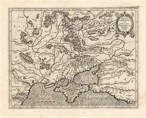
Taurica Chersonesus. Nostra aetate Przecopsca et Gazara dicitur.
$900.00
Acquire
- Digital Map Information
- Suitable for large format printing
- DPI: 600
- File Size: 34.31 MB
- File Type: ZIP / TIFF
- ICC color profile embedded
- Delivered instantly via download link
This is the 1595 first state of Mercator's map of the Crimea, still known to geographers by its Ptolemaic name of Taurica Chersonesus. The engraving is bold and sharp - a product of the youth of the copperplate. Many recognizable place names can be found on this detailed map, including Kiev, Moscow, Smolensk, and Chernobyl. The course of the Dniepr river is particularly well detailed. The primary focus of this map, however, is Muscovy's extremely fluid southeastern border with the Crimean Tatars. The border garrisons of Ryazan (Rezan on the map) and the Crimea suffered yearly assaults from the steppes. Moscow’s response - the annual raising of an army of tens of thousands to patrol this border - was instrumental in developing the centralized power of the Tsar in the 16th and 17th centuries. (more details)
First edition of Mercator's Map of Transylvania.
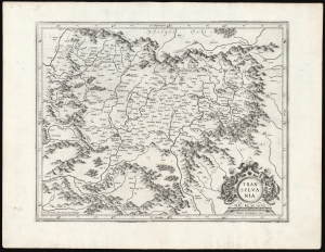
Transylvania.
$750.00
Acquire
- Digital Map Information
- Suitable for large format printing
- DPI: 600
- File Size: 44.51 MB
- File Type: ZIP / TIFF
- ICC color profile embedded
- Delivered instantly via download link
This is a superb example of Gerard Mercator's 1595 map of Transylvania, covering what is now central Romania, in its first edition. (more details)
Carlow County During the Elizabethan Era.
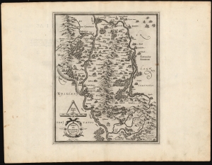
Udrone, Irlandiae in Catherlagh Baronia.
$450.00
Acquire
- Digital Map Information
- Suitable for large format printing
- Full resolution TIFF file
- ICC color profile embedded
- Delivered instantly via download link
This is Gerard Mercator's map of the Barony of Idrone in County Carlow, Ireland, here in its 1595 first atlas edition. (more details)
Ulster During the Elizabethan Era.
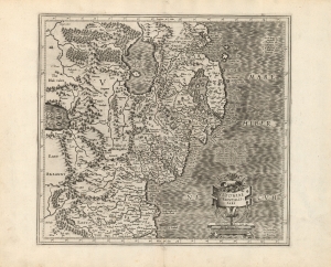
Ultoniae Orientalis Pars.
$500.00
Acquire
- Digital Map Information
- Suitable for large format printing
- DPI: 600
- File Size: 44.92 MB
- File Type: ZIP / TIFF
- ICC color profile embedded
- Delivered instantly via download link
This is a superb, 1595 first atlas edition of Gerard Mercator's map of the east part of Ulster, Ireland. It is the earliest specific map of the northern part of Ireland to appear in an atlas. (more details)
Most detailed representation in print of Robert Lythe's surveys.
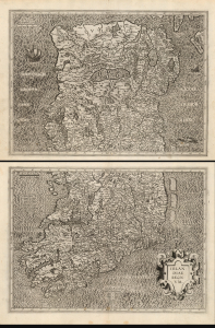
Irlandiae regnum.
$1,800.00
Acquire
- Digital Map Information
- Suitable for large format printing
- Full resolution TIFF file
- ICC color profile embedded
- Delivered instantly via download link
This is a superb, 1595 first atlas edition of Gerard Mercator's two-sheet map of Ireland. It is the most detailed of the early atlas maps of Ireland, and one of the earliest printed maps to be substantially based on actual surveys - to wit, the surveys of Robert Leith. (more details)
Historically contested Lorraine.
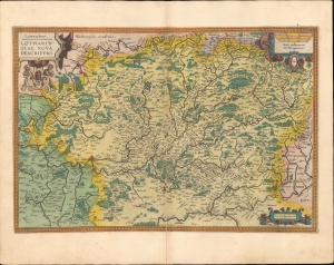
Lorraine Lotharingiae Nova Descriptio.
$350.00
Acquire
- Digital Map Information
- Suitable for large format printing
- Full resolution TIFF file
- ICC color profile embedded
- Delivered instantly via download link
This is a beautiful, original-color example of Abraham Ortelius' 1595 map of the Lorraine region from his Theatrum Orbis Terrarum. (more details)
Key Caribbean islands.
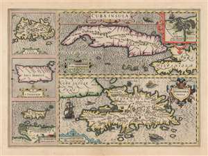
Cuba Insula. / Hispaniola Insula. / Insula Jamaica. / Ins. J. Ioannis. / I.S. Margareta Cum Confiniis.
$1,100.00
Acquire
- Digital Map Information
- Suitable for large format printing
- DPI: 600
- File Size: 67.48 MB
- File Type: ZIP / TIFF
- ICC color profile embedded
- Delivered instantly via download link
This is a superb, original color example of Jodocus Hondius's 1609 map of Cuba and Hispaniola, with inset maps of Jamaica, Puerto Rico, and Margarita Island. It is a beautifully engraving, whose rich detail, ships and sea monsters make it a most desirable work. (more details)
A Beautifully Engraved map of Lazio and part of Abruzzo, Italy.
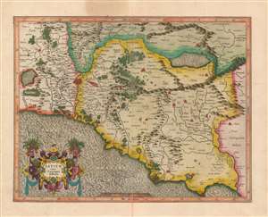
Latium nunc Campagna di Roma.
$850.00
Acquire
- Digital Map Information
- Suitable for large format printing
- Full resolution TIFF file
- ICC color profile embedded
- Delivered instantly via download link
A beautiful, original color example of Gerard Mercator's map of central Italy, focusing on Rome and the Roman Campagna. The superb engraving is the work of Mercator himself, most notable in the water areas, the elegant strapwork cartouche, and the precise Italic lettering. Forests and mountains are shown pictorially. Towns are illustrated with simple marks, although larger cities are shown as clusters of houses heightened in red color. These of course include Rome, but also Ostia, Alba, Palestrina, Formia, Terracina, and others. Also marked in red, to the east of Rome, is one of the ruined Roman aqueducts. Rivers are pictured in detail. (more details)
Mercator's British Isles in original color.
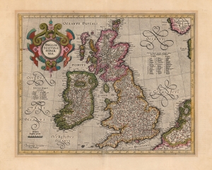
Anglia, Scotia et Hibernia.
$1,100.00
Acquire
- Digital Map Information
- Suitable for large format printing
- Full resolution TIFF file
- ICC color profile embedded
- Delivered instantly via download link
This is a beautiful, original-color example of Gerard Mercator's 1595 map of the British Isles, in its 1623 Hondius edition. This would be the definitive map of the British Isles for many subsequent decades. (more details)
Most beautiful 17th century map of the Channel Islands.
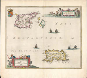
Sarnia insula, vulgo Garnsey et Insula Caesaraea, Vernacule Jarsey.
$1,200.00
Acquire
- Digital Map Information
- Suitable for large format printing
- Full resolution TIFF file
- ICC color profile embedded
- Delivered instantly via download link
This is a gorgeous, original-color example of Joan Blaeu's 1645 map of Guernsey and Jersey, the most beautiful map of the primary Channel Islands to be produced in the 17th century. (more details)